Mountain range, region / State
/ Austria
Season
Fall
26. 09. 2021
Difficulty
3 / 5
Elevation
↑ 2063 m
↓ 2063 m
Length
12.1 km
8 hours
Altitude
max. 2360 m n.m.
min. 967 m n.m.
Tips for hikes in the country Austria
A circular hike to the mythical Leonsberg in the Salzkammergut
Autumn trek to Großer Grießstein in the Seckauer Alps
Circular trek over the Schreinl peak in the Wölz Tauern
Circular trek over four peaks in the eastern part of the Tennengebirge
Starting point
The starting point is a parking lot in the woods near the Karalm restaurant above the town of Abtenau at approximately 1000 m above sea level. A road leads to the car park from the town of Abtenau north of the mountains.
Description of the hike
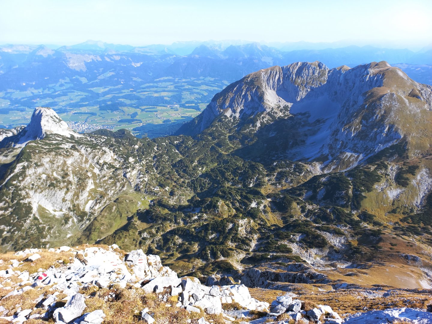
The Tennengebirge is a massive limestone mountain range located about 40 km southeast of Salzburg. Geologically it belongs to the Eastern Limestone Alps. From the Salzachtal and Lammertal valleys rises a steep mountain wall with a plateau at 2 000 metres, from which more than twenty peaks rise to a height of more than 2 000 metres. The highest mountain in the range is the Raucheck (2 430 m). The plateau is also rich in karst formations - chasms and caves, some of which are open to the public, such as the Eisriesenwelt above the village of Tenneck. The steep southern slopes are popular with ferratists and climbers.
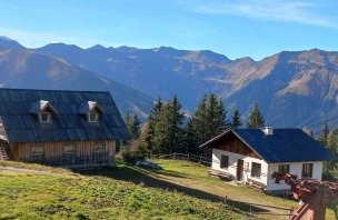
From the town of Abtenau I turn to the Karkogelbahn cable car and then along the narrow road towards Karalm to the forest car park (at about 1000 m). Here I leave the car and follow the marked AV route through the forest towards the Laufener Hütte. After about an hour's ascent through the mixed forest I come to a small wooden almo where a spring rises below the Tagweide 2,128 m above sea level, leading into a small trough. I refill the water and continue along the path between rocks and kneelers, through limestone ravines to the Laufener Hütte hut (1 726 m). Above the hut, the first peak of my route - Fritzerkogel (2,360m) - shines in the morning sun.
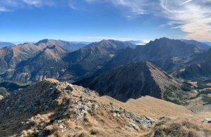
At the hut, a path separates westwards across the plateau to the nearest other hut, Leopold Happisch Haus (6 hours' walk away) and to the second highest peak, Bleikogel (2,411 m). I head south towards Fritzerkogel. The route leads me to the saddle between Fritzerkogel and Edelweißkogel (2 029 m), where the path to the summit turns off. On the opposite hill I see a herd of chamois frolicking. The trail climbs steeply up the bare slope, my legs are getting tired, the last 150 metres are rocky and sometimes I have to help myself with my hands. Finally I see the summit cross, climb over the last rock and a magnificent view of the entire Tennergebirge plateau opens up in front of me. The white rocky plain, sparsely covered with grass and with protruding peaks, literally shines. From the cross, the north face of the Dachstein with its glacier is visible to the east, the Hochkönig massif with its snow-capped peaks rises to the west, and the three thousanders of the High Tatras - Hochalmspitze, Ankogel and Grossglockner - are visible in the distance. In the north, the Salzburg plain and the green peaks of the Salzkammergut with the highest Gamsfeld.
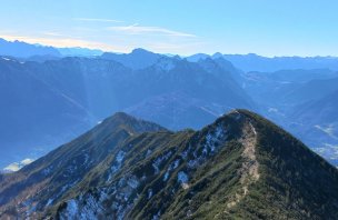
I enjoy the views for a while and then descend the same way back to the saddle and take the unmarked path to the next Edelweißkogel. The hill does justice to its name, I find several flowering prothea in the grass even in September, and there is a small cross on the top, also with an engraving of this alpine flower. I kneel down a few dozen metres to the next saddle, where I again encounter the marked path from the Laufener Hütte. From the fork, the climb to the third hill, Hochkarfelderkopf (2,218 m), begins. The path is grassy, rather just steps made of sod. Over a few terrain undulations I reach the top with a wooden cross. From here there is a wonderful view of the opposite Dachstein and Gosaukamm.
The route continues along the ridge, climbing for a while, descending for a while, crossing rocks, in a few places it is secured with a rope, but always only a few meters, nothing difficult. At the end of the ridge above the viewpoint of Abtenau is the massive cross of the fourth peak Tagweide. From here it's a steep descent down a grassy slope to the First Saddle at 1818 m. The descent is secured with ropes in several places, but can be dangerous in wet conditions, the limestone and grass slippery. At the saddle I say goodbye to Dachstein and descend along the Schallwand wall down to the almo where I took water in the morning. Then along the same forest path back to the car. On the way 8 hours, about 12 km, climbed about 2000 vertical meters.
Difficulty
The ascents to the Tennergebirge plateau are demanding in terms of altitude and there are not many opportunities to rest and refresh at the huts on the plateau itself. The total elevation gain of this trek is around 2000 metres!
Water availability
It is possible to refill water at the spring at the beginning or end of the trip. Refreshments at the Laufener Hütte.
Sleeping options
One-day trek, overnight stay at Laufener Hütte or in the valley.
Mountain peaks
The route passes the following peaks - Fritzerkogel 2,360 m above sea level, Edelweisskogel 2,029 m above sea level, Hochkarfelderkopf 2,218 m above sea level and Tagweide 2,128 m above sea level.
Views east - north face of the Dachstein, Gosaukamm, south - Scladming Tauern, High Tauern, west - Hochkönig, north - Salzkammergut (Salzkammergut)
Danger
Alpine trek mostly through meadows, grassy and gravel paths, steep rocky ascent to Fritzerkogel (watch out for falling rocks), steep descent from Tagweide sometimes secured with ropes (at the end you run out of strength).
Food
Takeaway food, refreshments only available at the Laufener Hütte.
Attractions
The route can be shortened by the Fritzerkogel or extended by descending back to Abtenau (cable car, toboggan run).