Mountain range, region / State
Schneeberg and Rax Aple / Austria
Season
Summer
21. 09. 2024
Difficulty
3 / 5
Elevation
↑ 1166 m
↓ 1166 m
Length
16.2 km
6 hours
Altitude
max. 1597 m n.m.
min. 525 m n.m.
Tips for hikes in the mountain range Schneeberg and Rax Aple
Trek in the Raxalpe mountains with a short ferrata

Raxalpy -Preinerwand,Heukuppe: combined crossing: via ferrata-trip
Krummbachstein 1 603 m above sea level near Schneeberg, Austria
Starting point
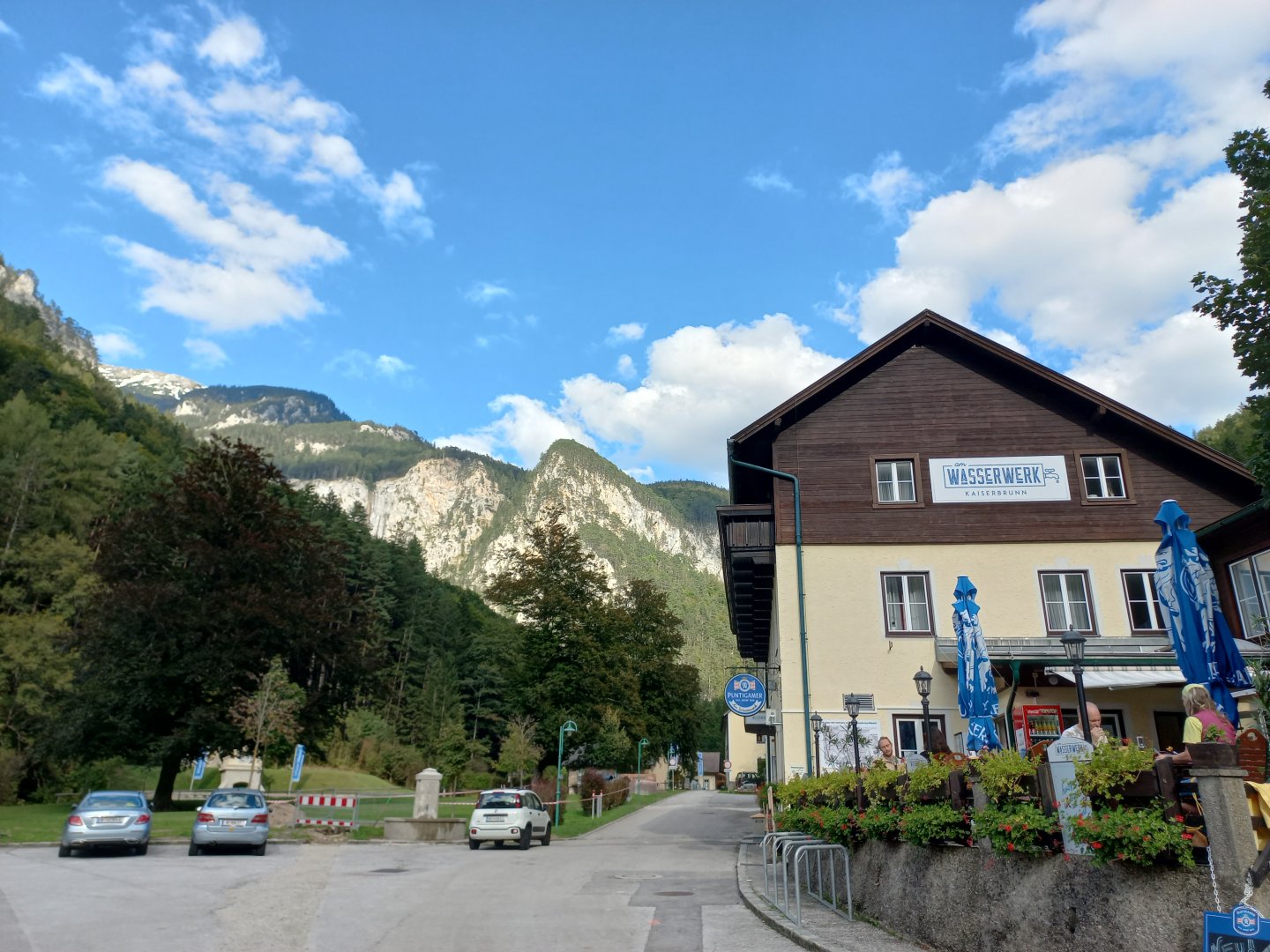
The village of Kaiserbrunn in the Höllental valley. The road leads here from Reichenau an der Rax.
Description of the hike
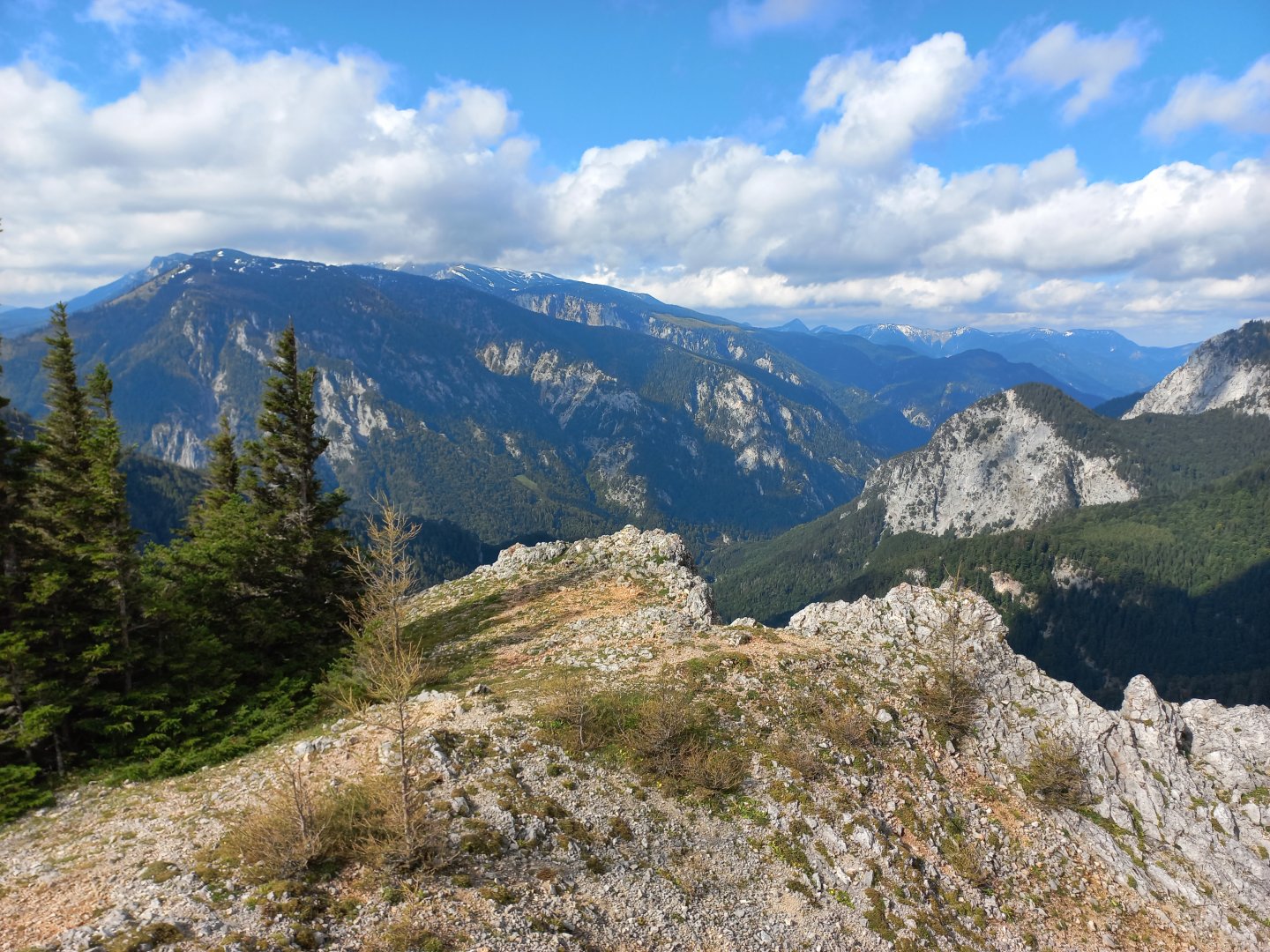
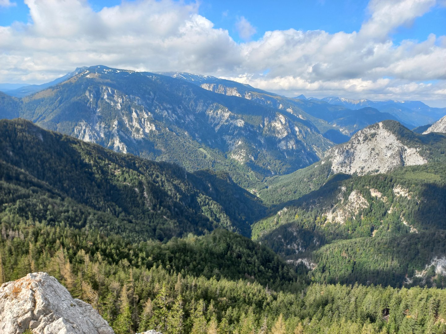
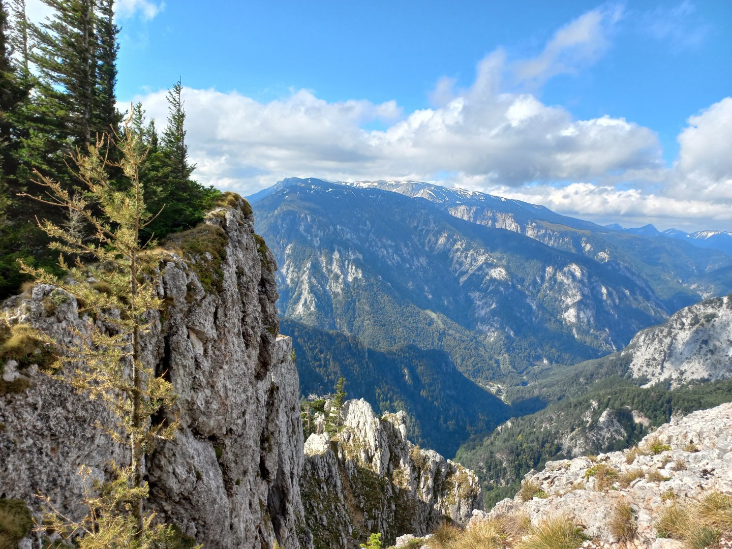
Krummbachstein caught my eye the first time I read about it on an Austrian blog. A mountain with beautiful views of the adjacent two-thousand-foot Schneeberg and the nearby Raxalpe and Schneealpe mountains, an interesting cross and a height of 1,603m, just like the Czech Sněžka. Several paths lead to Krummbachstein. Probably the most visited is from the south, from Reichenau an der Rax, via Eng. I went up it from the west from the village of Kaiserbrunn.
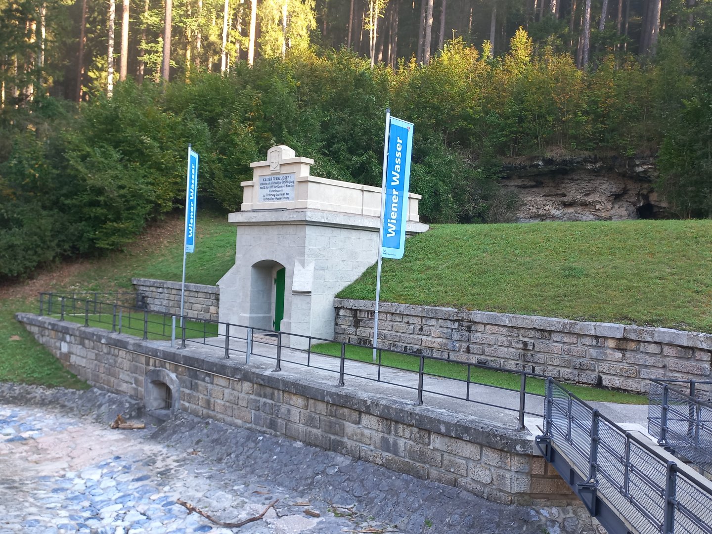
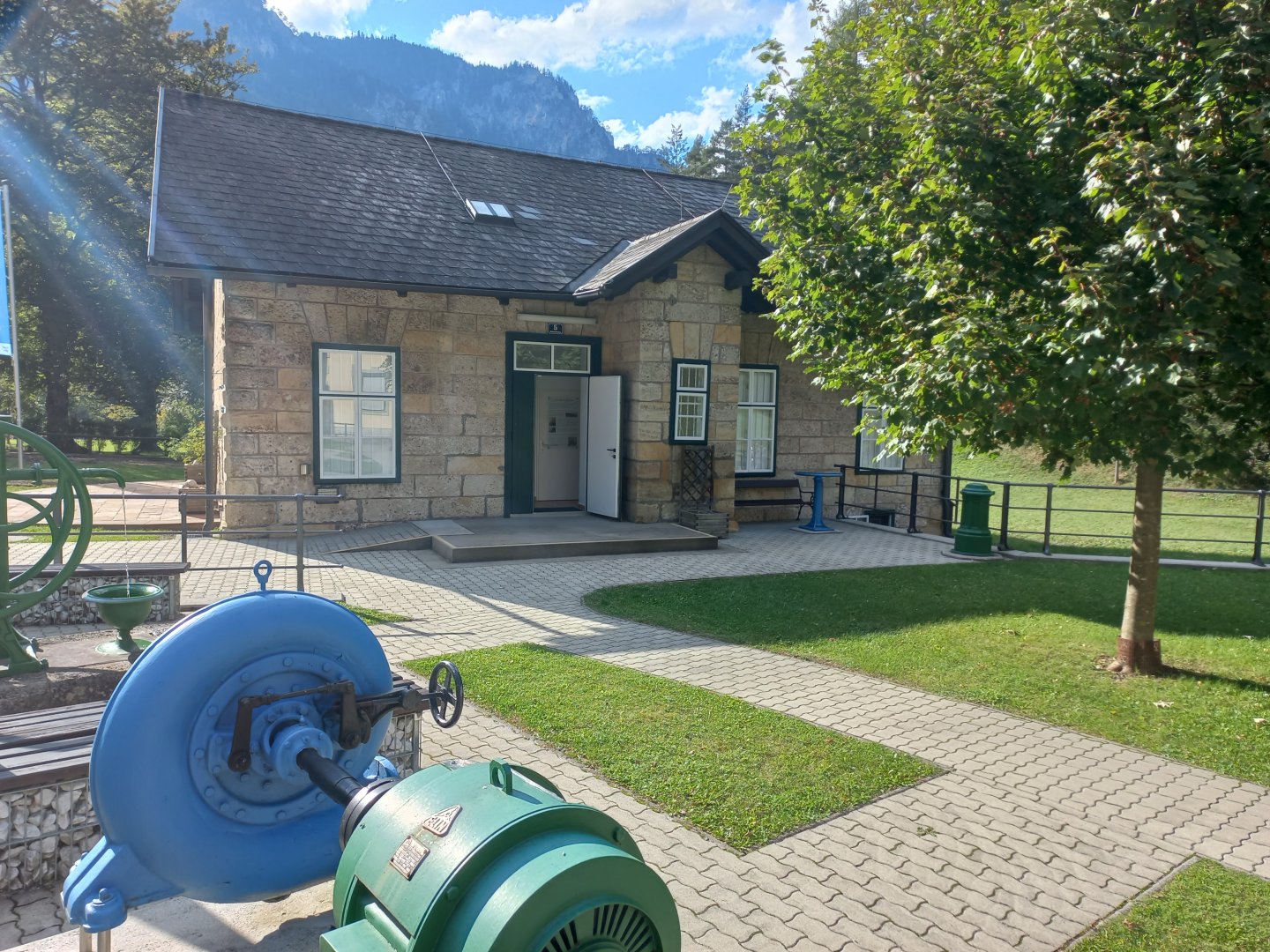
I leave my car in the parking lot in Kaiserbrunn. The name Kaiserbrunn means Imperial Spring, which recalls the history of this place - the strong spring that springs here was donated by Emperor Franz Josef to Vienna and in 1869 an underground canal was built from here, bringing water to Vienna. The magnificent waterworks, which still supplies Vienna with fresh water from the Rax and Schneeberg, covers a distance of 150 km and delivers water to Vienna by gravity alone in 24 hours. There is also an exhibition about water and the Hochquellen-Wasserleitung Wien, which you can visit free of charge.
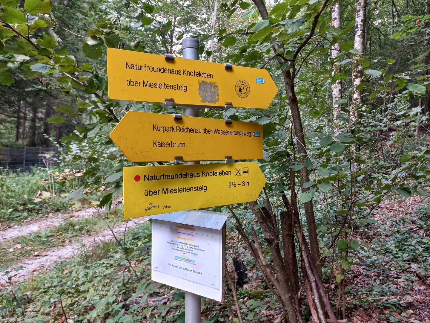
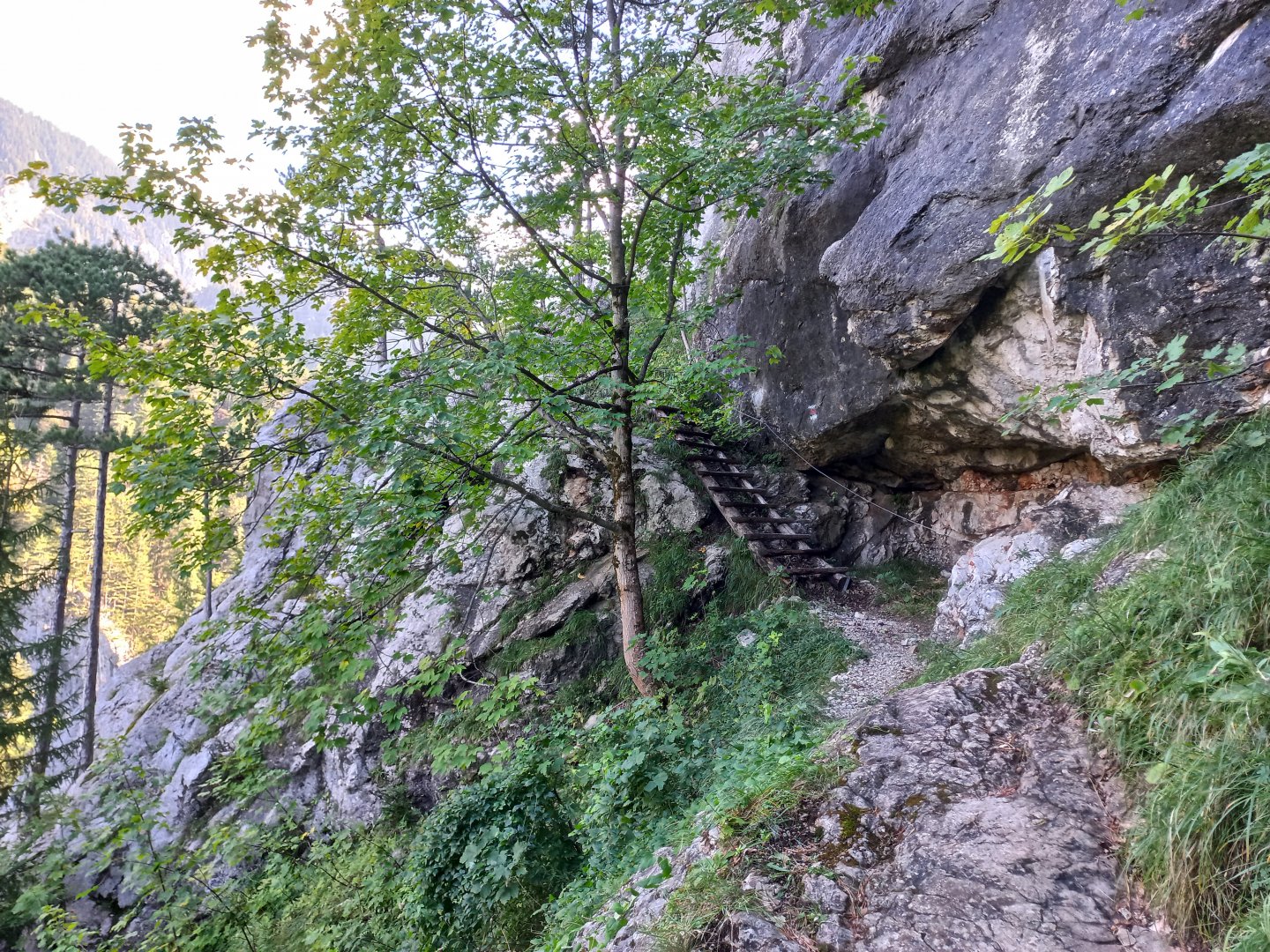
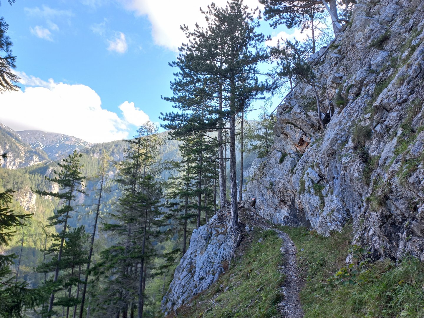
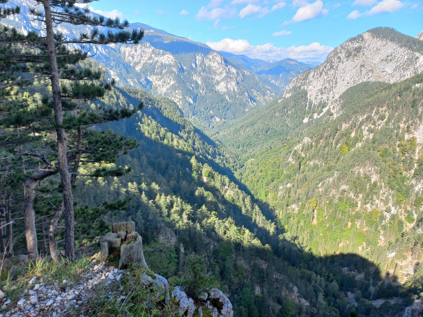
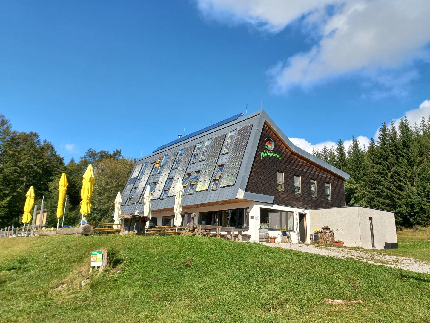
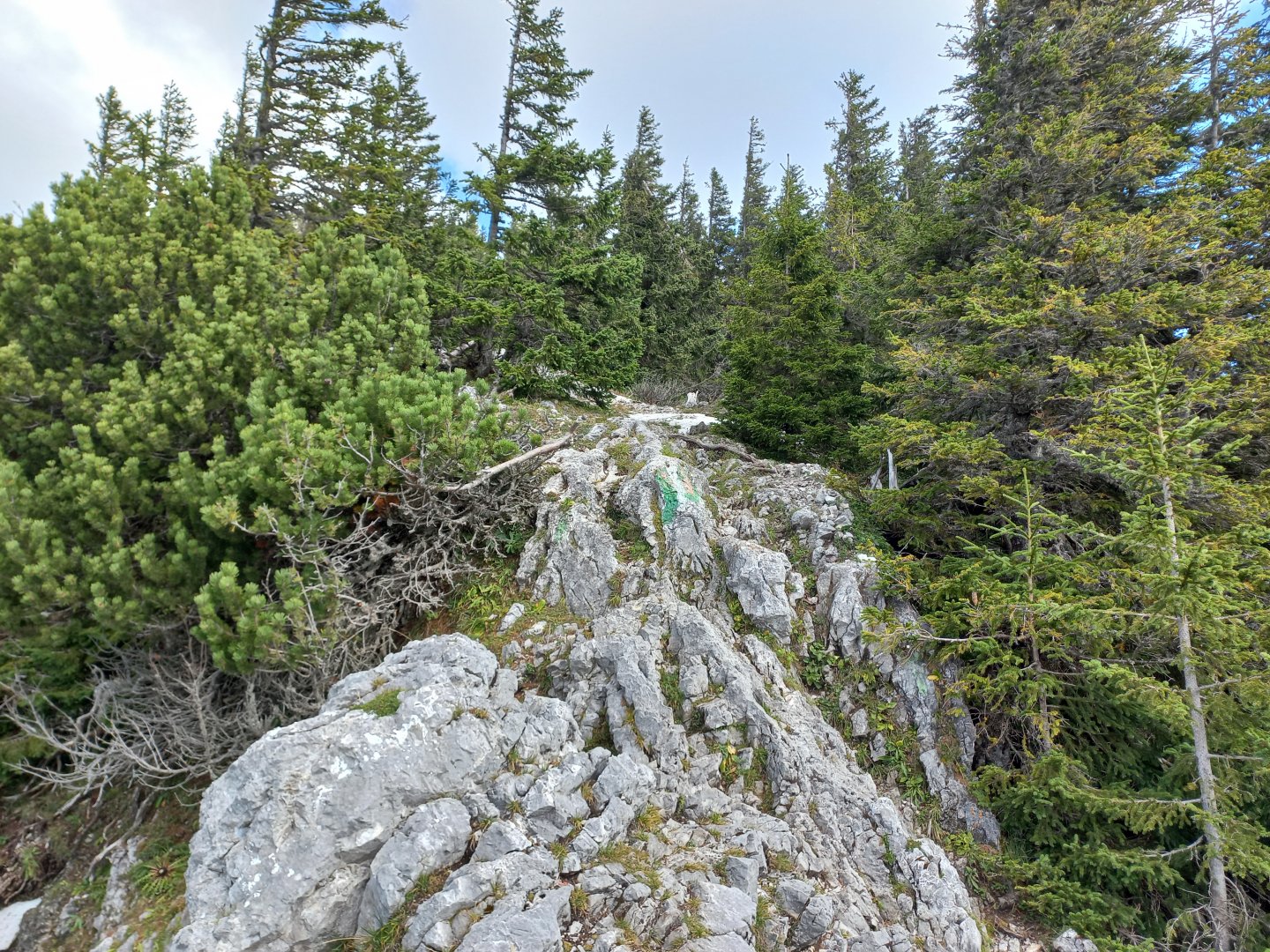
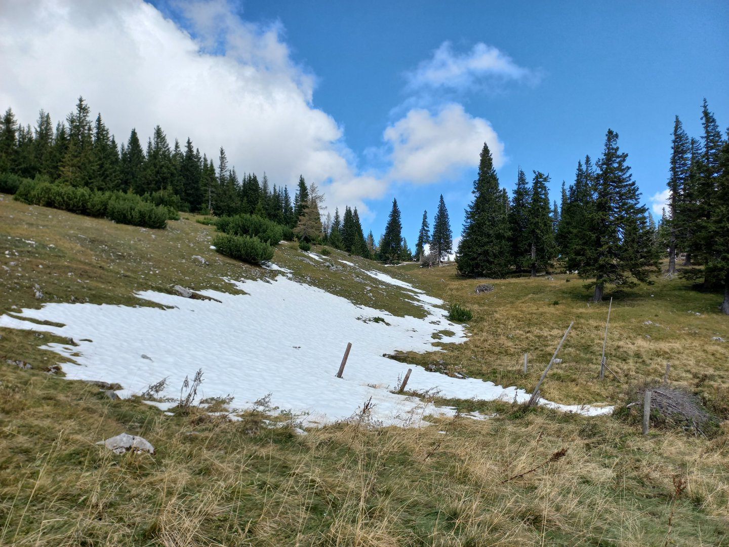
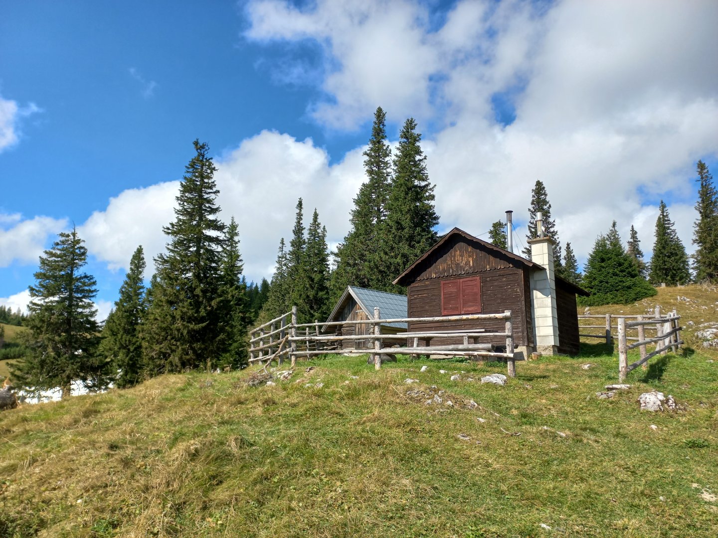
Just past the houses of Kaiserbrunn, the hiking trail starts to climb up the slope to the right. The Miesleitensteig trail, which leads through the Klausgraben and Knofelebengraben ravines, amuses me - the narrow path traverses steep slopes through the forest, bypasses rocks, and features several ladders. There are a couple of sections secured with ropes, but this is not a ferrata, just a safer way to cross the rocky sections. From the start of the route there are views of the south-western slopes of the Schneeberg with its jutting cliffs. Beyond the Höllental valley, where the road leads, you will see the main ridge of the Raxes and the upper station of the Raxseilbahn. The ascent to the Naturfreundehaus Knofeleben hut takes about 2 hours.
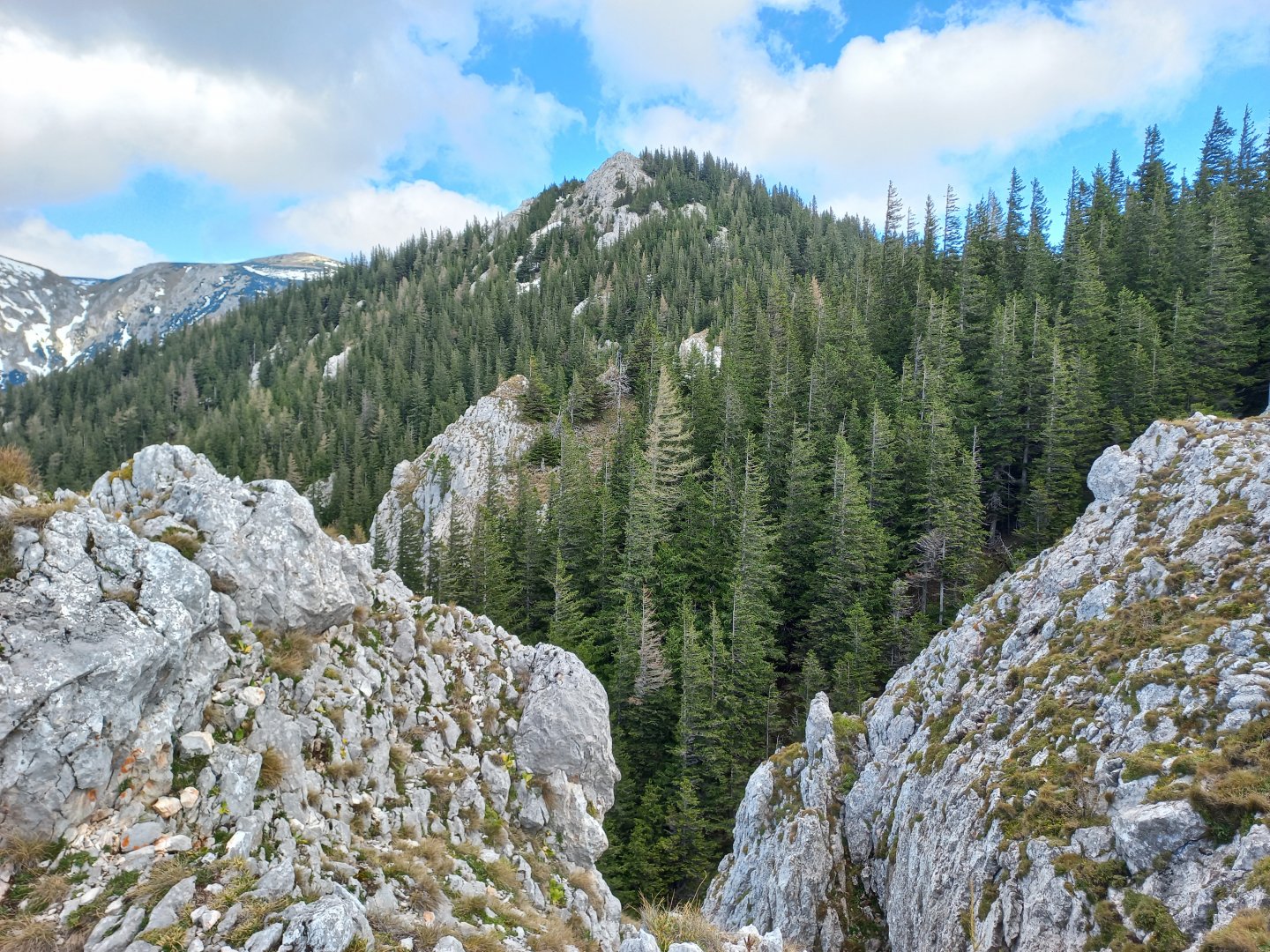
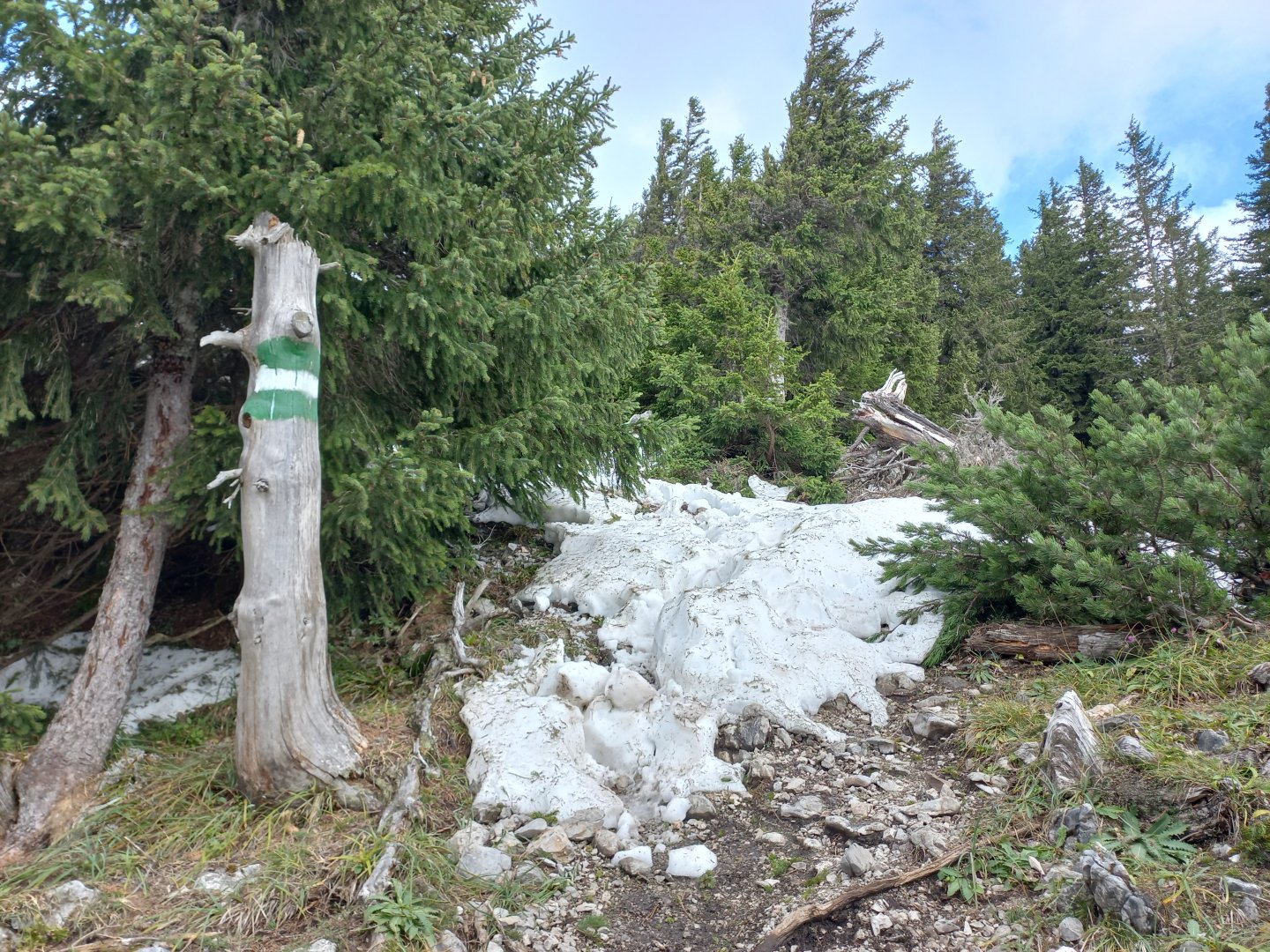
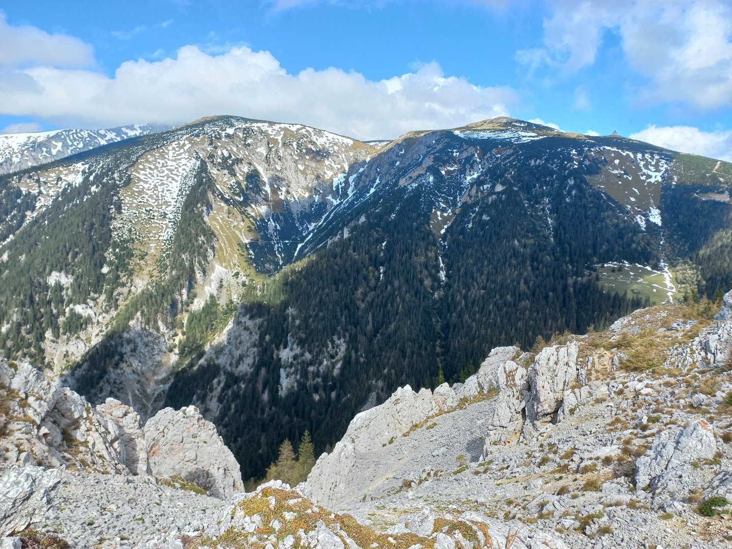
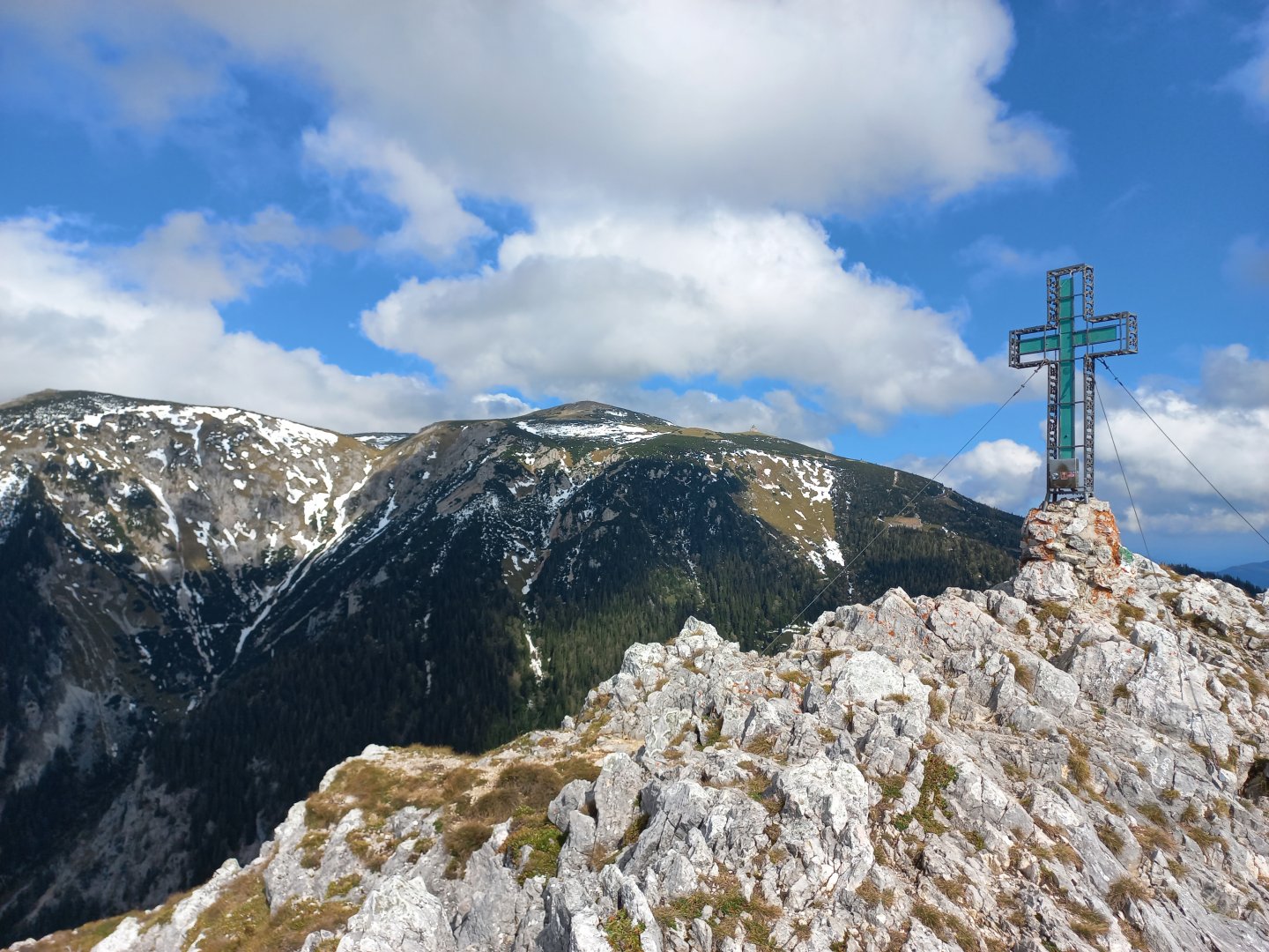
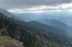
After the hut, the path continues along the edge of the slope to Krummbachstein. The last few metres lead over stone crags, sometimes involving your hands, but nothing too demanding. The top is rocky and decorated with an unusual green cross. The Schneeberg is within easy reach - to the north is the summit Klosterwappen (2,076m) with its transmitters and summit cross, to the east you will see the Waxriegel (1,888m) and the Elisabeth Kircherl chapel. The church was built on an elevated site by Emperor Franz Josef in memory of his wife, Empress Elisabeth - Sissi. In the slope of the Schneeberg there is a tunnel through which runs the cog railway of the colourful Salamander Zug (Schneebergbahn), an almost obligatory attraction of the region. To the west, the panorama of the Rax and the Schneealpe opens up. I sit at the top for a while, watching the yellow trains and the mountains dusted with the first snow.
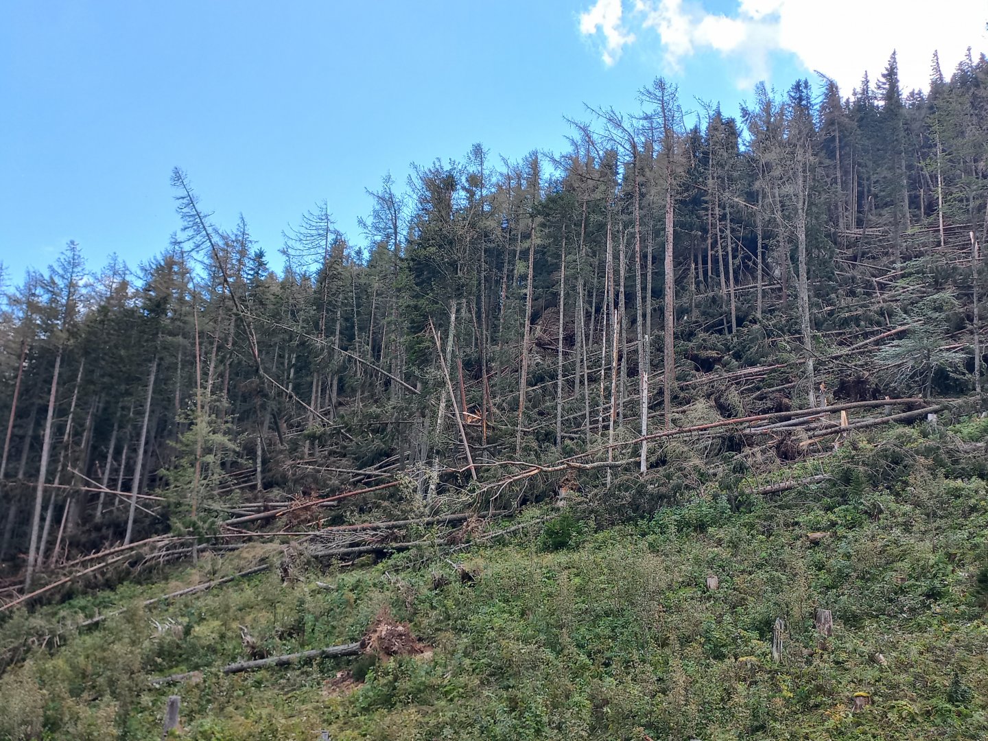
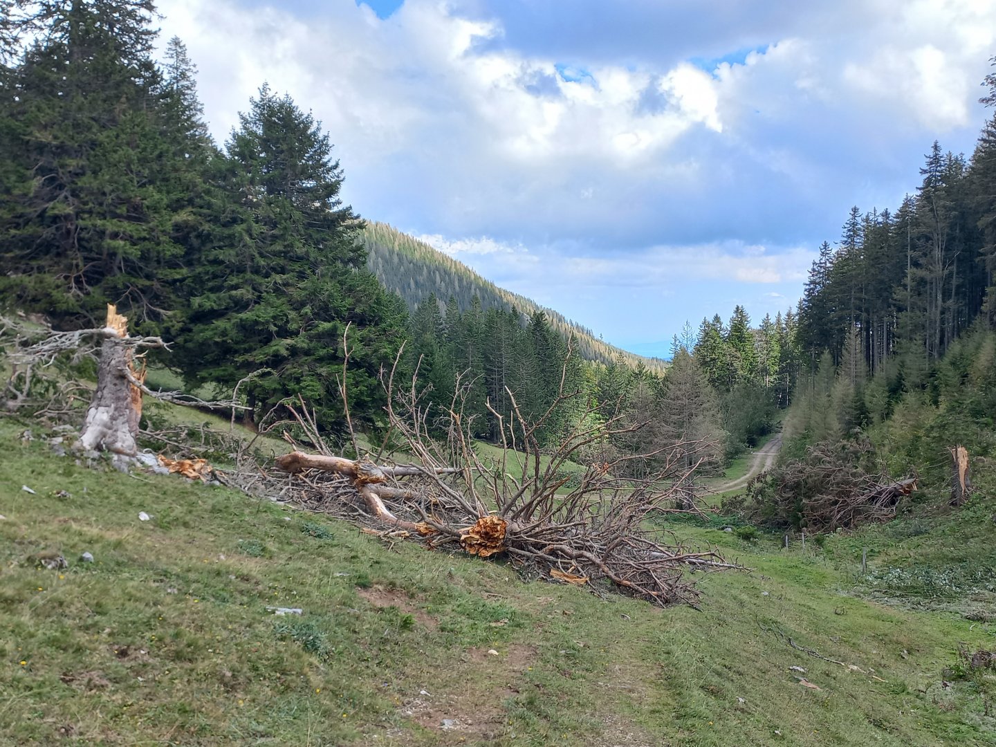
Tourists come from the other side and say that it is impossible to pass because of the fallen trees. Boris pressure low here has triggered a major hurricane. Despite this, I set off on the yellow trail past the small hut Alpenfreundehütte through the alm down. But right at the edge of the forest I am stopped by a large log which cannot be avoided. I return to the ridge and try the blue marker on the other side of the hill. Here too there are a few fallen trees, but I pass onto the meadows of Nesselgraben. I follow the yellow trail back along the wide forest path to the Knofelebe hut. I then follow the same path back down the ravine to Kaiserbrunn.
Difficulty
It is a climb to the scenic peak on marked hiking trails, there are no exposed places on the route. The hut is located approximately in the middle of the route.
Water availability
Water with you, refreshments are available at the cottage.
Sleeping options
Naturfreundehaus Knofeleben (good starting point also for climbing the Schneeberg - 5 hours away)
Mountain peaks
Climb to the top of Krummbachstein 1 603 m above sea level, views of Raxalpe, Schneebelg and Schneealpe.
Danger
The route is not dangerous, it leads along marked paths. In some places a steel rope or ladder is installed to make walking easier. But nothing difficult. At the time of this trek, there were large tree breaks in the forest passages due to a previous windstorm.
Food
Food to go or at the Knofeleben hut.
Attractions
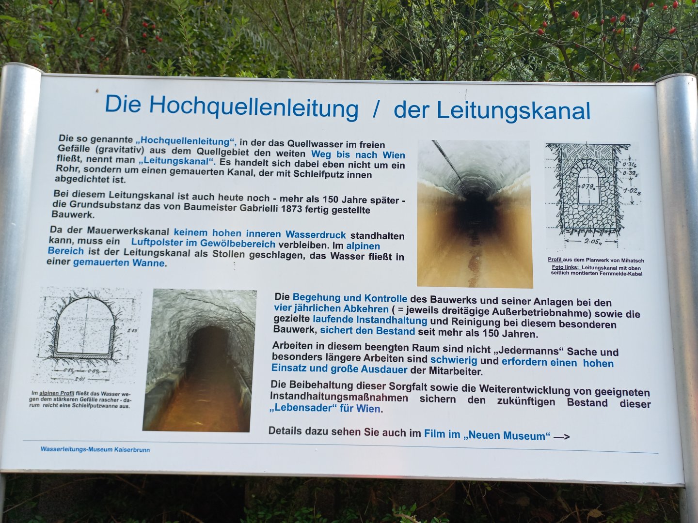
You can find out more about the Hochquellenwasserleitung Wien, which brings water from the Alps to Vienna in two canals, on this website.
The Hochquellenleitung began to be built in the 1860s to solve the acute water shortage in Vienna. The population in the capital of the monarchy was growing rapidly and the water supply from domestic wells was not sufficient.
In 1864 it was decided to build a waterworks to bring water from the Rax and Schneeberg regions to Vienna. Studies were drawn up and the construction of the works was awarded to the London builder Gabrielli. Emperor Franz Joseph symbolically donated the spring in Kaiserbrunn to the Viennese people. At the end of 1969, construction began with the first blast in the Höllental valley, and four years later, the Hochquellenleitung was inaugurated in Vienna by Kaiser Franz Josef.
The first Hochquellenleitung emanated from the Kaiserbrunn and the water travelled to Vienna through tunnels in the rock, brick passages and several aqueducts. The movement of the water was made possible only by gravity - by self-propulsion, where the water overcame an altitude difference of almost 300 m along the 90 km route. It took about 16 hours for the water to reach Vienna. Later, the Wasserleitung was extended to the Raxalpe area, about 150 km from Vienna. After 1900, the construction of the 2nd Hochquellenleitung from the Hochschwab area, near Wildalpen, began. Along the way, water is collected in several reservoirs, the capacity of which is approximately equal to four days' water consumption in Vienna. The Hochqellenleitung supplies water to the metropolis of two million people to this day.