Mountain range, region / State
Ennstal Alps / Austria
Season
Summer
11. 08. 2024
Difficulty
3 / 5
Elevation
↑ 801 m
↓ 801 m
Length
8.2 km
4 hours
Altitude
max. 1548 m n.m.
min. 849 m n.m.
Tips for hikes in the mountain range Ennstal Alps
Climb to Hochtor, the highest mountain in the Ennstal Alps
Climb to the top of Scheiblingstein in the Ennstal Alps

Hike to the Wasserklotz lookout in Kalkalpen NP
More challenging trek to the Kampermauer wall in NP Kalkalpen
Starting point
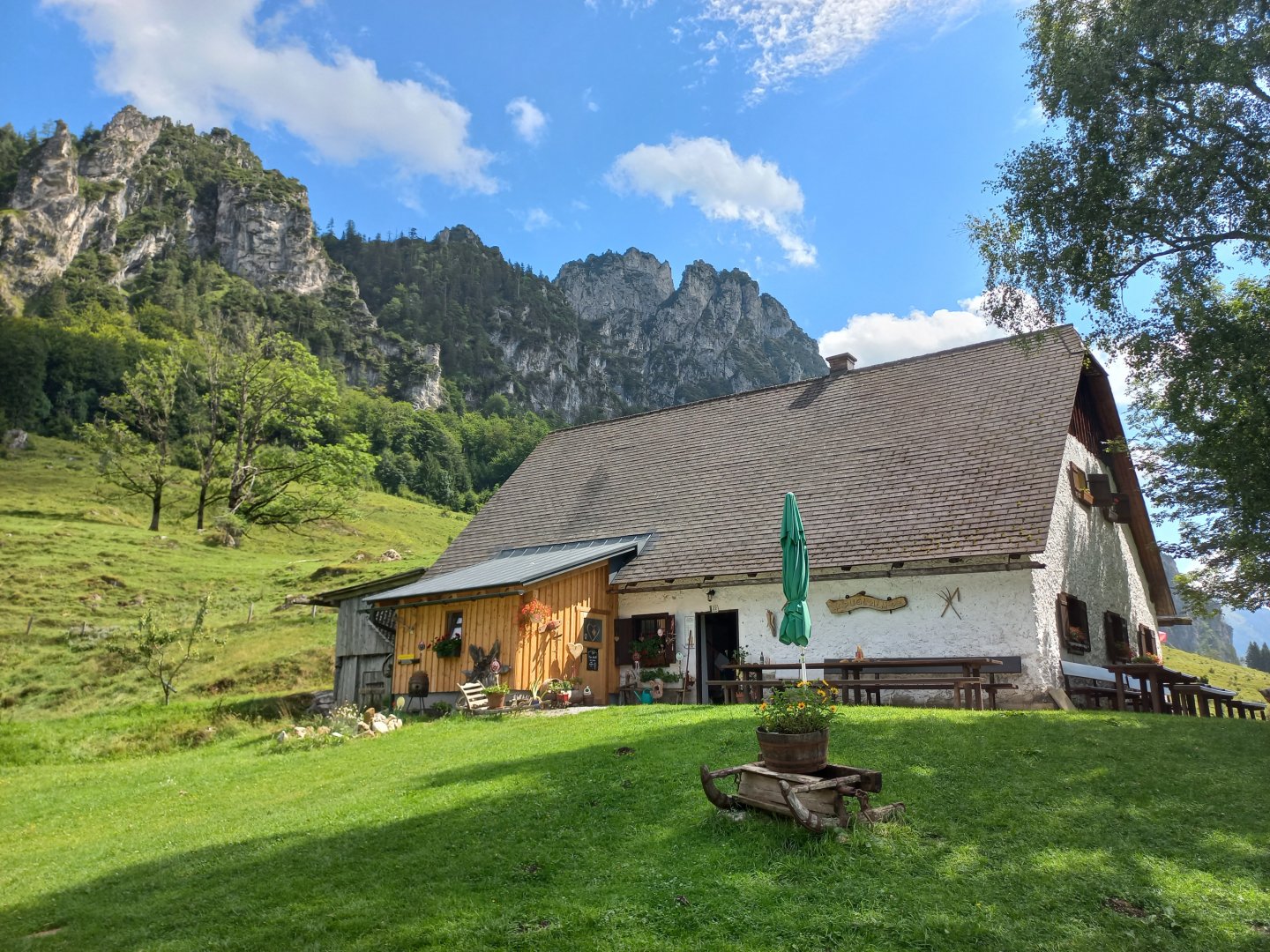
Hengstpassstrasse, free parking under the Puglalm. The road leads here from Windischgarsten.
Description of the hike
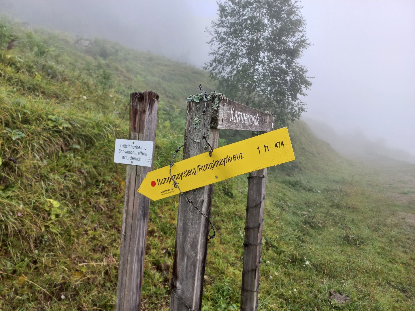
I park my car just off the Hengstpassstrasse in the free car park under the Puglalm alm. It's 7.30 in the morning, everything is foggy, only a white goat is watching me curiously. I can't see more than 20 metres in the fog, so I rely on Maps.cz and walk up the wet meadow. Below the forest I find the turn-off to Rumplmayrsteig/Rumplmayrkreuz, a journey that should take an hour. There is also a warning that the path is more technically demanding (Trittsicherheit und Schwindelfreiheit erforderlich!).
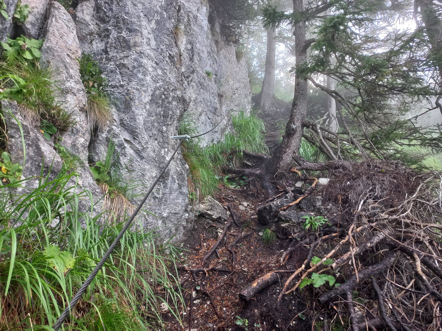
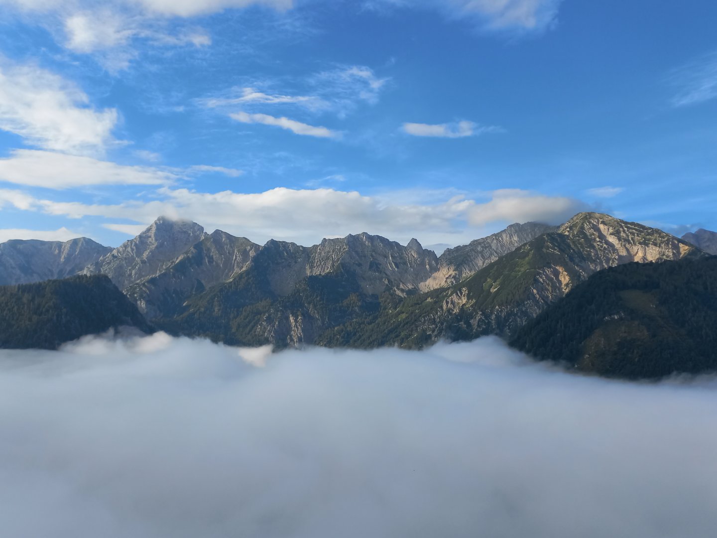
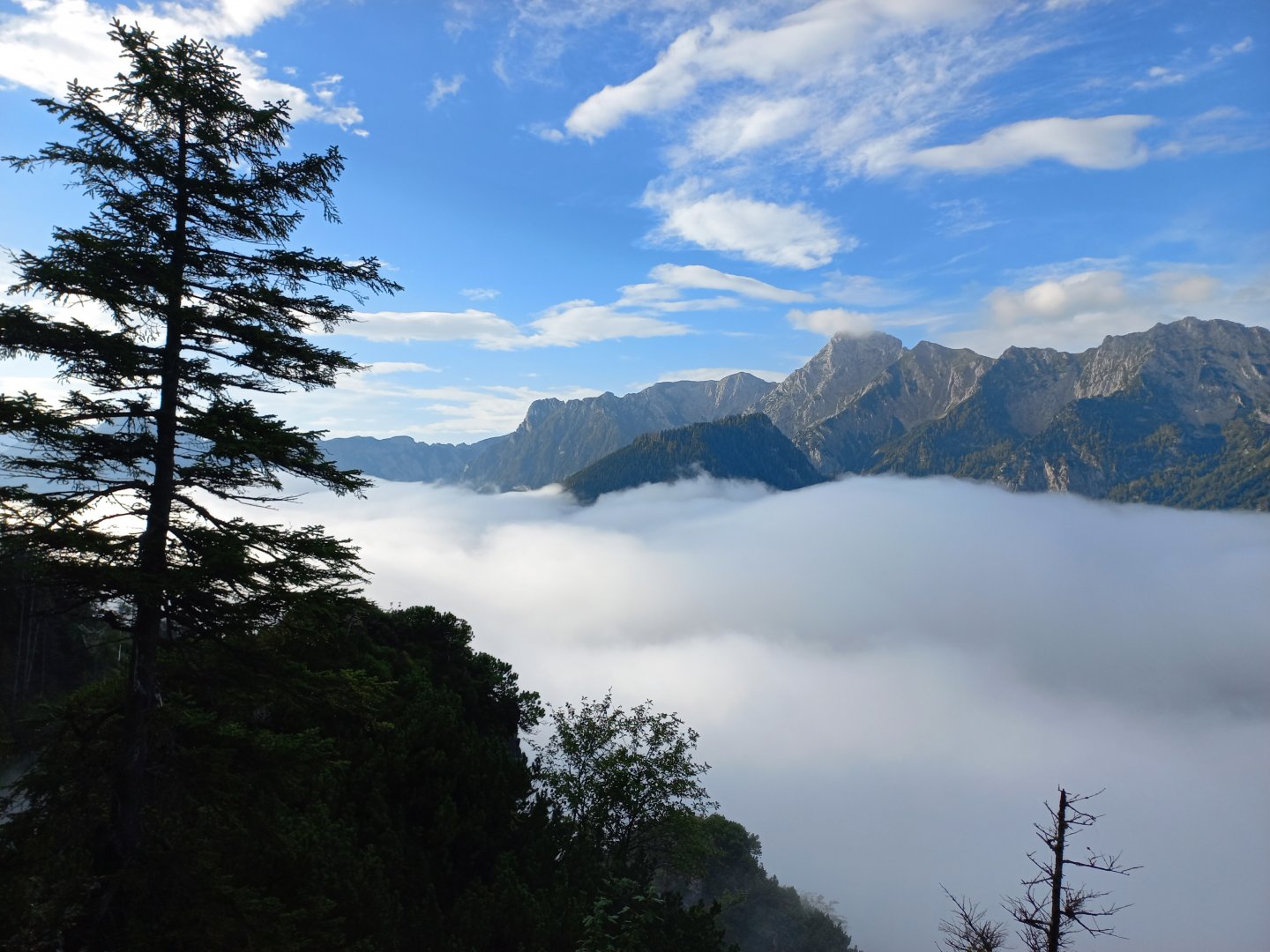
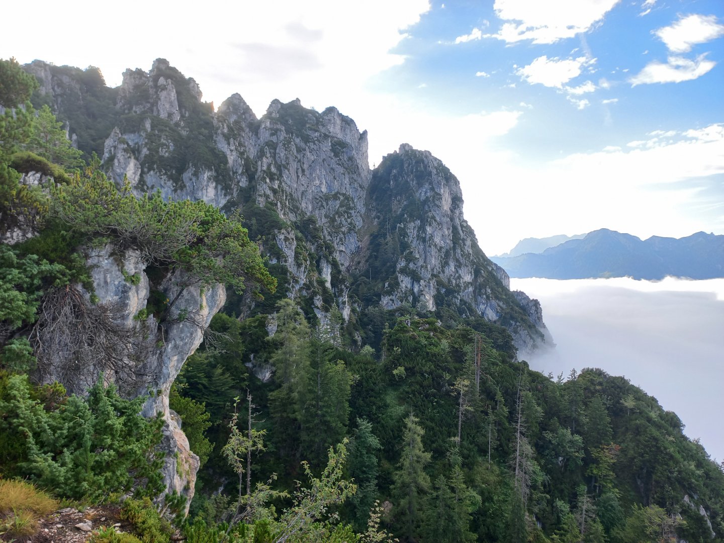
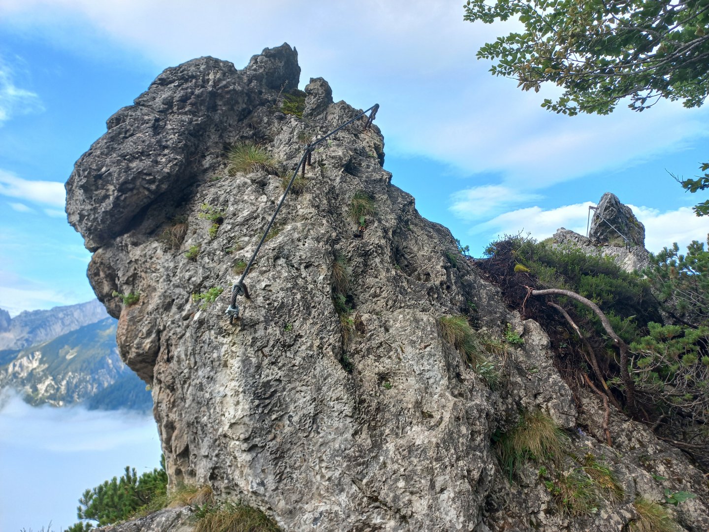
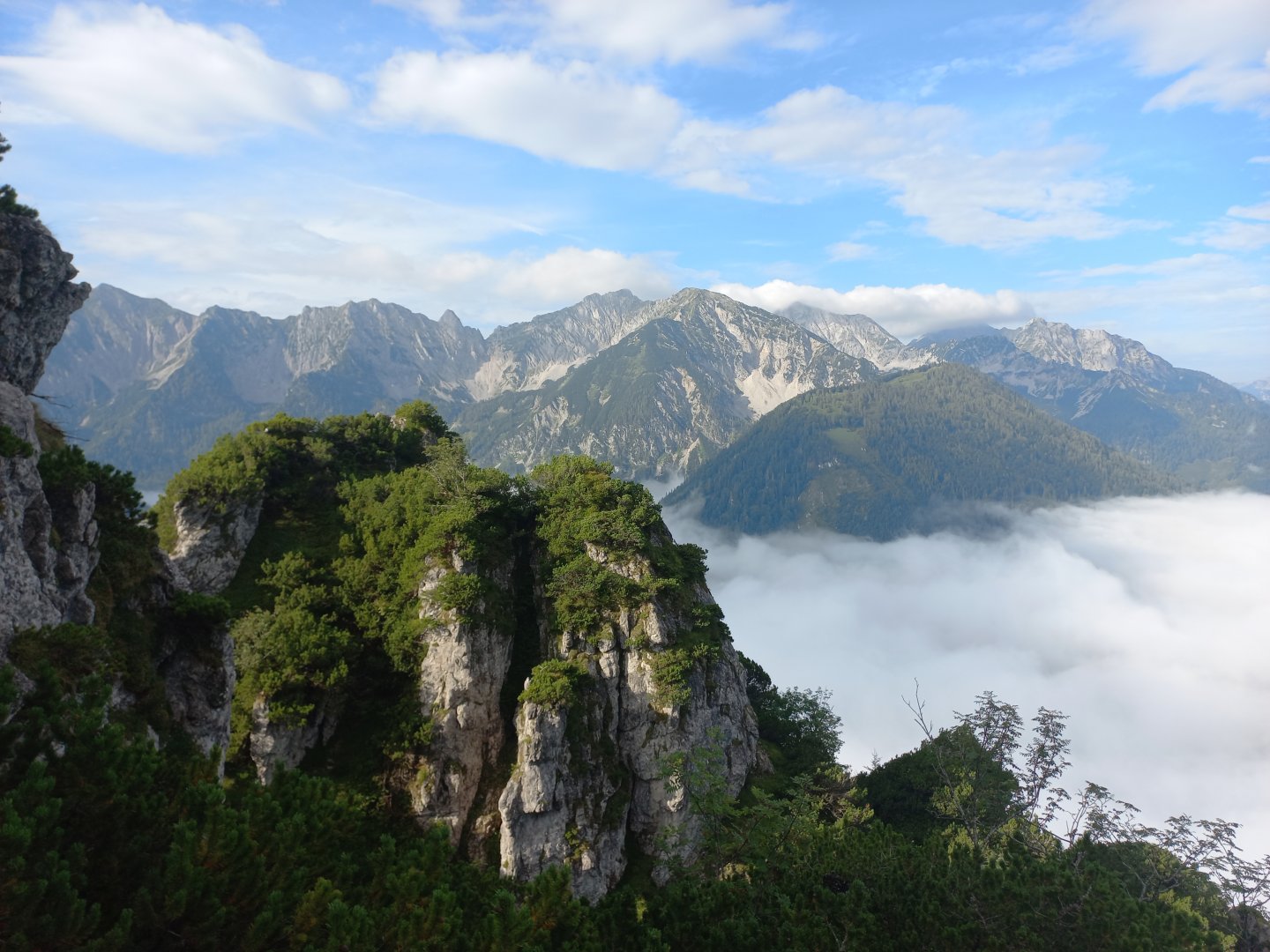
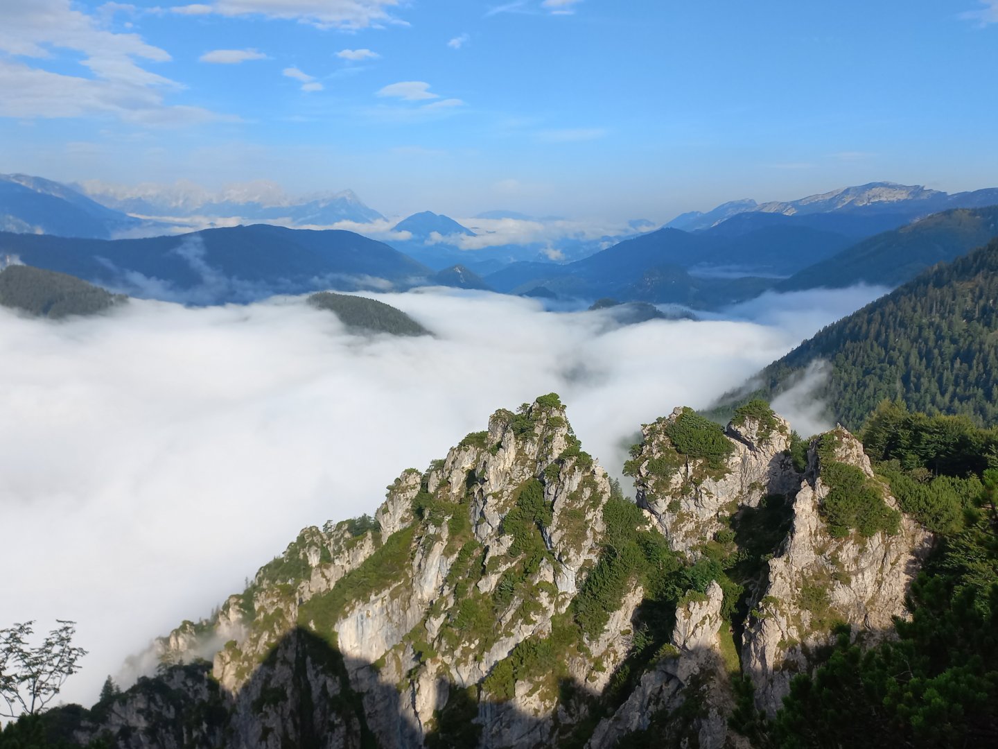
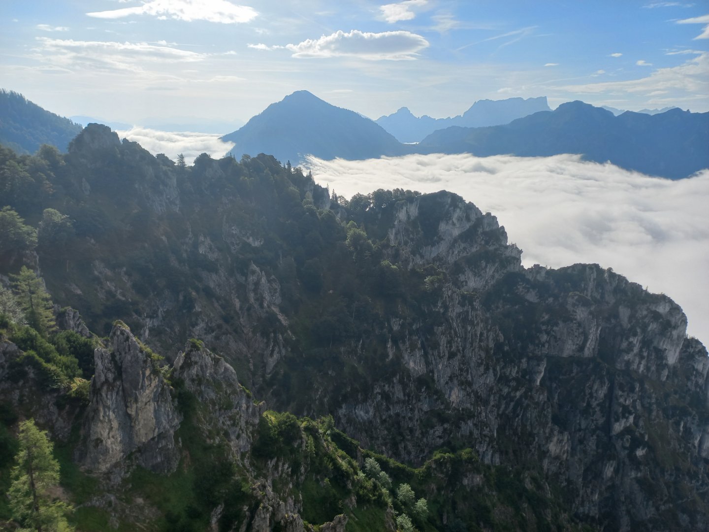
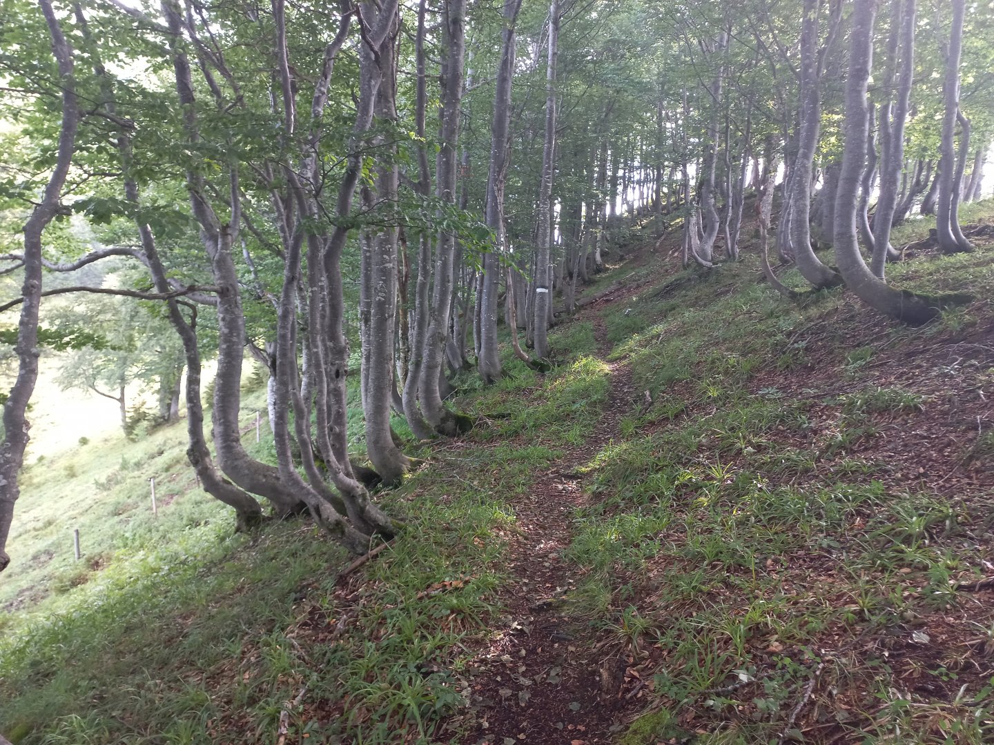
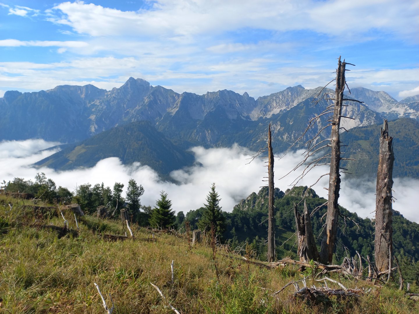
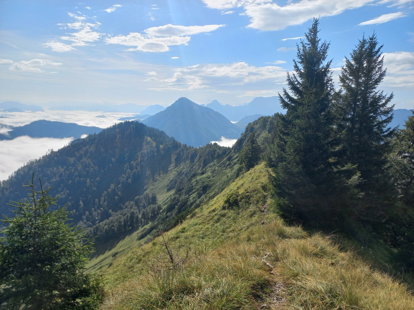
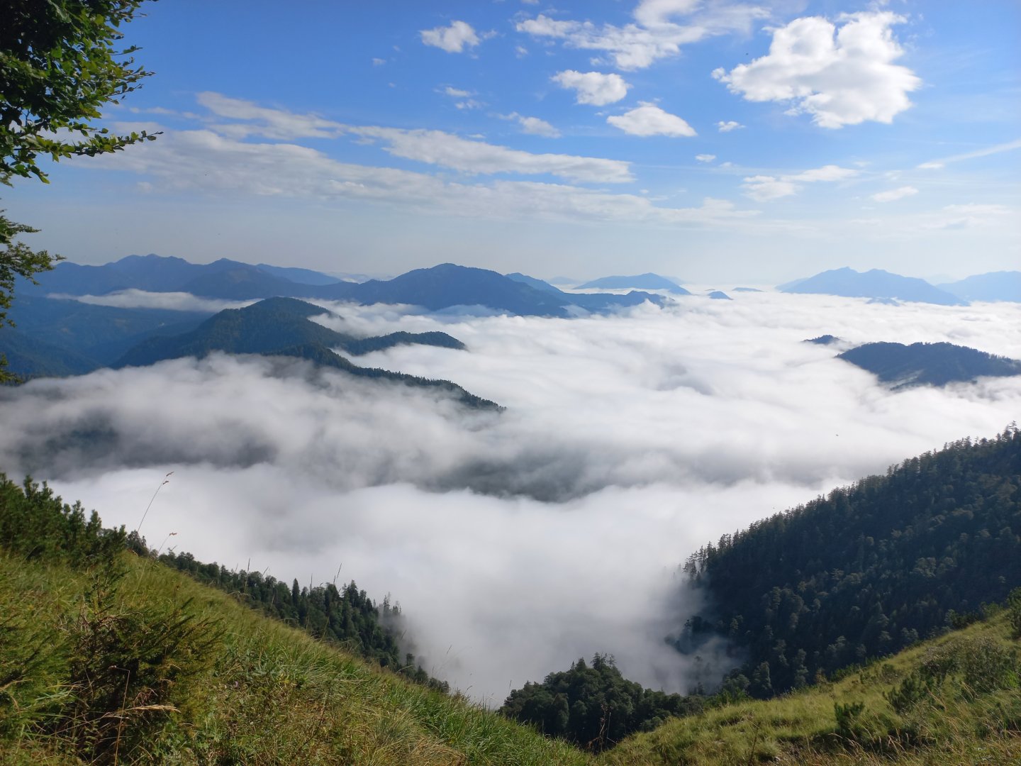
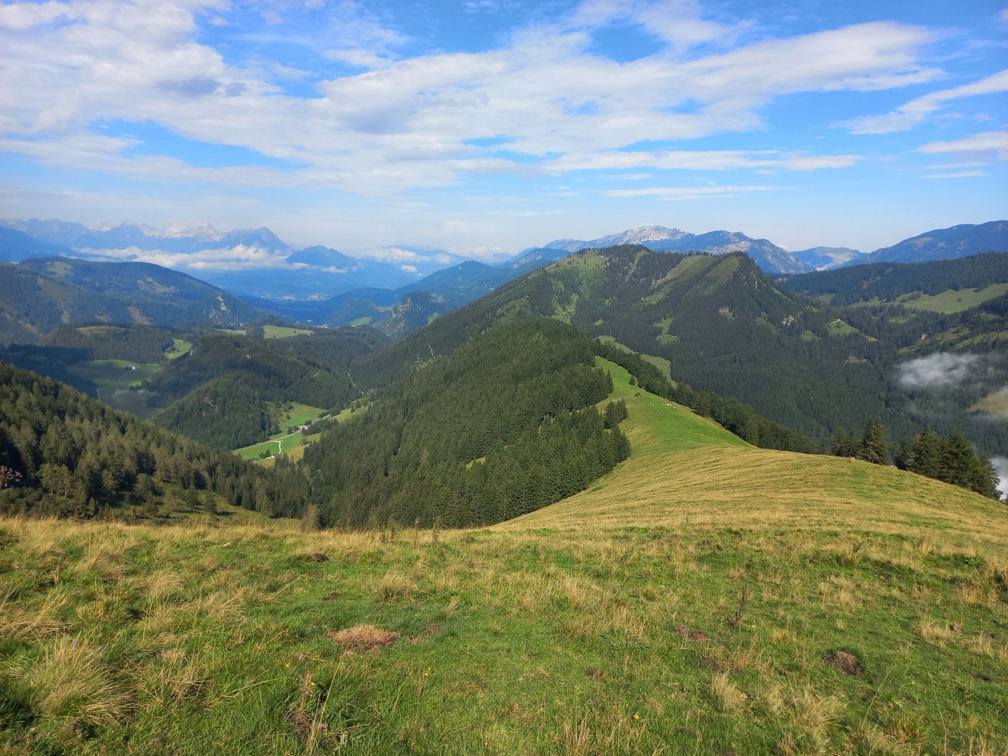
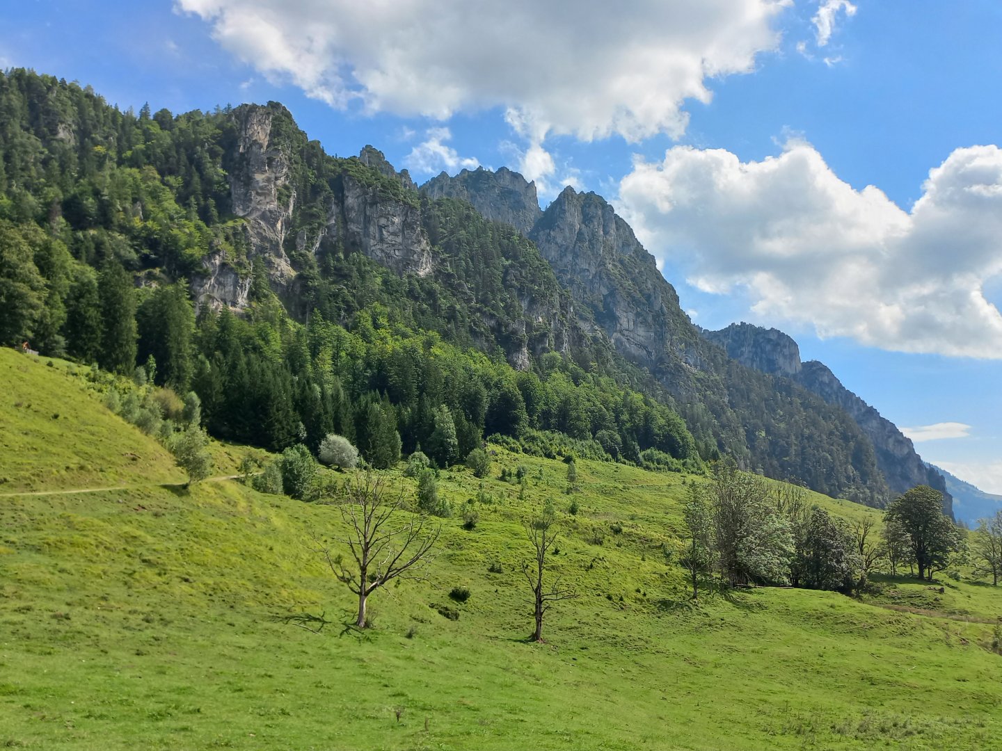
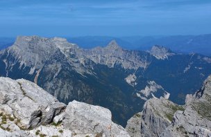
The path climbs steeply up a narrow forest path. Not entirely pleasant in the wet, the roots are slippery. The first rocks appear, somewhere a rope is stretched to hold them, but nothing exposed yet. I still can't see much in the fog, I'm still climbing up. And then suddenly the fog clears and I see the sunlit Haller Mauern across the valley. It's incredibly beautiful, a river of mist bubbling below me, the two-thousanders Hexenturm, Scheiblingstein, Grosser and Kleiner Pyhrgas basking in the sun above. To the west in the distance Warscheneck, Grosser and Kleiner Priel in the Totes Gebirge and Hoher Nock, the highest mountain of the Sengsengebirge. Timing exactly to the Rumpmayrkreuz (Karlkreuz) viewpoint at about 1200 m. The Kampermauer wall (1394 m) also emerges from the mist.
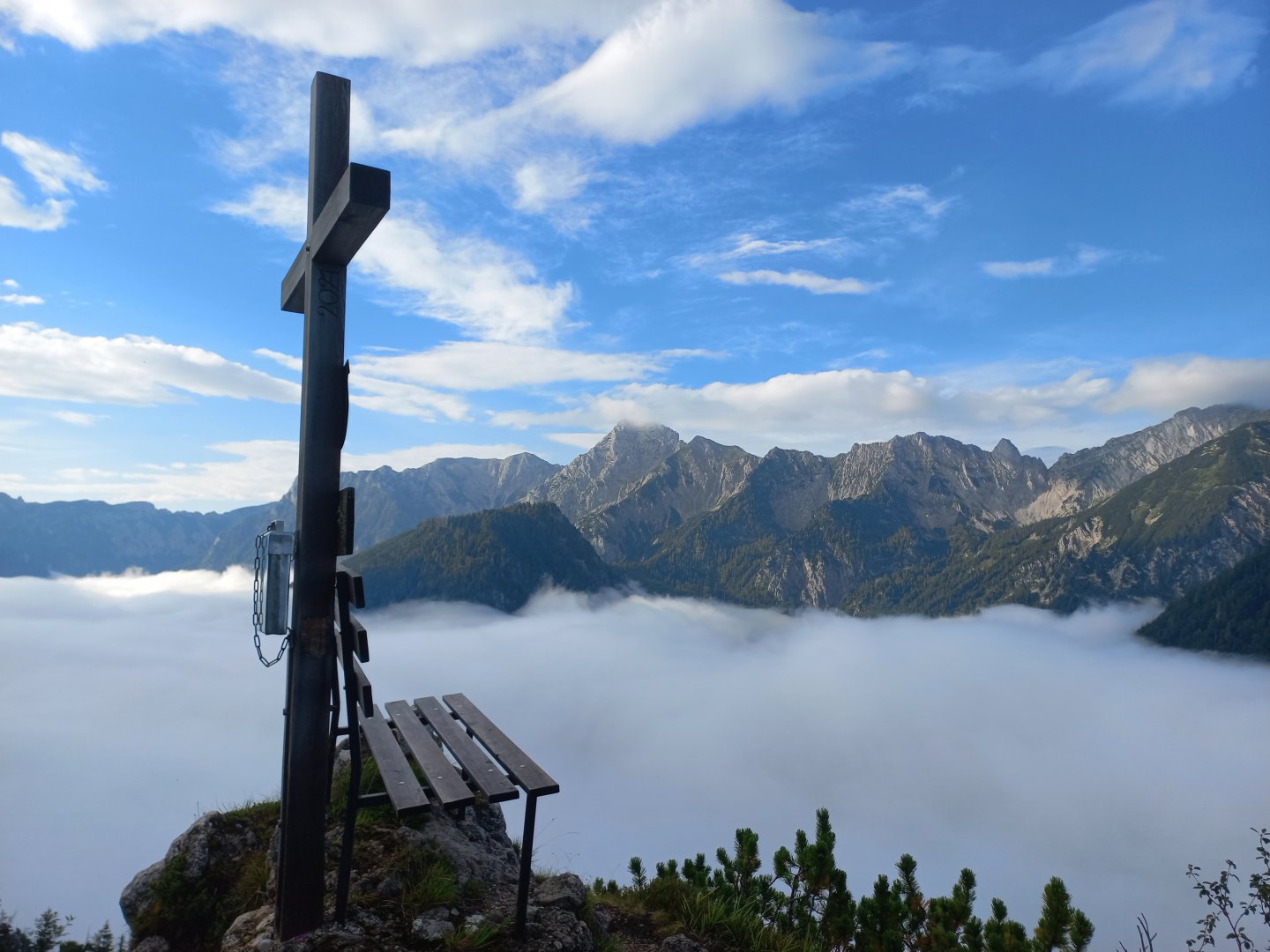
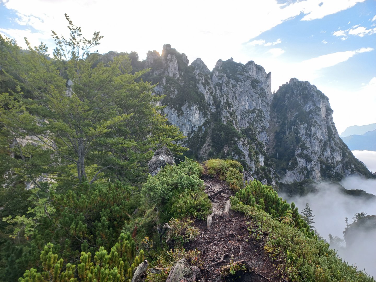
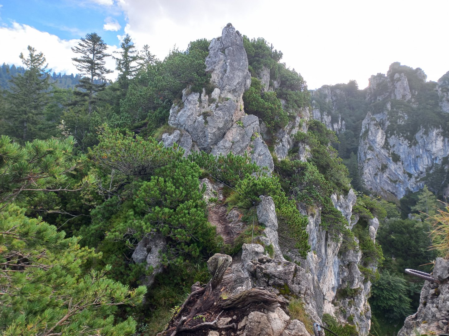
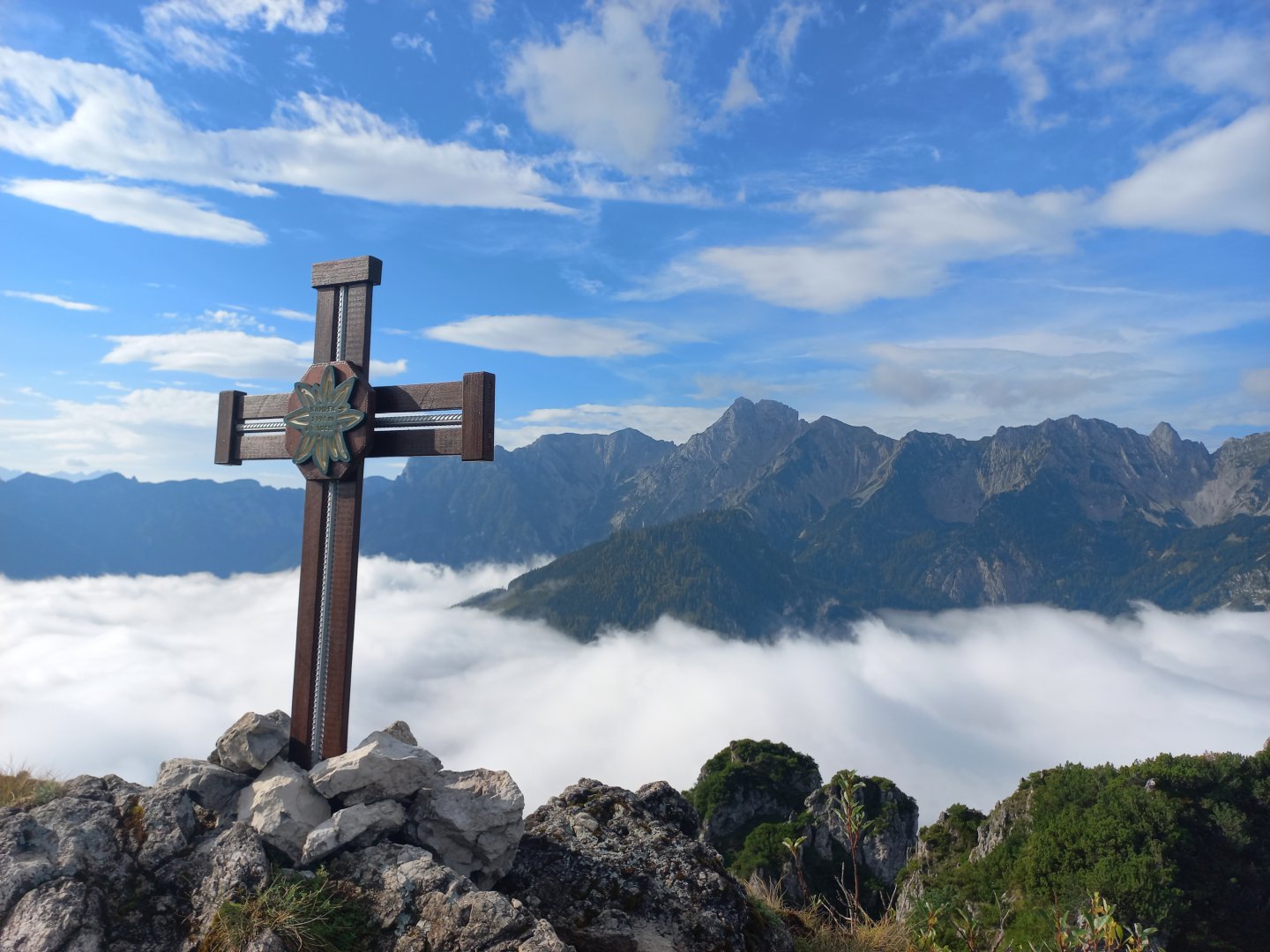
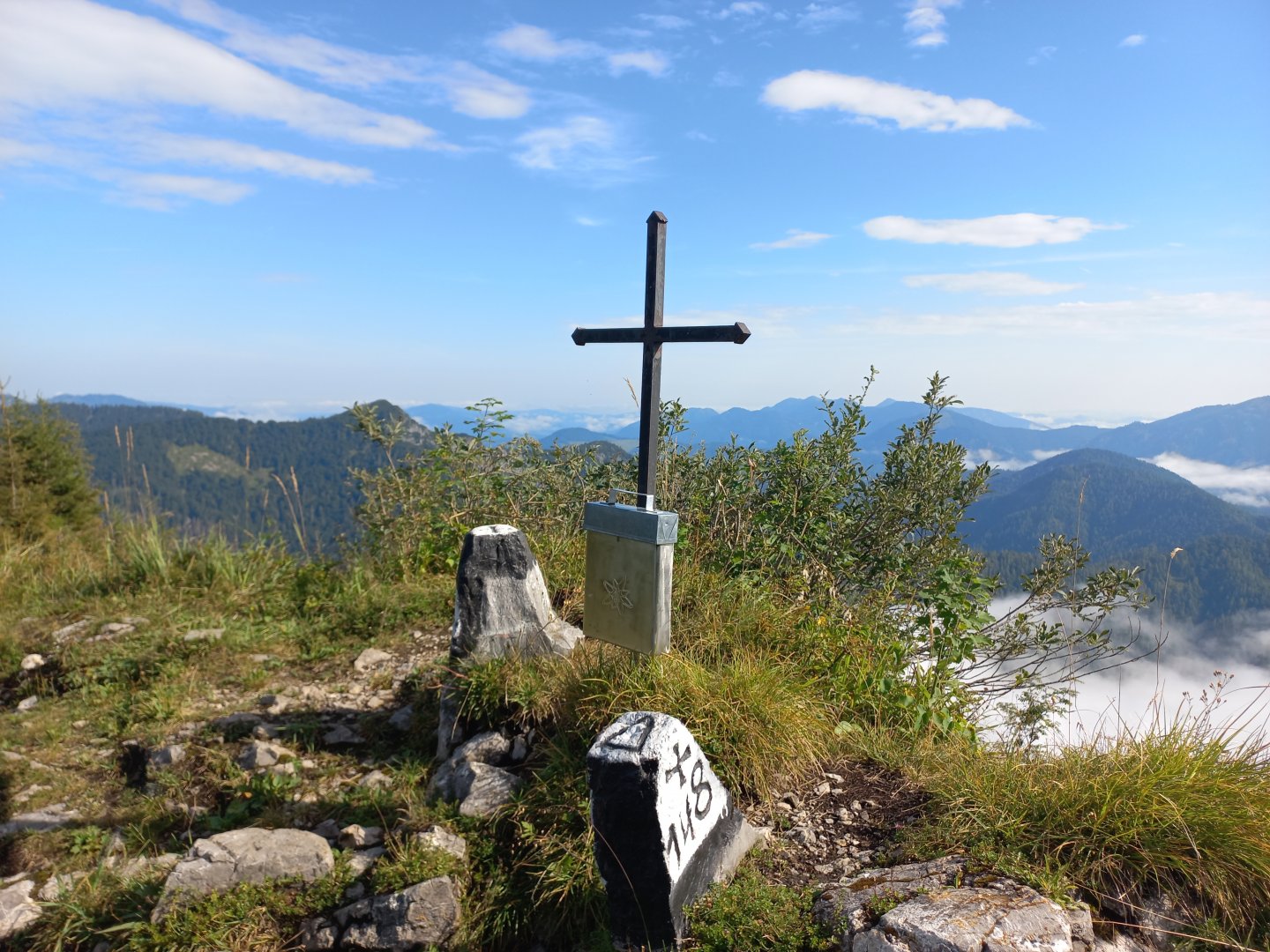
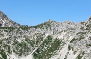
Beyond Karlkreuz the route is a bit more exposed, but the dangerous places are well secured with a fixed rope and there are metal holds and stupas in the rock. After crossing the more challenging section, the trail bypasses the abyss through the beech forest, turns slightly to the right and is followed by a final short climb to the Kampermauer summit cross, again secured with ropes. The cross is not at the highest point of the wall, but in a place with a good view. The summit is narrow, with a maximum of two or three people safely fitting. The views of the Haller Mauern are joined by other mountains to the east - the nearby Grosses Maiereck and behind it the Gesäuse - Grosser and Kleiner Buchstein.
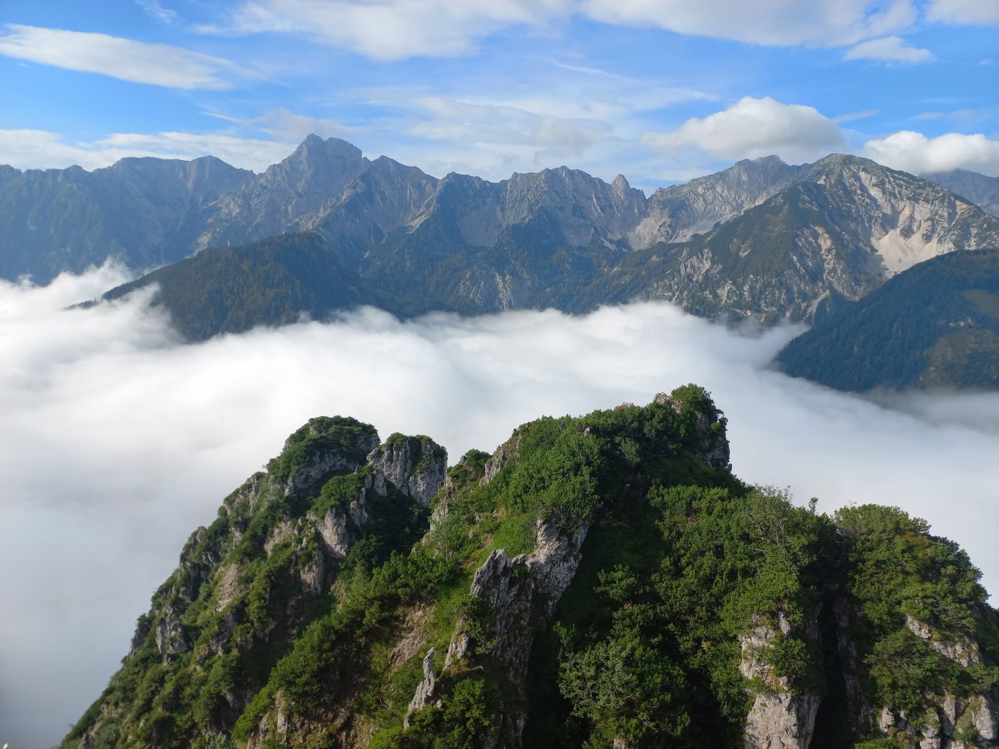
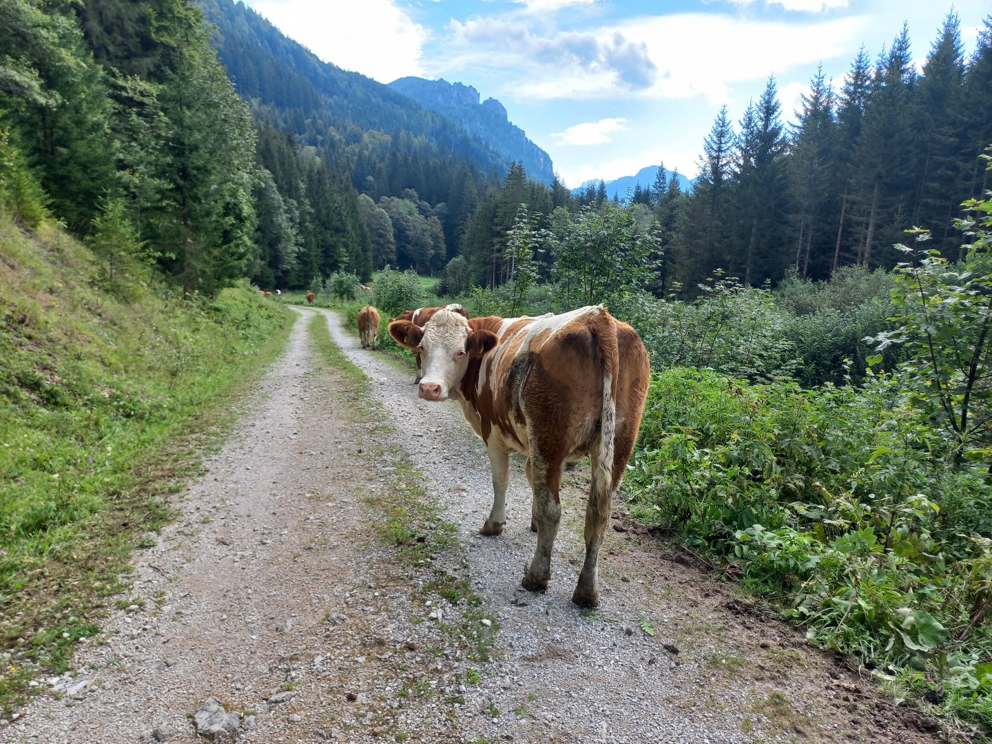
After resting for a while, I return about a hundred metres into the forest and continue on the unmarked path to the ridge. The path leads past the Menauer Alm pastures, where it is possible to return to the road. It is about 150 metres up to the ridge, mostly through the forest or on meadows. On the narrow ridge the path turns left. The Schwarzkogel (1554 m) is marked only by a stone, while a simple metal cross stands on the Tannschwärze (1533 m). From the ridge you can see across to the Voralpen and the Danube. More prominent is the nearby lookout peak Wasserklotz (1505 m). It's beautifully quiet here, I haven't met anyone on the whole trip.
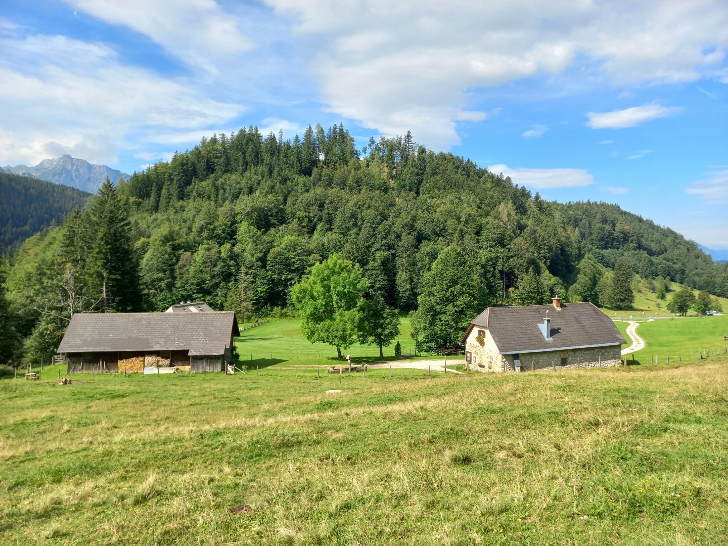
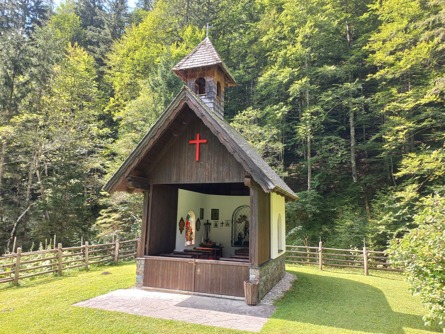
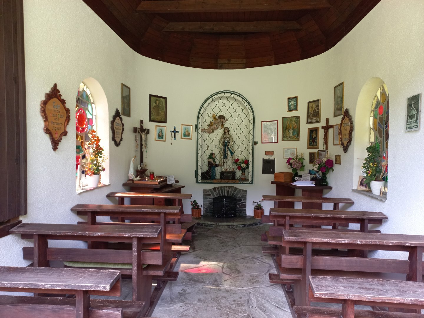
From Tannschwärz I descend down a long meadow and then left through the forest along a stream to the Hengstpass (985 m) and the Spitzenbergeralm. In order not to have to go back by road, I return by the easy Themenweg "Von Alm zu Alm" (From Alm to Alm). The route follows the old Proviantweg - the supply trail through the Hengstpass. Before Puglam I turn off to the Rot-Kreuz-Kapelle, a wooden pilgrimage chapel not far from the road with a red cross on the gable. It's only about 15 minutes back to Puglam and the car park.
Difficulty
Half-day trek, steep and technically demanding climb to Kampermauer (secured by ropes in places), but no climbing, no ferrata equipment required. After Kampermauer unmarked route along the ridge, from Hengstpass easy forest paths.
Water availability
Refreshments are available at the almshouses at the beginning and end of the trip.
Sleeping options
There are no huts on the route, plenty of accommodation in the valley.
Mountain peaks
Crossing the Kampermauer, Schwarzkogel, Tannschwärze peaks. Views of Haller Mauern, Totes Gebirge, Gesäuse, Sengsengebirge.
Danger
Starting the climb to Kampermauer requires a bit of experience with the mountain terrain. However, the exposed places are well secured. There are steel ropes, crampons and steel holds. In wet conditions the trail is slippery in places, especially on roots and rocks.
Food
Refreshments are available at the beginning and end of the trip at the almshouses.
Attractions
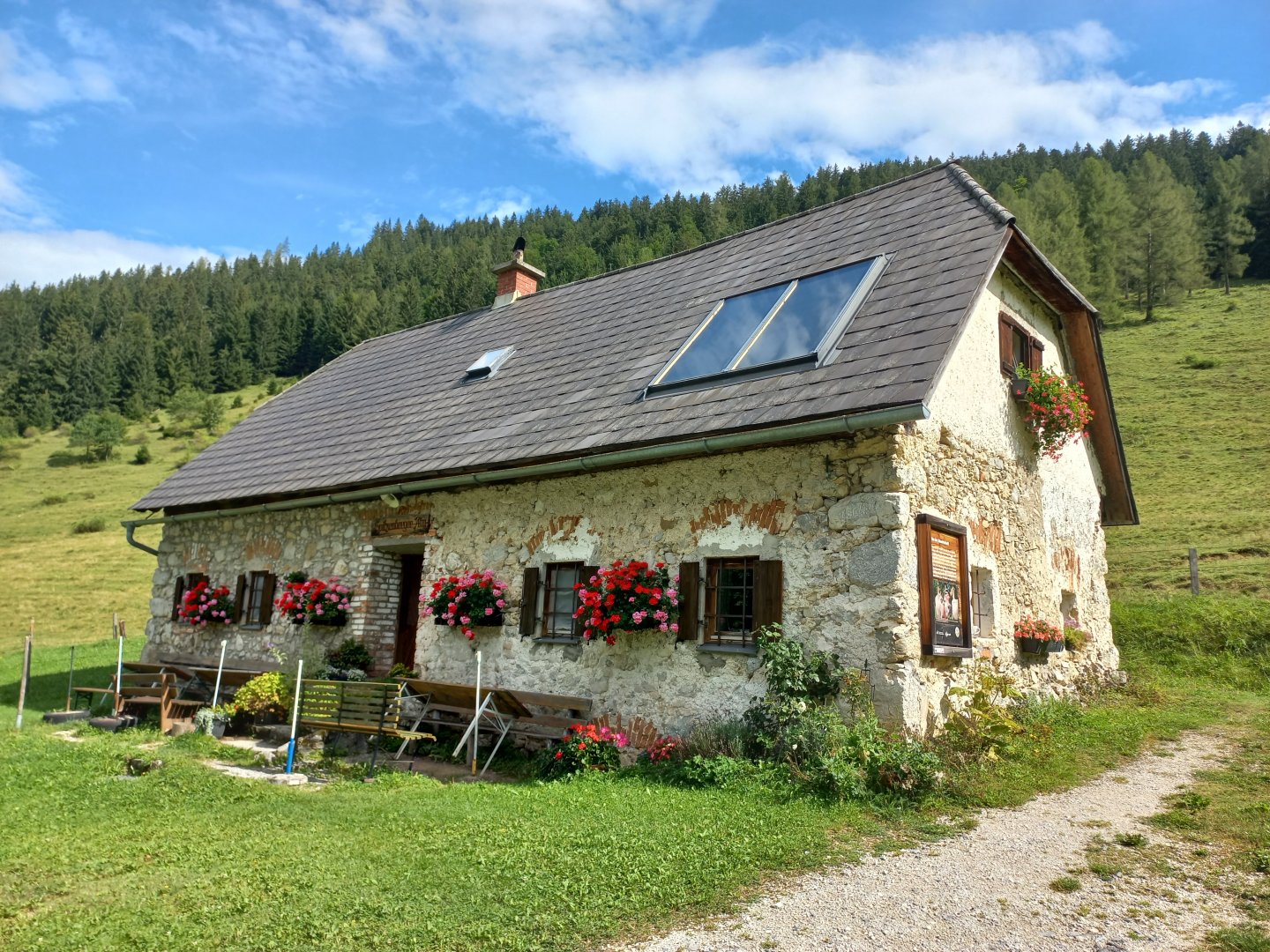
The route also leads past the pilgrimage chapel Rot-Kreuz-Kapelle. A healing spring flows directly through the chapel. The chapel was built on the spot where, according to legend, a tired pilgrim saw a wounded mouse that was miraculously healed by the spring. The pilgrim drank the water, washed his wound from his journey and was able to continue his journey in good health. There are still processions to the chapel from Windishgarsten and Unterlauss, on the first Sunday after St Matthew's Day (21 September).