Mountain range, region / State
Ennstal Alps / Austria
Season
Summer
23. 08. 2024
Difficulty
3 / 5
Elevation
↑ 1578 m
↓ 1578 m
Length
13.1 km
8 hours
Altitude
max. 2364 m n.m.
min. 865 m n.m.
Tips for hikes in the mountain range Ennstal Alps
Half-day hike in NP Kalkalpen with climbing the Kampermauer wall
Climb to the top of Scheiblingstein in the Ennstal Alps

Hike to the Wasserklotz lookout in Kalkalpen NP
Trek in N.P. Gesäuse over the Hochtor mountain
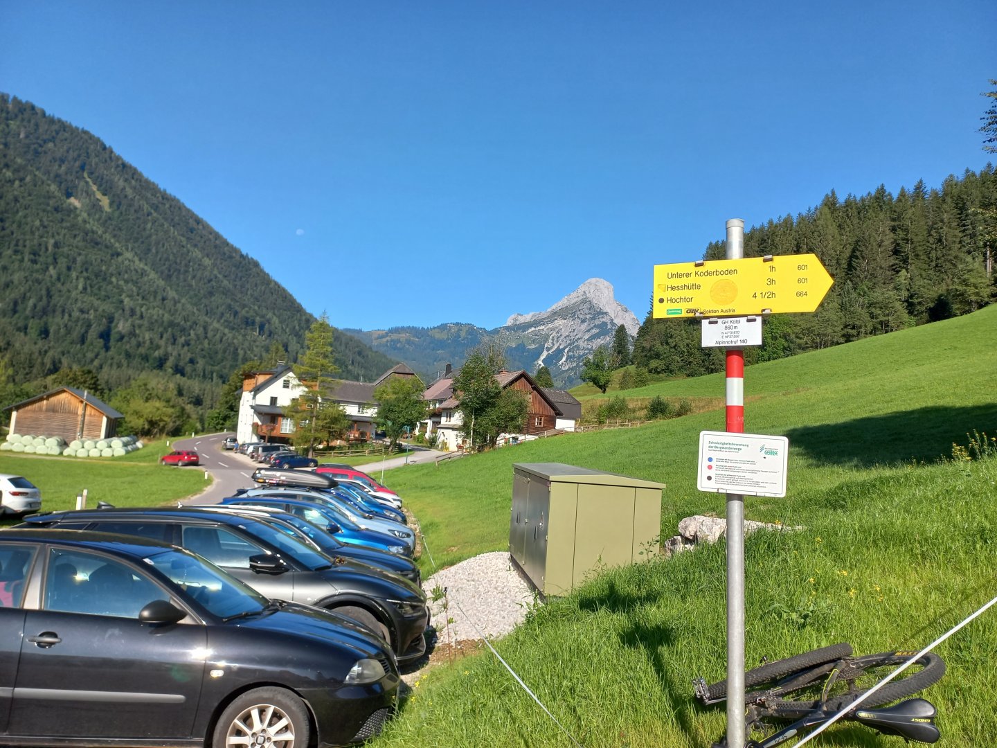
Starting point
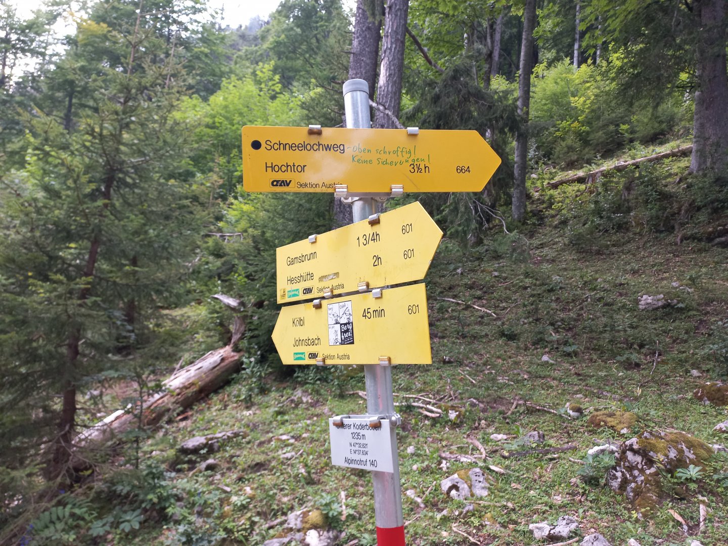
Village of Johnsbach, parking lot of the Köblwirt Inn. Parking is free.
Description of the hike
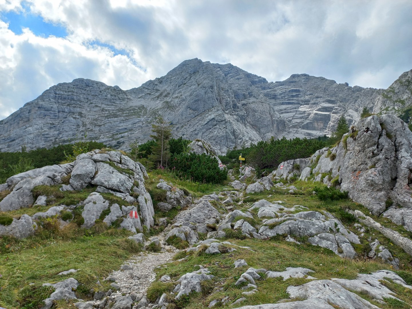
I park my car at the end of Johnsbach by the Köblwirth Inn. There is a starting point for routes in several directions, the parking lot is quite busy. The signpost points to Hochtor 4,5 hours, the black dot of the highest difficulty. I start up, first on the meadows, then on the forest path. After less than an hour the path splits, left ascent via Schneelochweg, right to Hesshütte. There is a handwritten note on the sign saying that the Schneelochweg is rocky and without a belay.
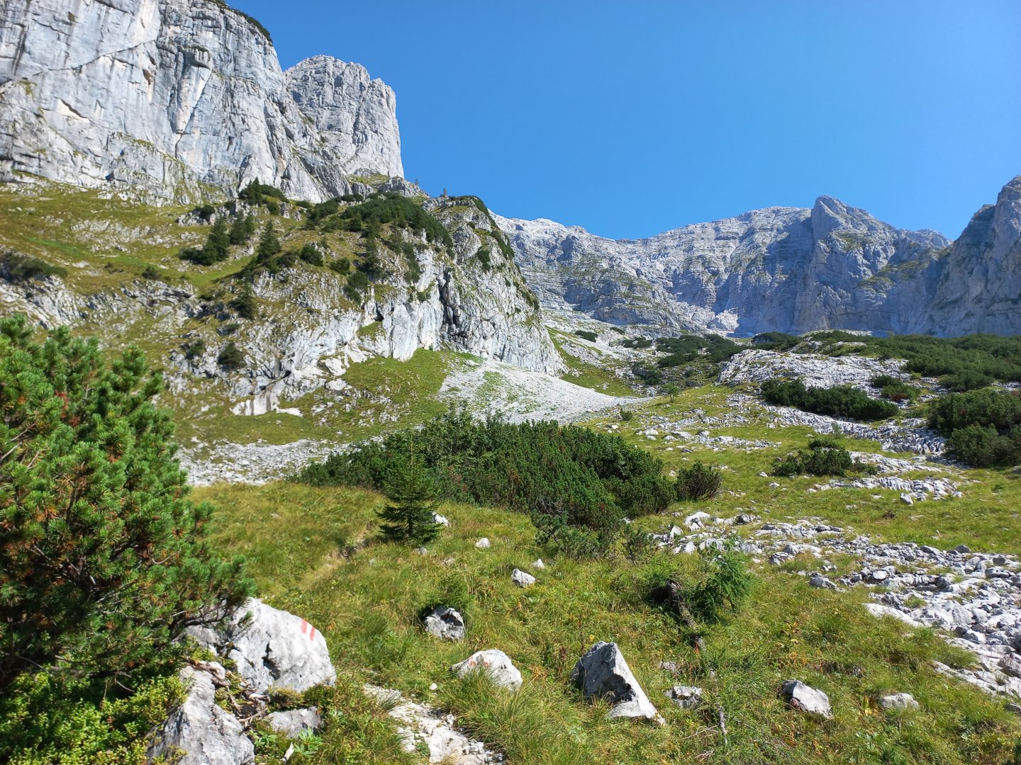
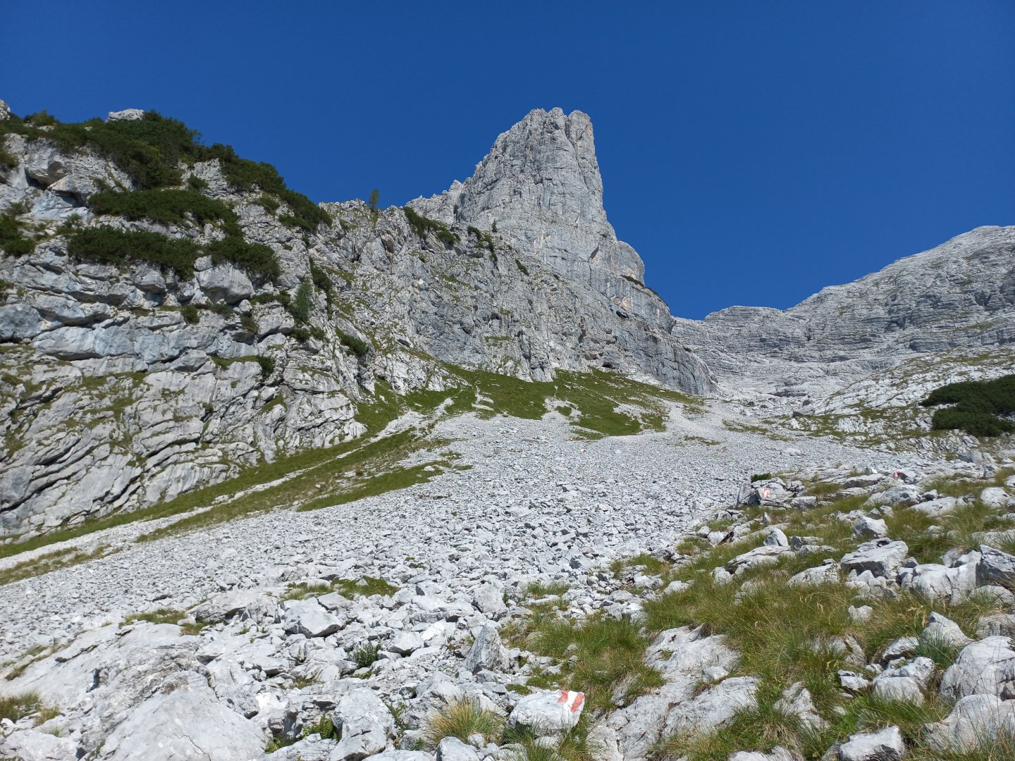
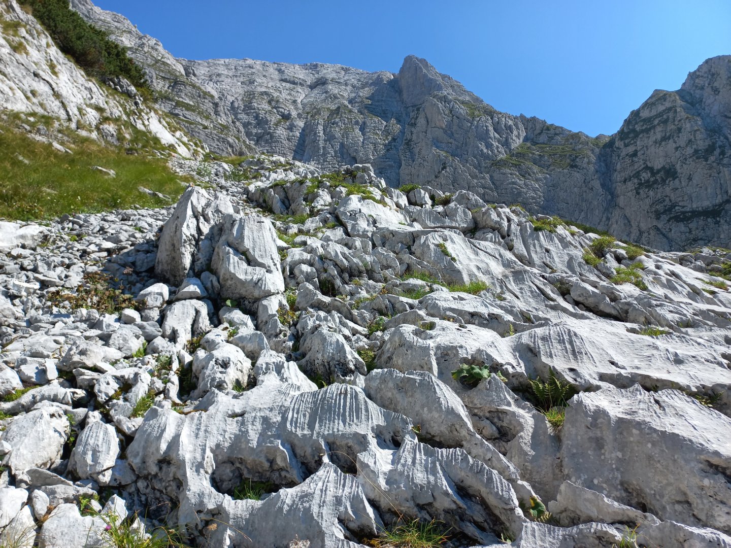
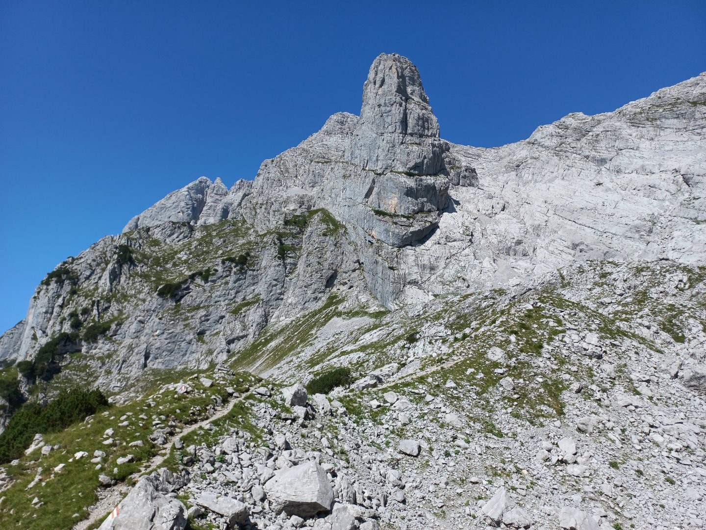
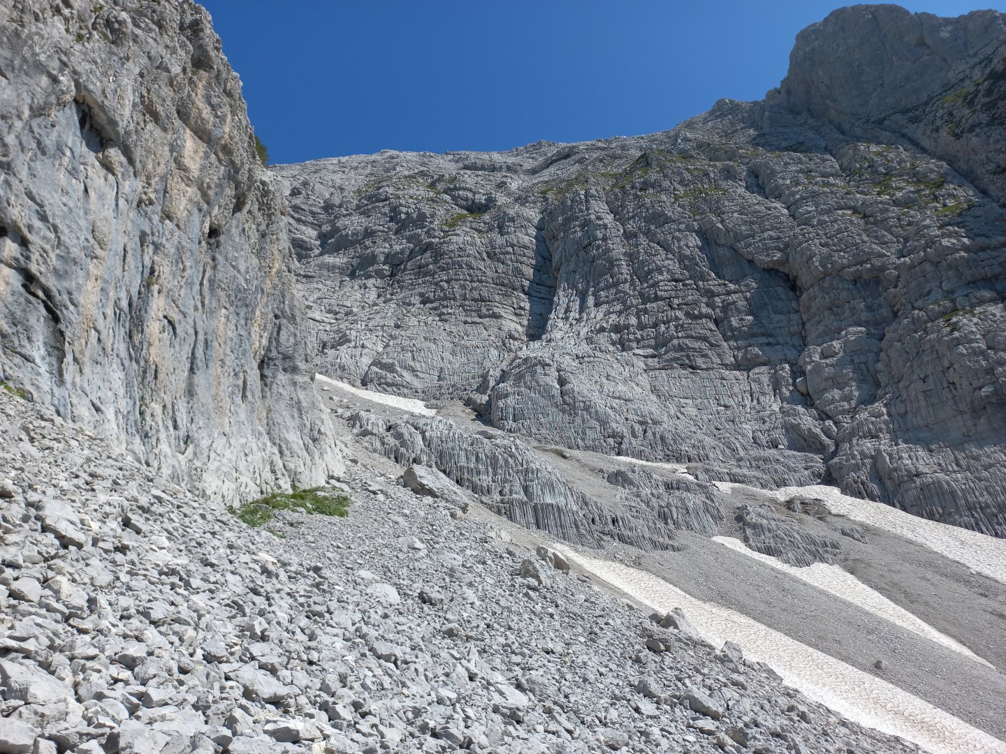
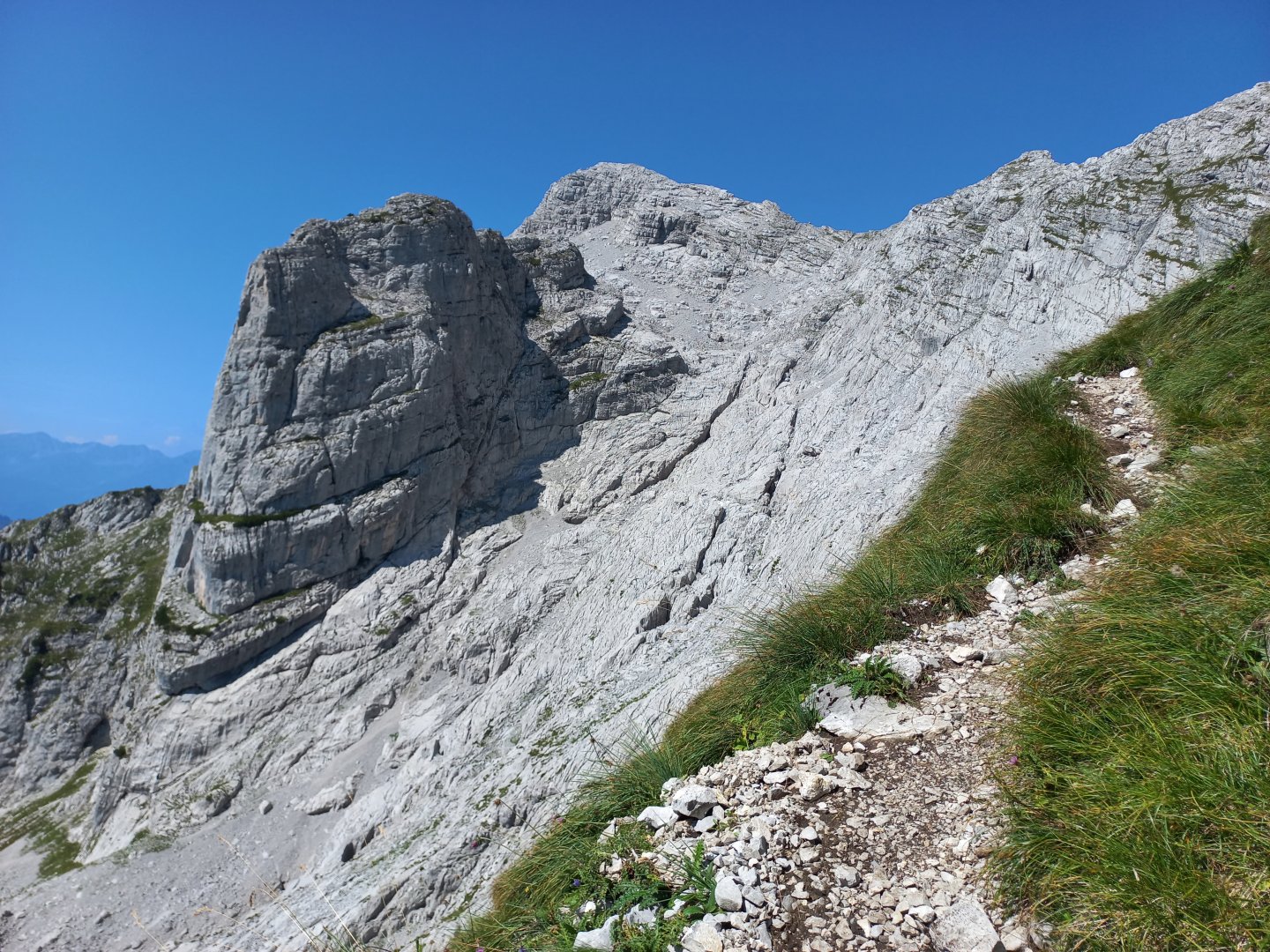
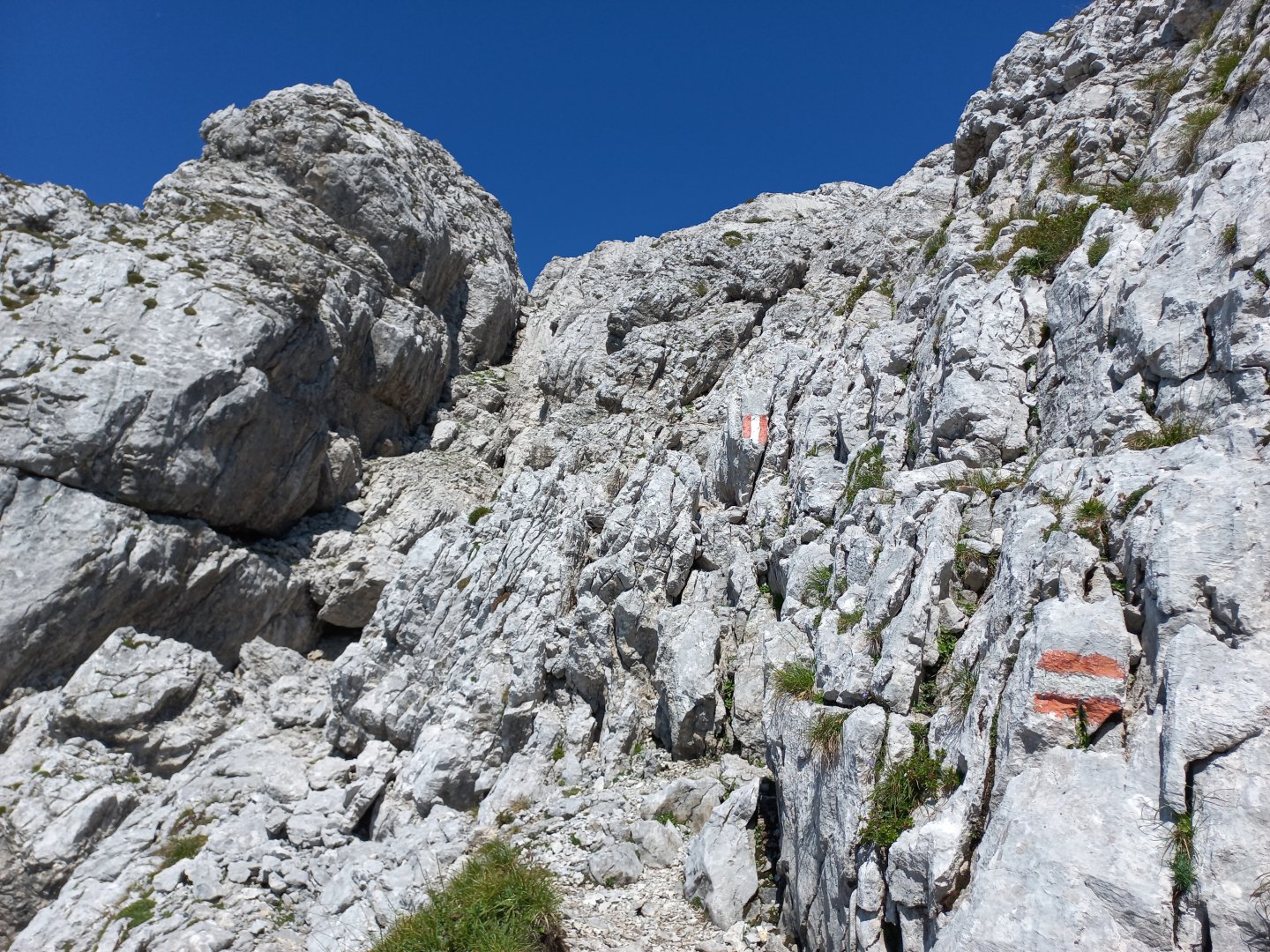
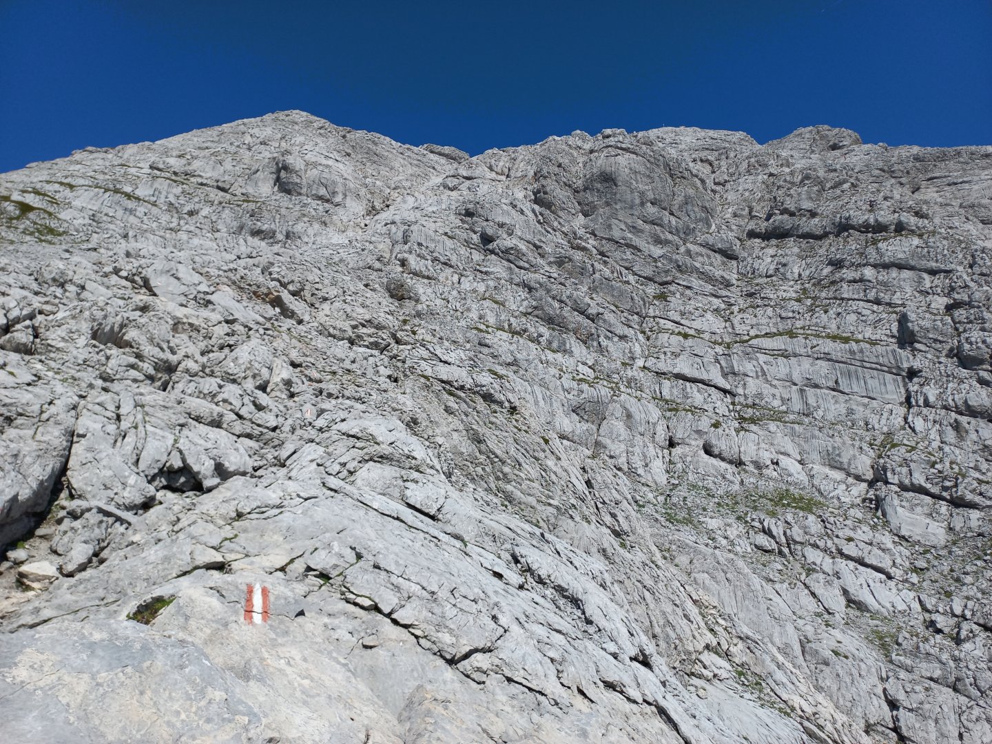
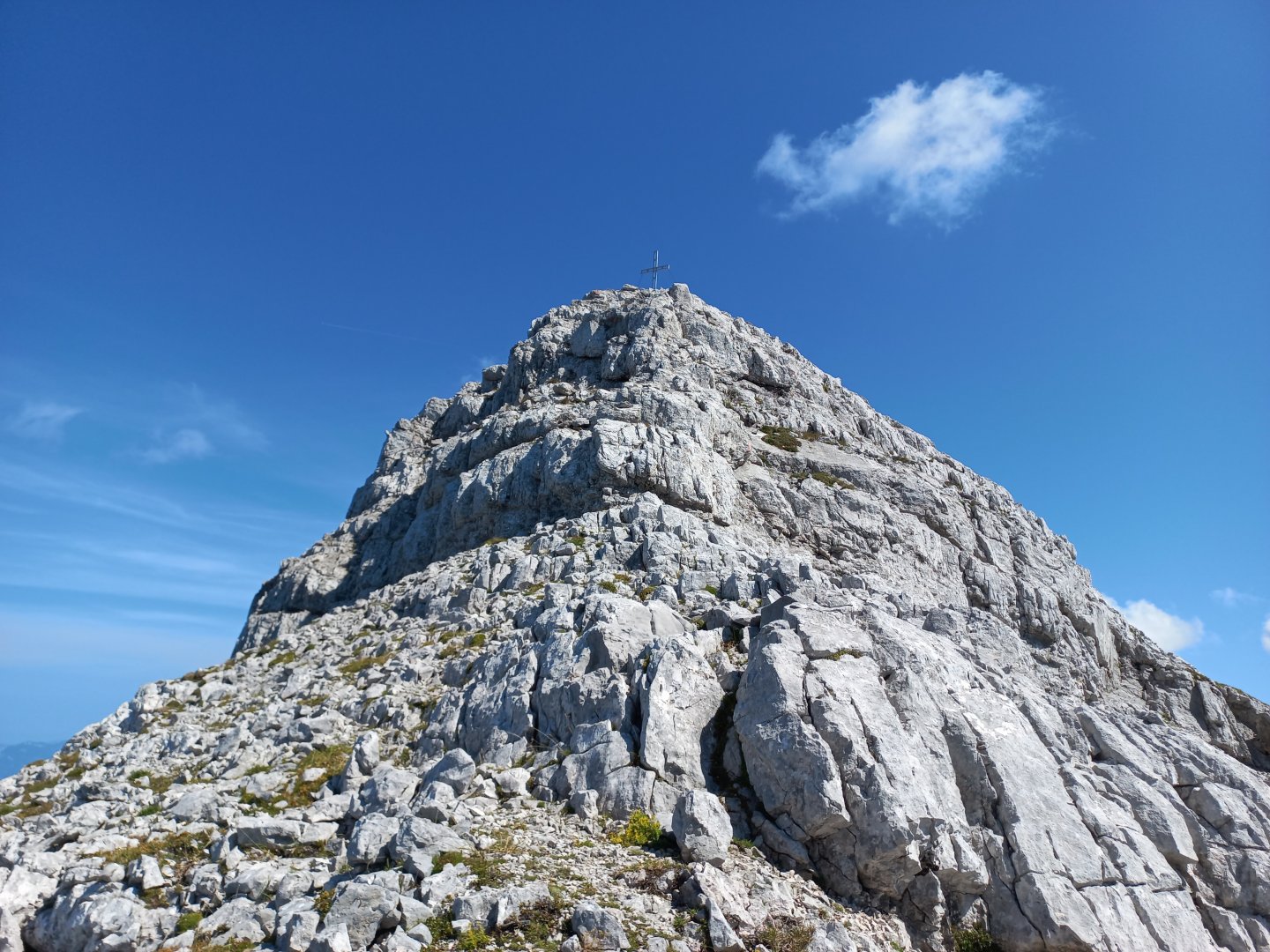
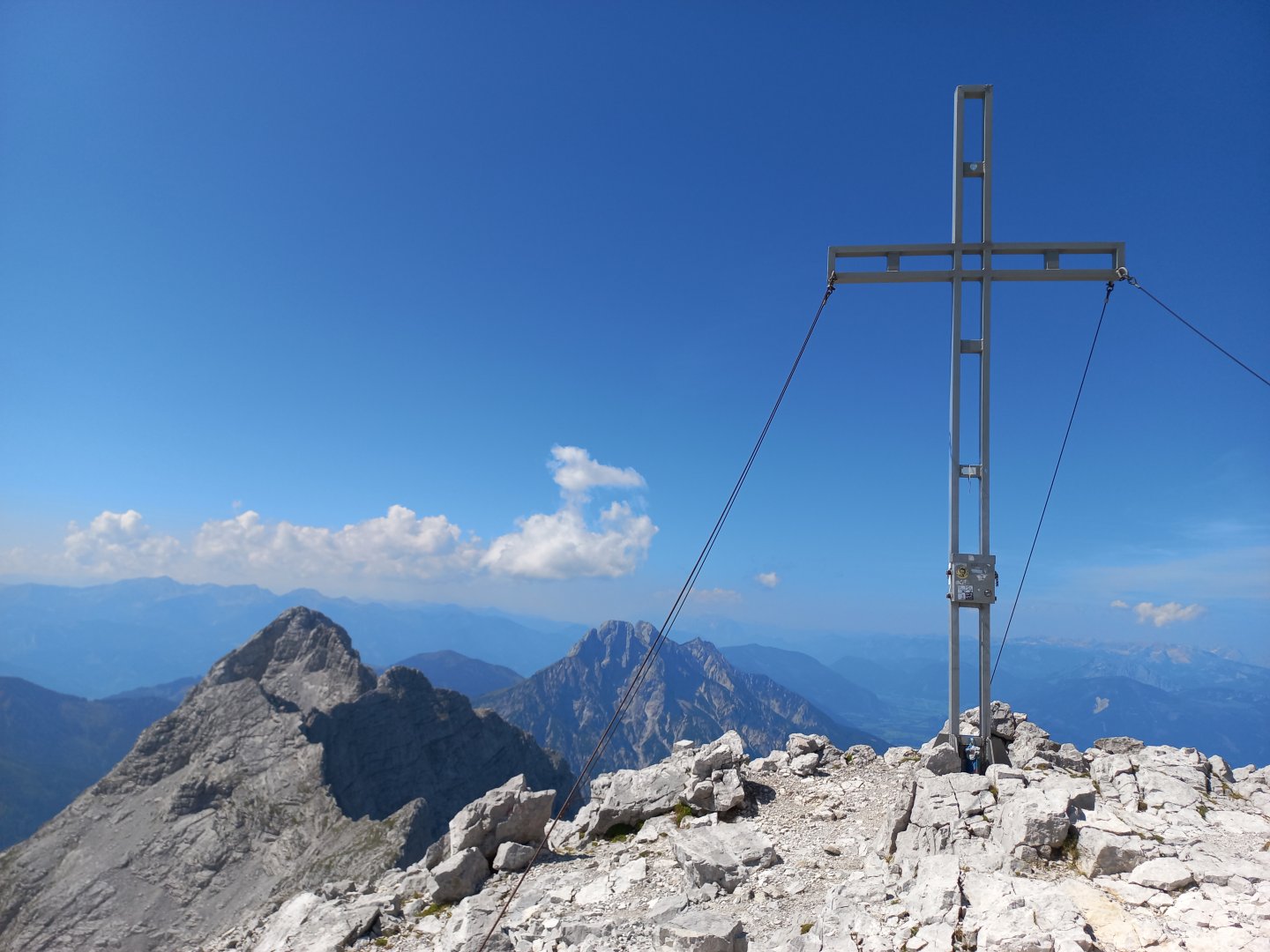
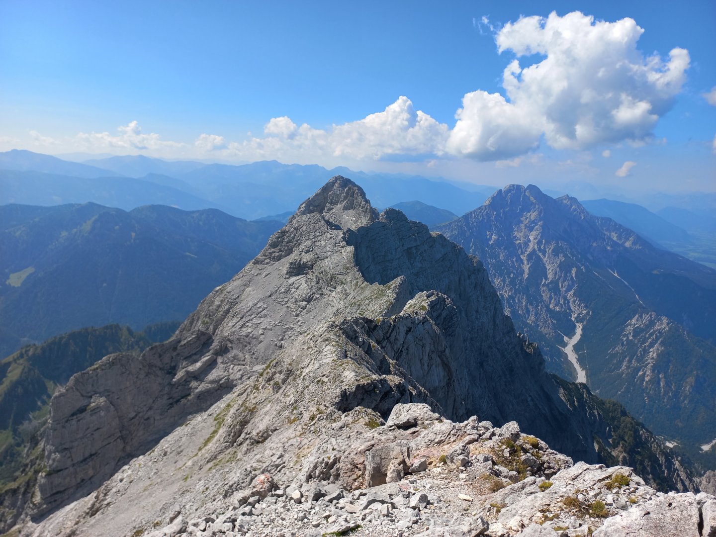
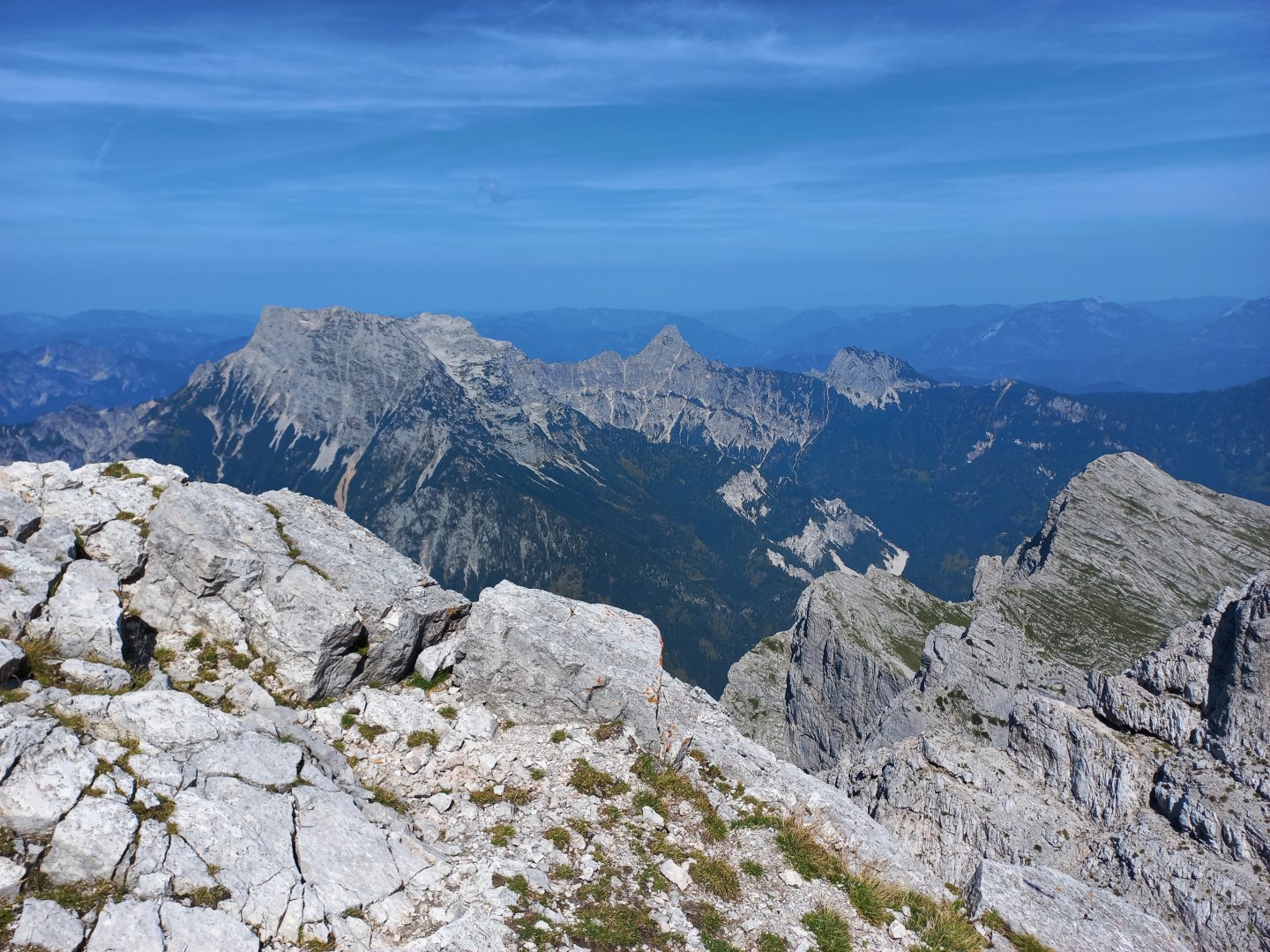
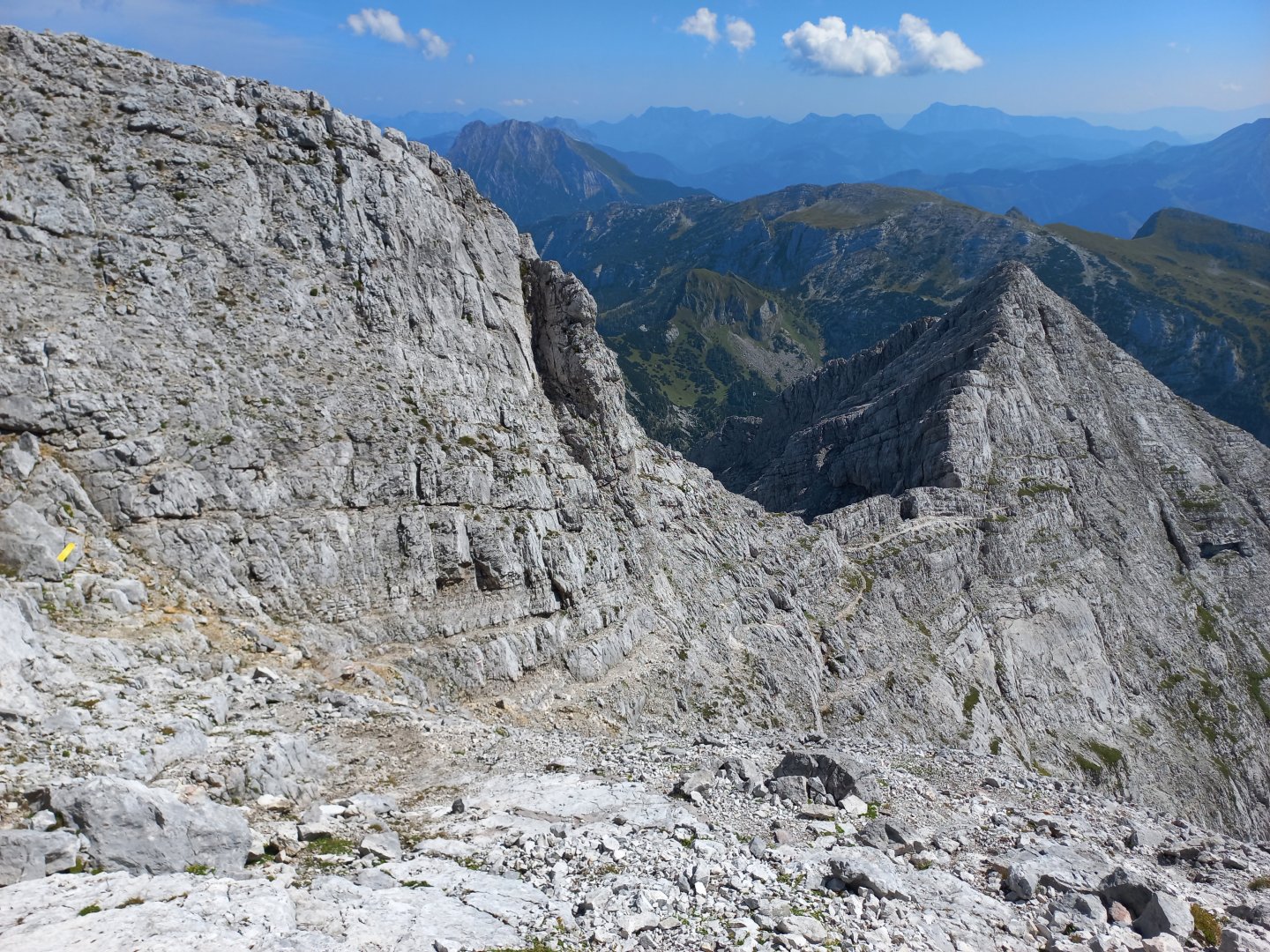
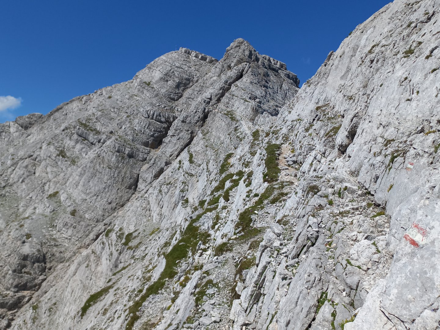
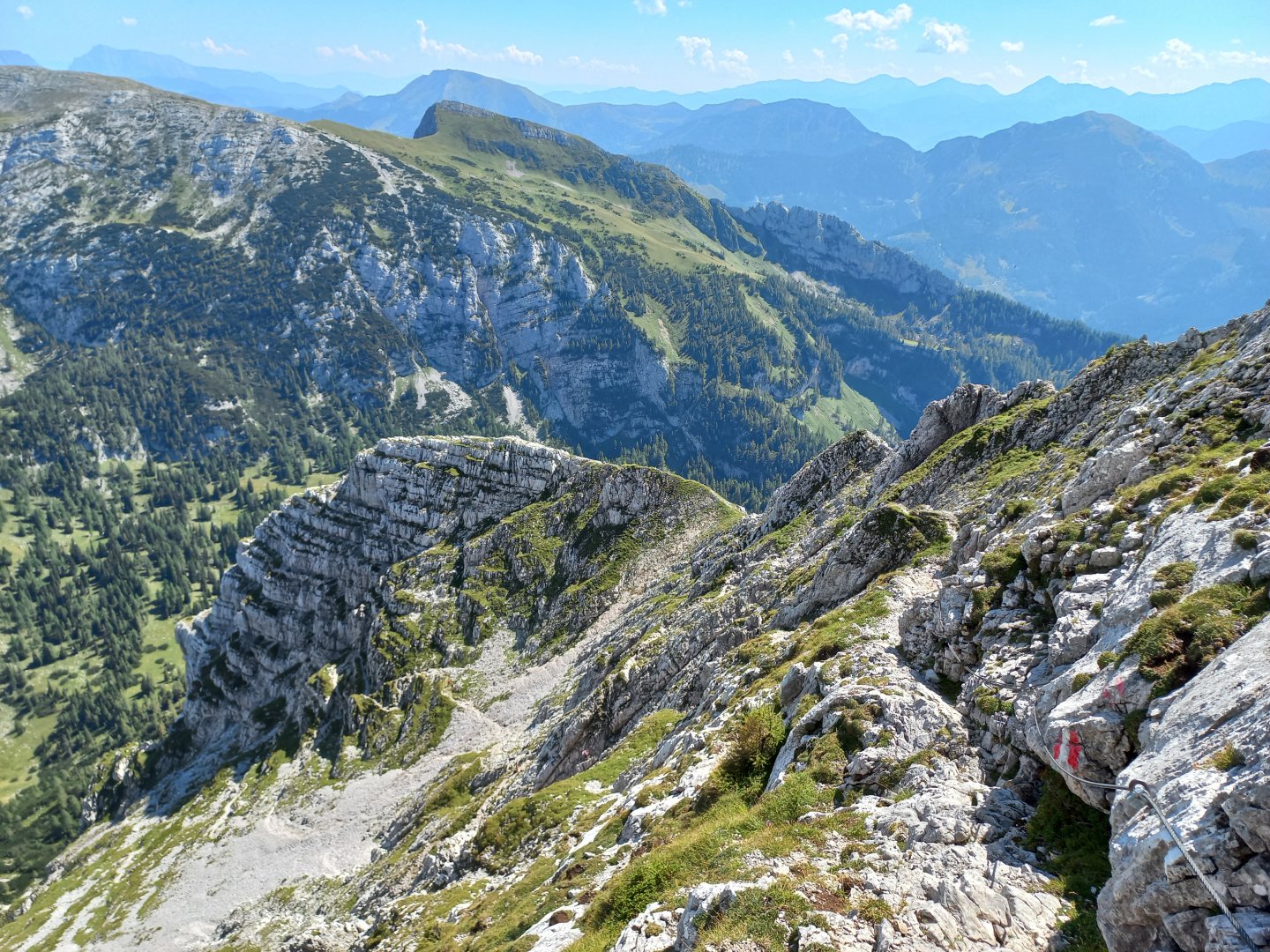
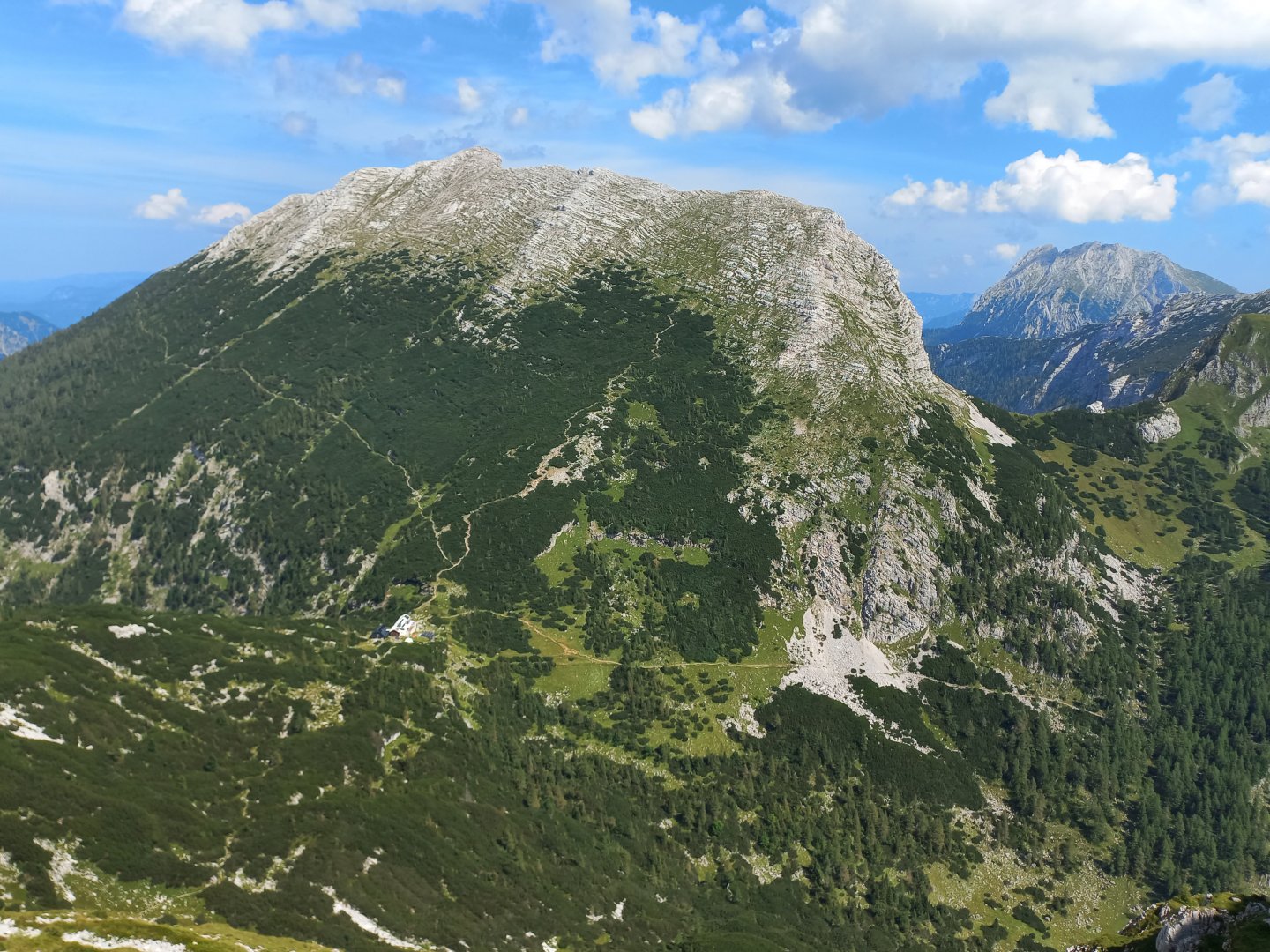
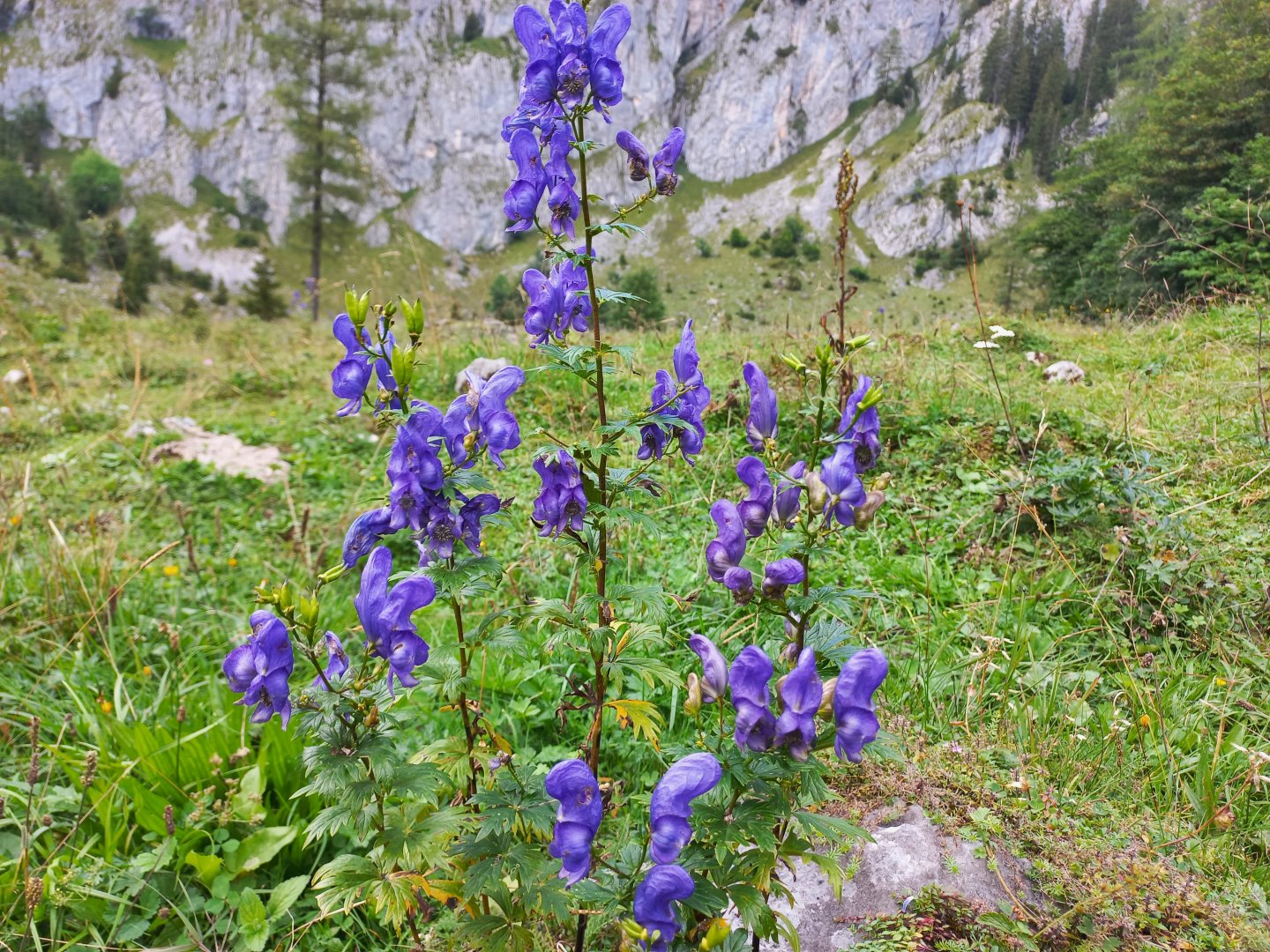
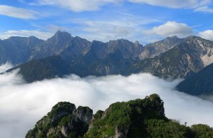
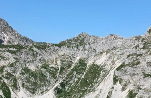
After about half an hour on the Schneelochweg I get above the forest line and the alpine landscape begins - islands of kneeling, bleached limestone rocks, rubble. Above the road towers a needle like from the Dolomites - Schneekarturm. The trail passes over rubble, sometimes there is a Schneeloch, a snow pit with remnants of snow. The footpath turns under a wrinkled wall and starts to climb steeply. Here it is necessary to help yourself with your hands sometimes. The trail traverses limestone wrinkles and overcomes smaller rocks. The top is already visible, but it is still far away. The last 200 metres or so of the climb are on rock and stone. At the top of the Hochtor (2,369 m) there is a great view of the entire Ennstal Alps - to the west Ödstein and Admonter Reichenstein, to the north Grosser and Kleiner Buchstein and the grassy Tamischbachturm, to the east the nearby Planspitze and Hochzinödl, beyond that Lugauer. To the south, the silhouettes of the Seckauer and Rottenman Taur.
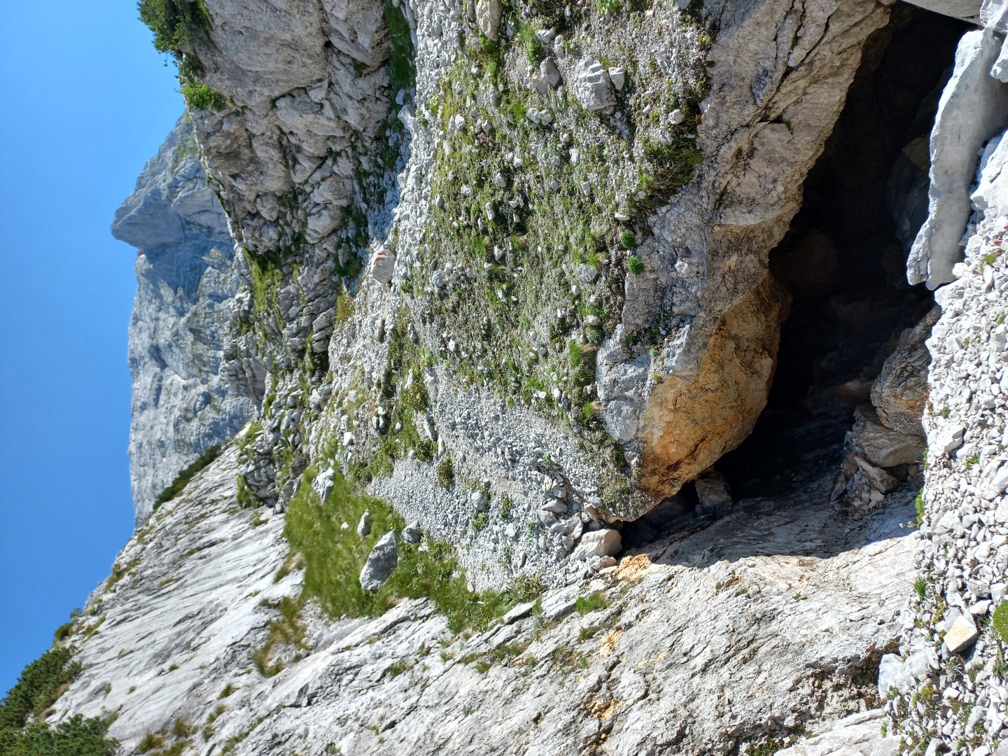
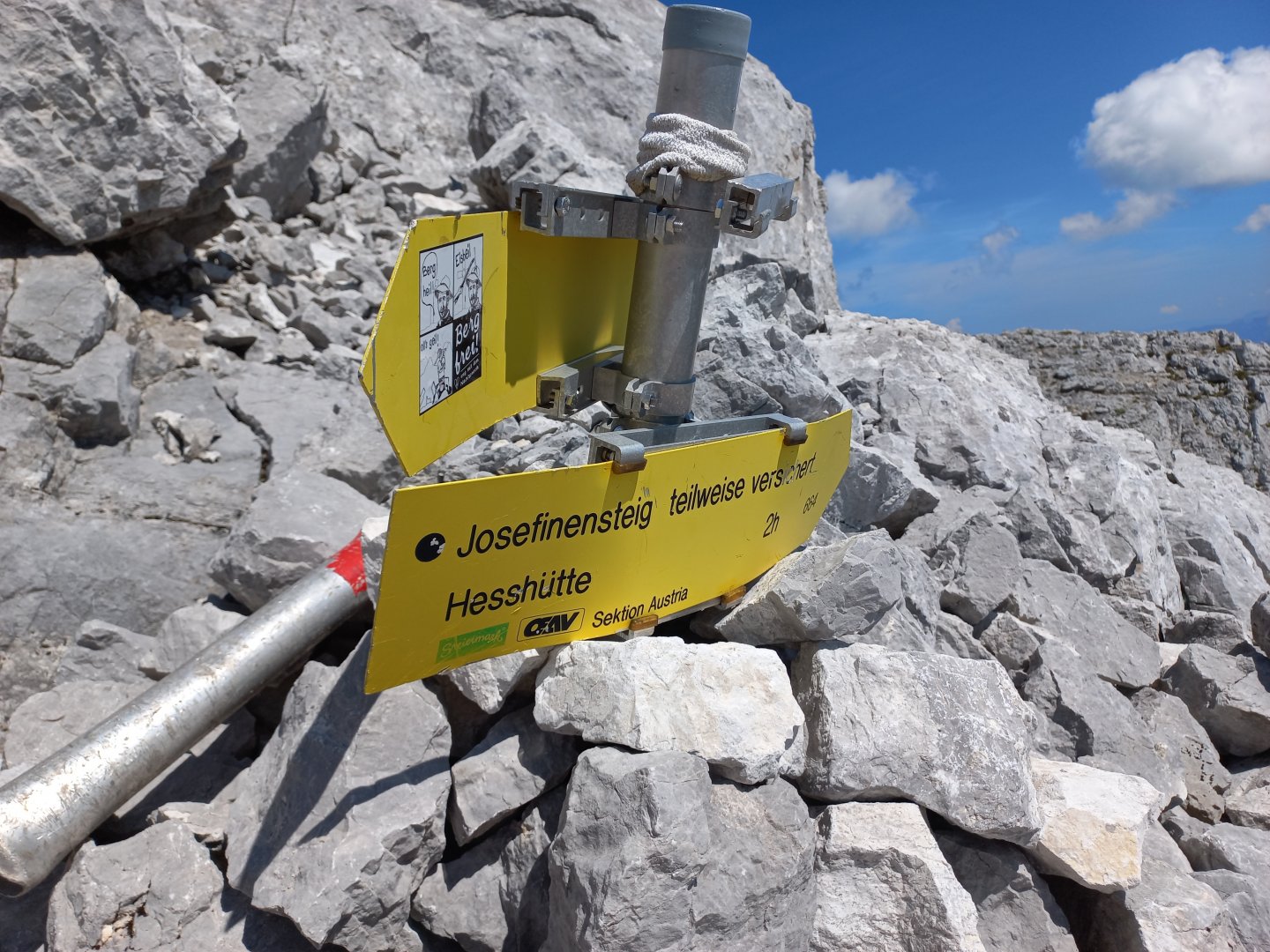
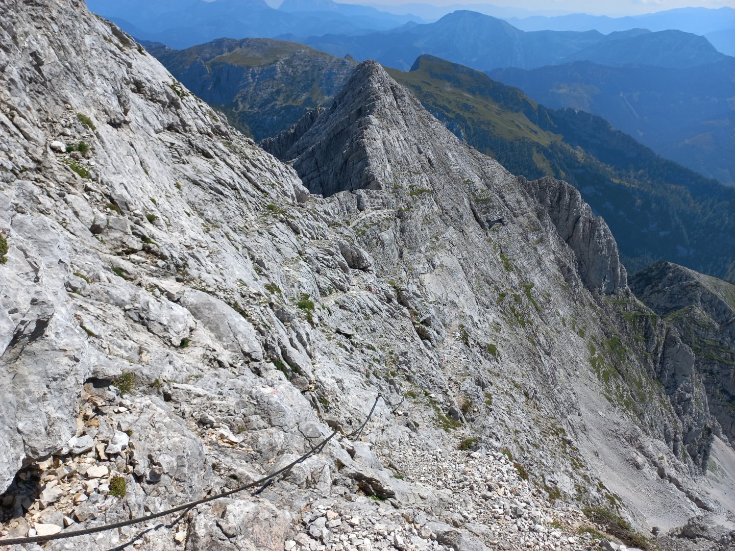
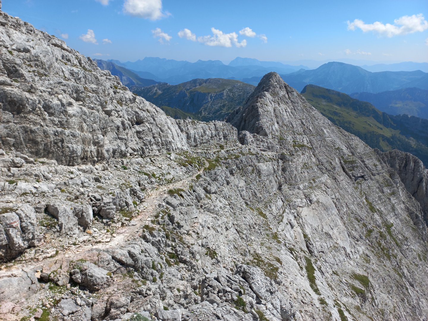
After sufficient rest I start descending in the opposite direction on Josefinensteig. The descent is also marked as a difficult hiking trail with secured sections. The first metres of the descent are like a reward - a narrow path along a ledge follows the ridge, views still on all sides. There are secured sections right from the start, but nothing difficult. After a few hundred metres the trail crosses over to the other side of the ridge and descends faster. There are more ropes, the secured sections are steeper (at the bottom of the infotable the difficulty is listed as B/C, but these are only short sections with a walker in between). Some people going the other way are wearing ferrata gear or helmets, but no one is clicking carabiners. The ropes are usually only a few metres. Gloves are useful.
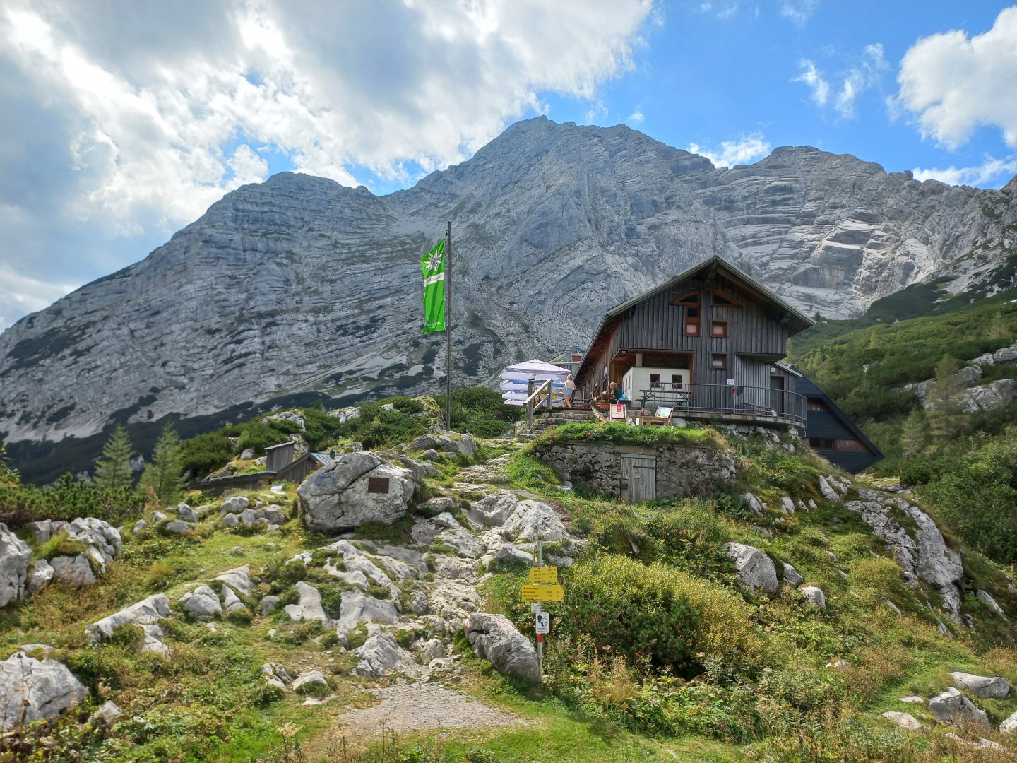
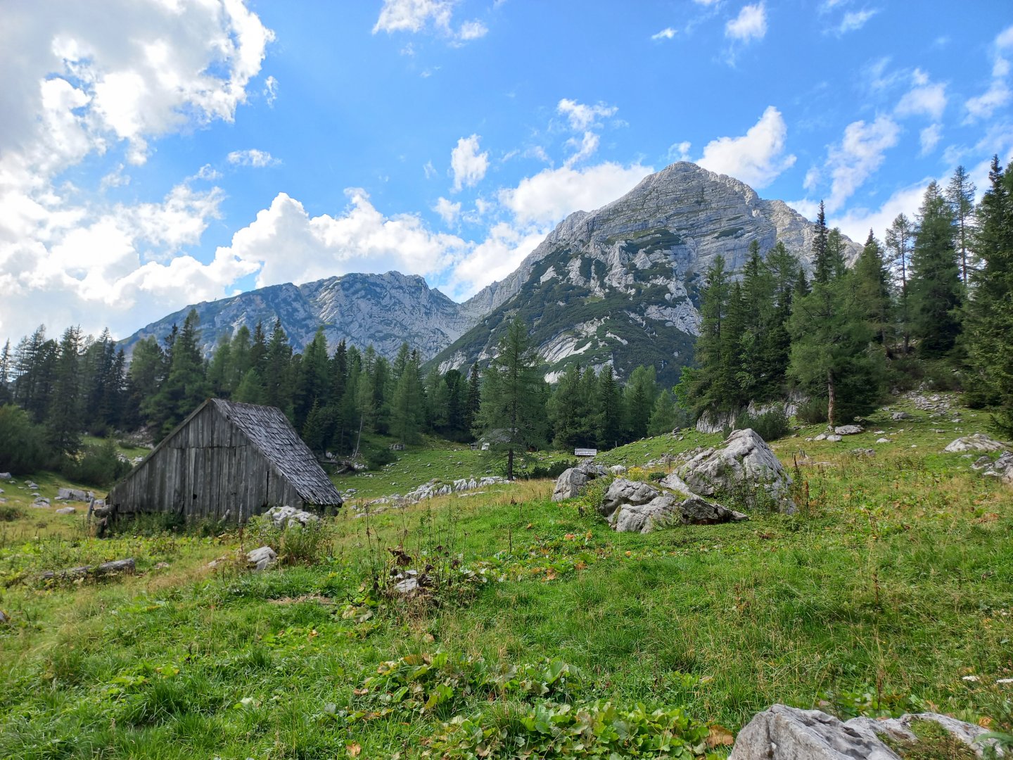
The descent to the Hesshütte hut takes about 2 hours. The hut has cooking facilities and it is possible to stay overnight. There is a spring below the hut. After refreshment I return to Johnsbach. The path descends gently past the Gamsbrunn spring and the wooden huts of the small alm. After about an hour, I reach the fork where I turned onto the Schneelochweg in the morning and then it's just a descent through the forest for about 40 min to the car park.
Difficulty
A challenging one-day trek with an elevation gain of about 1500 m and protected sections. It is necessary to have at least some experience with high mountain terrain and a sure step. Can be split into two days with an overnight stay at Hesshütte.
Water availability
The water is at the beginning of the route, then there is a spring below the Hesshütte hut and another spring called Gamsbrunn.
Sleeping options
On the way Hesshütte, ample accommodation in the valley, camping Gesäuse on Gesäusestrasse.
Mountain peaks
Ascent to Hochtor 2 369 m above sea level, views of the Gesäuse, the Enntal Alps, the Low Tauern.
Danger
It is a challenging hiking trail with secured sections. Some sections are of difficulty B/C klettersteig. However, these are only short sections, the rest of the route is a trail in the rocks.
Food
Takeaway food or you can eat at the Hesshütte.
Photos