Mountain range, region / State
Seckauer Tauern / Austria
Season
Summer
17. 08. 2024
Difficulty
3 / 5
Elevation
↑ 1237 m
↓ 1237 m
Length
13.5 km
7 hours
Altitude
max. 2142 m n.m.
min. 1200 m n.m.
Hiking map of the Seckauer Alps
Tips for hikes in the mountain range Seckauer Tauern
Autumn trek to Großer Grießstein in the Seckauer Alps

A leisurely hike over Mount Bremstein in the Seckauer Tauern

Circular hike in the eastern part of the Seckauer Tauern
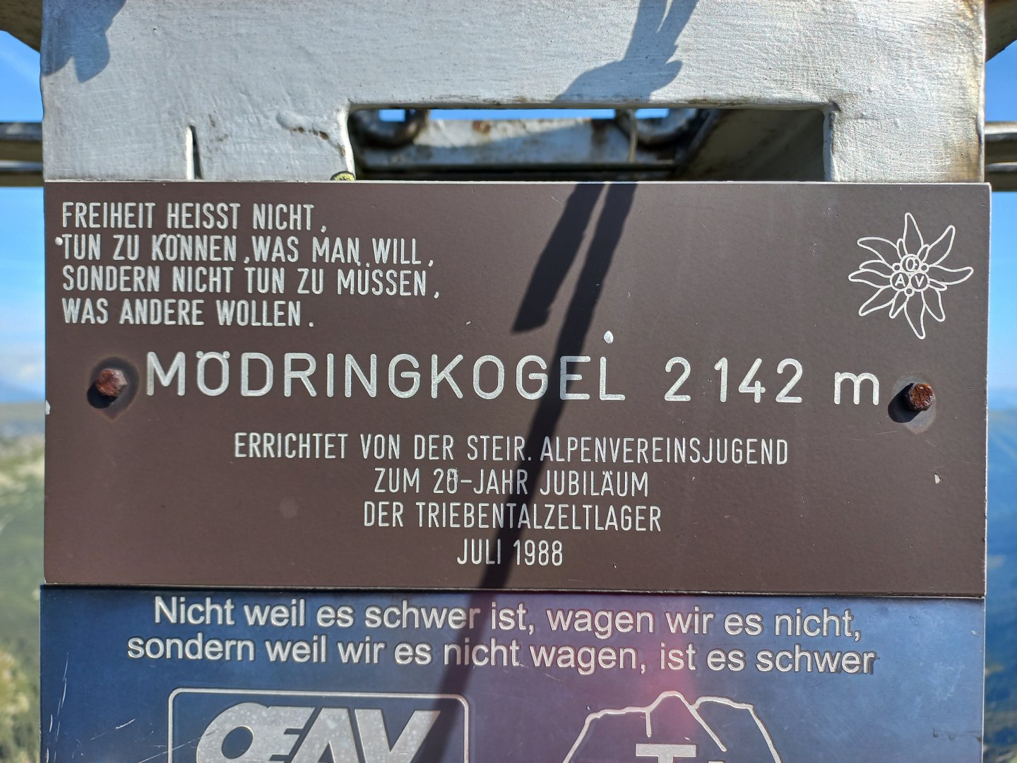
Sightseeing tour in the Seckauer Alps with ascent to Mödringkogel
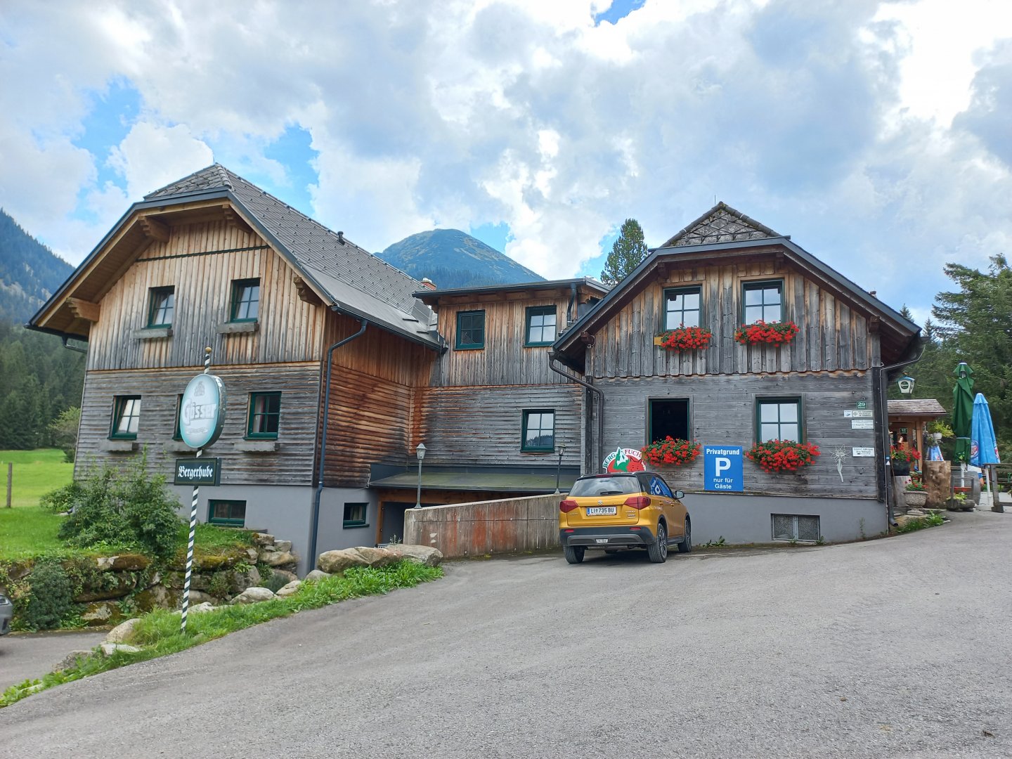
Starting point
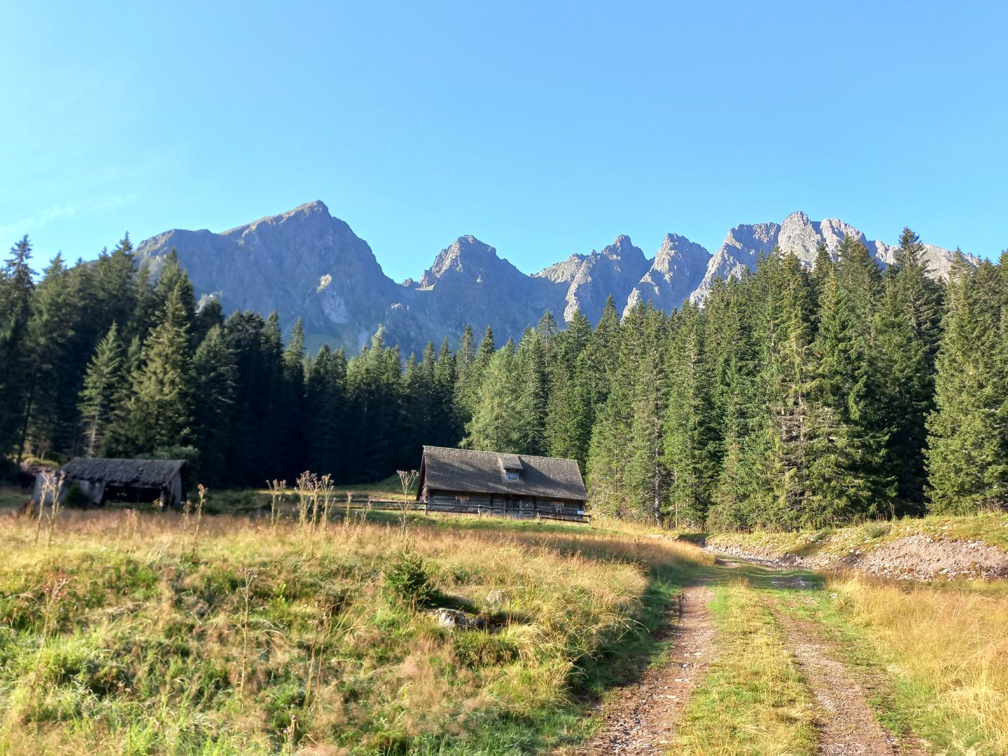
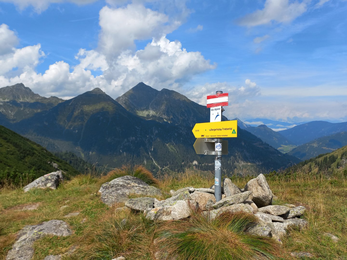
Parking at the Bergerhube Inn, at the end of the Triebental Valley in the Seckauer Alps.
Description of the hike
I leave my car in the parking lot of the Bergerhube Inn at the end of the Triebental Valley. From the hut there are marked hiking trails to the prominent peaks of the Seckauer and Triebental Alps - Großer Grießstein 2 337 m above sea level, Gamskögel 2 386 m above sea level and Geierhaupt 2 417 m above sea level. Somewhat in the background and off the marked route is the Mödringkogel 2 142 m above sea level, my destination today.
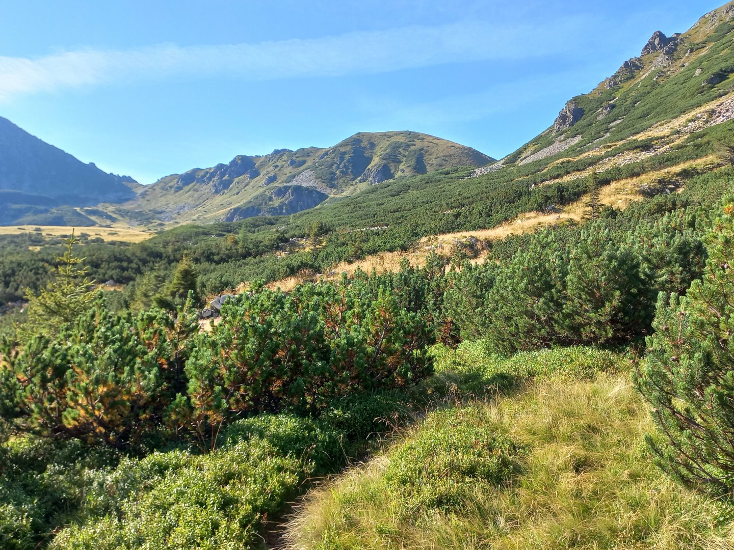
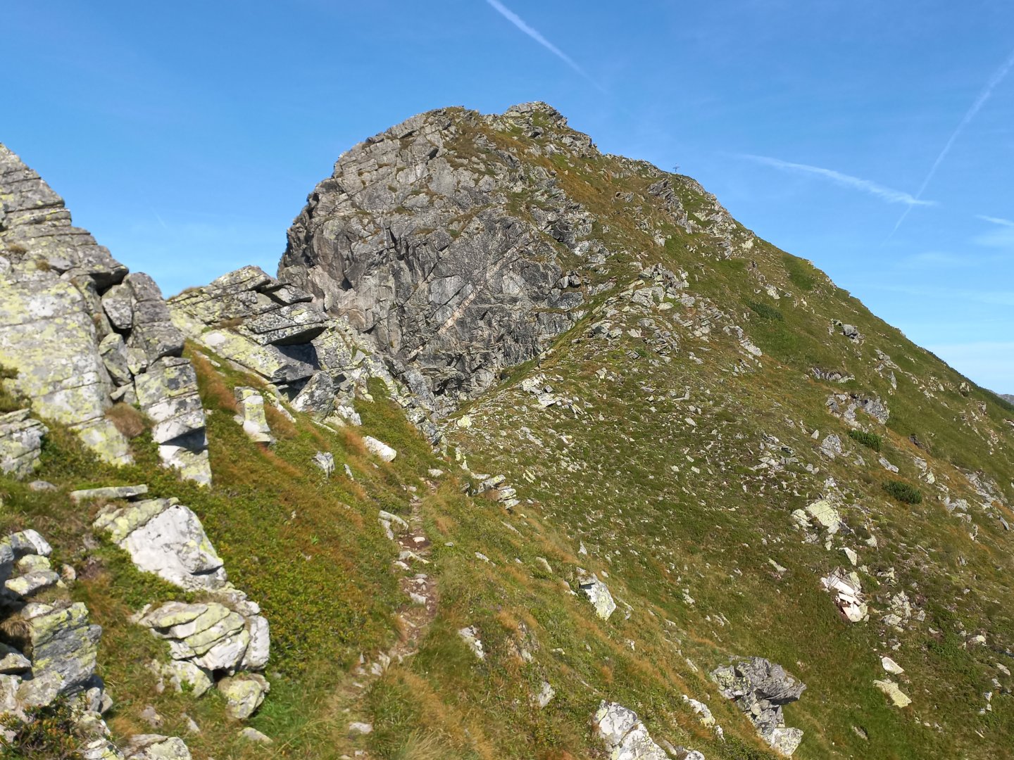
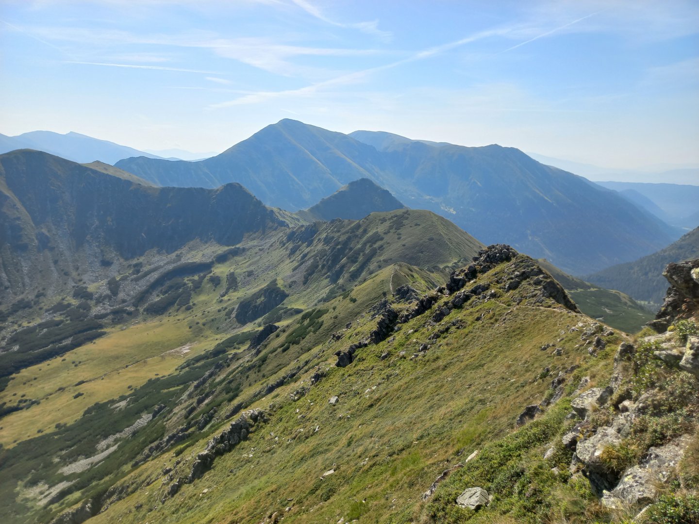
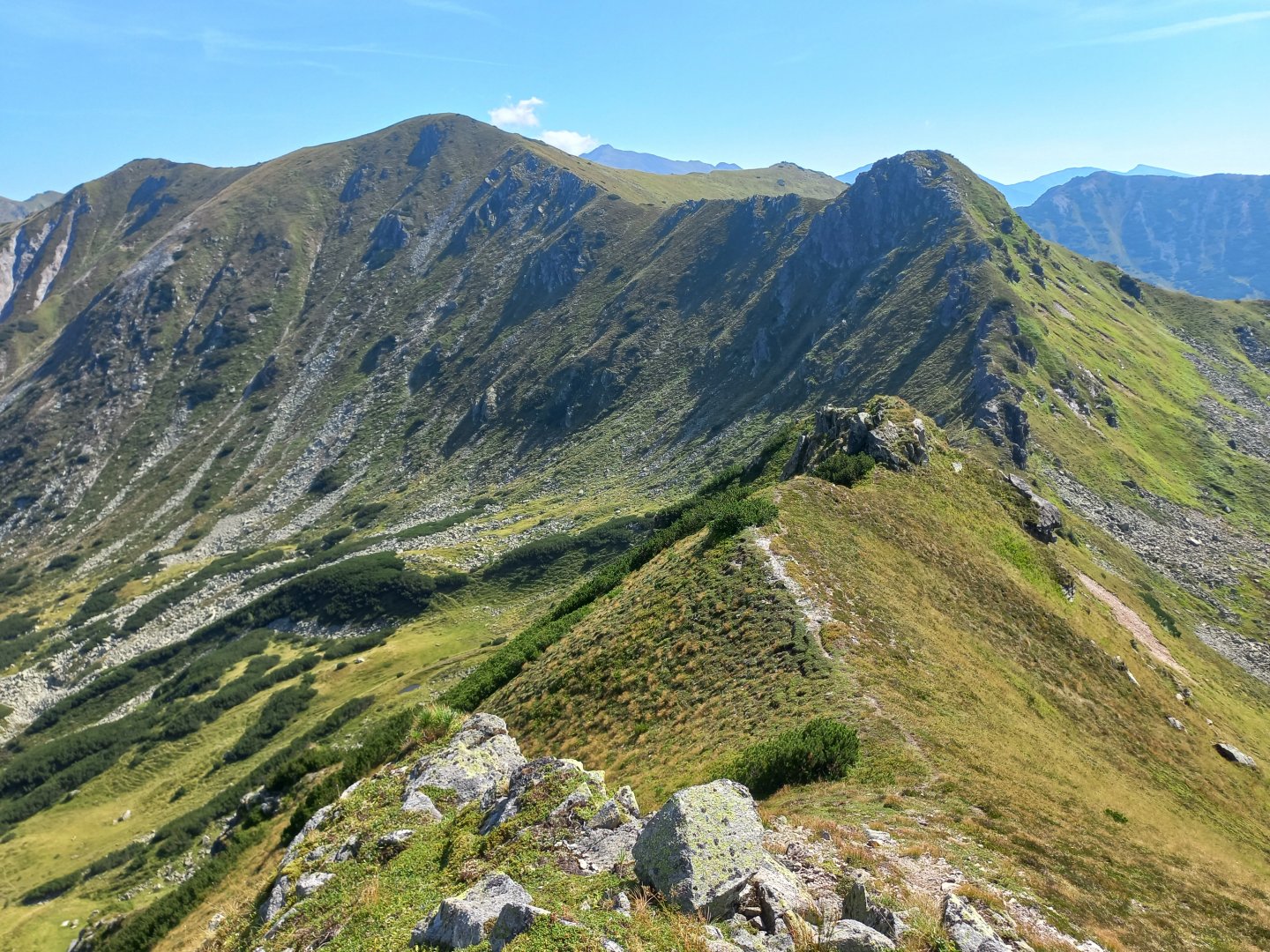
From the car park I follow the marked route towards Gamskögel. After about an hour's walk I come to the meadows of Mödringalm, where I leave the hiking trail and turn left onto a path marked by stone men. The majestic Gams towers above me, Mödringkogel is the cone on the left.
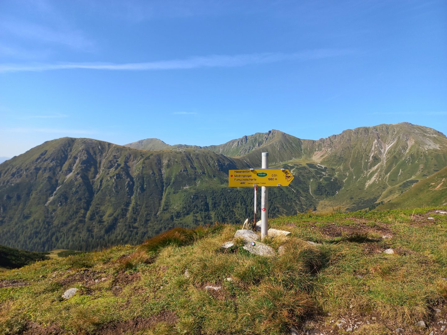
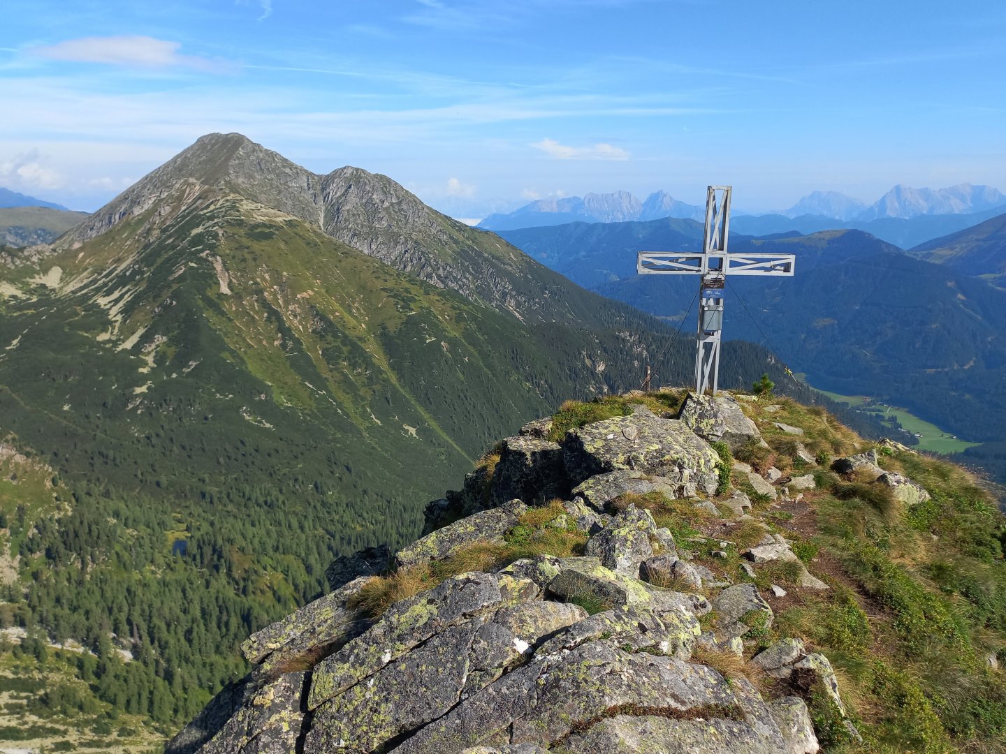
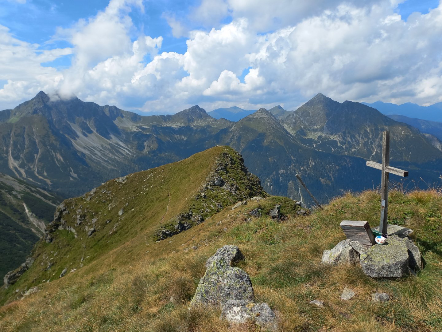
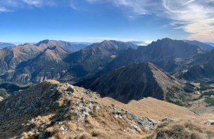
The footpath marked with stone men guides me reliably through the forest and the kneeling area. The direction is clear - the Hasenestörl (Hasene Törl) saddle at almost 2,000 m. There is a signpost in the saddle, but the route to the top is not marked, just a beaten path. It leads directly along the ridge, there is nowhere to turn. Below the summit there is a steeper section where you have to help yourself with your hands sometimes (no equipment needed). From the top there is a beautiful circular view - Gams to the west, Großer and Kleiner Grießstein to the north, the Admontergruppe and Gesäuse in the distance, the main ridge of the Seckauer Alps to the east, Sonntagkogel and the Murtal valley to the south.
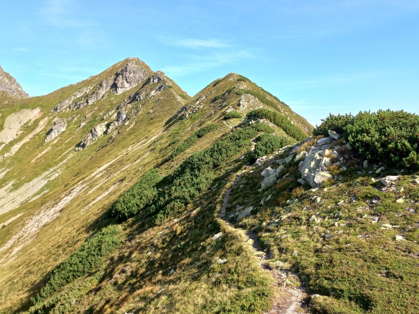
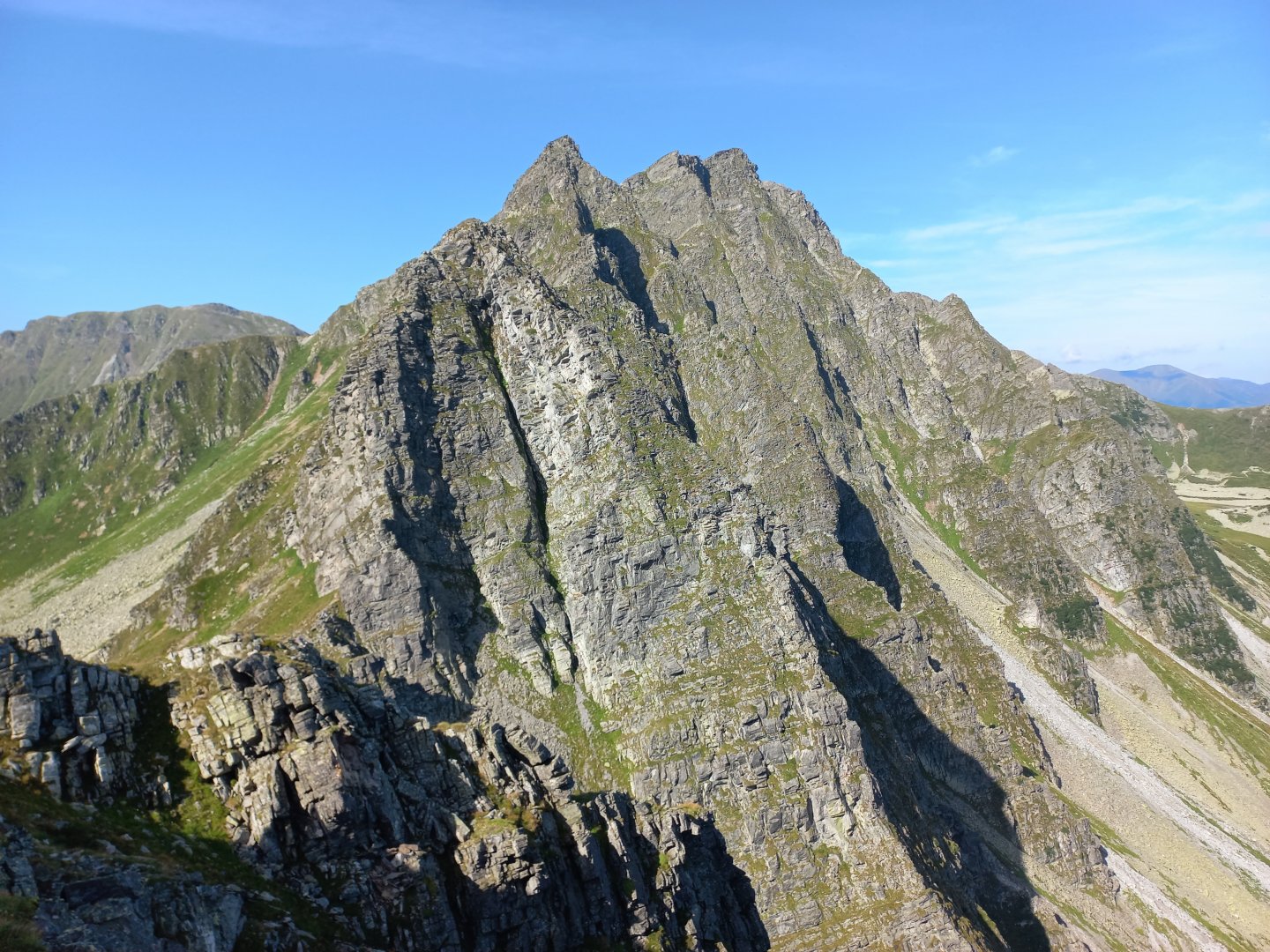
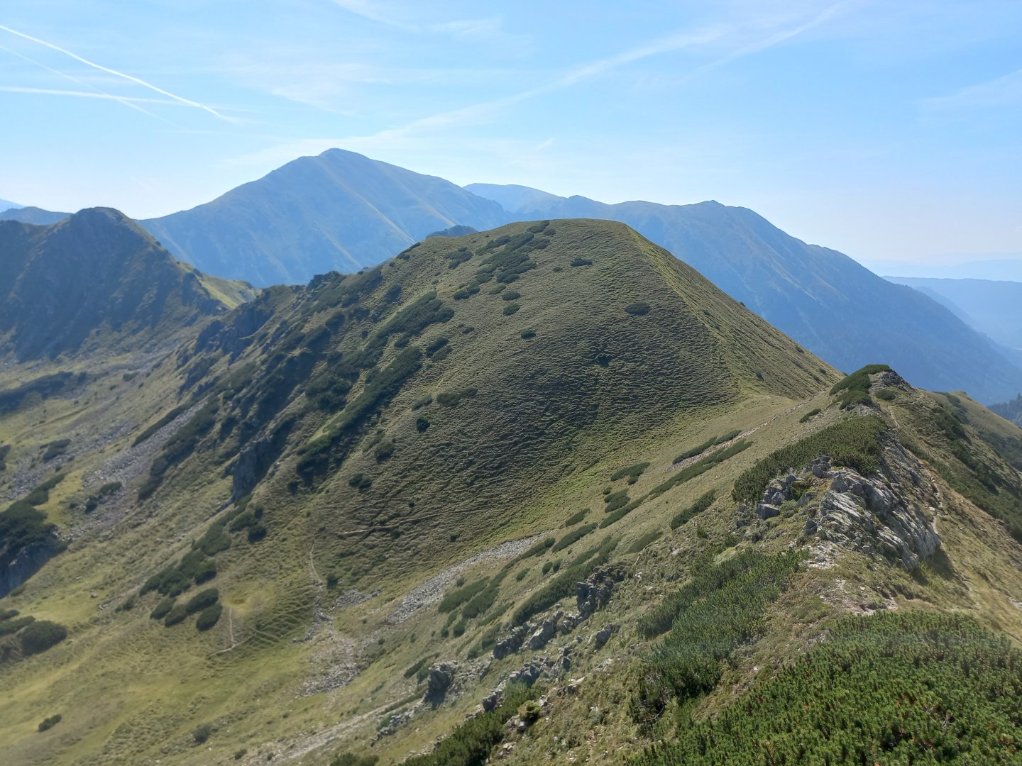
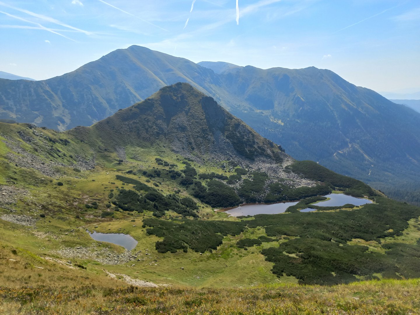
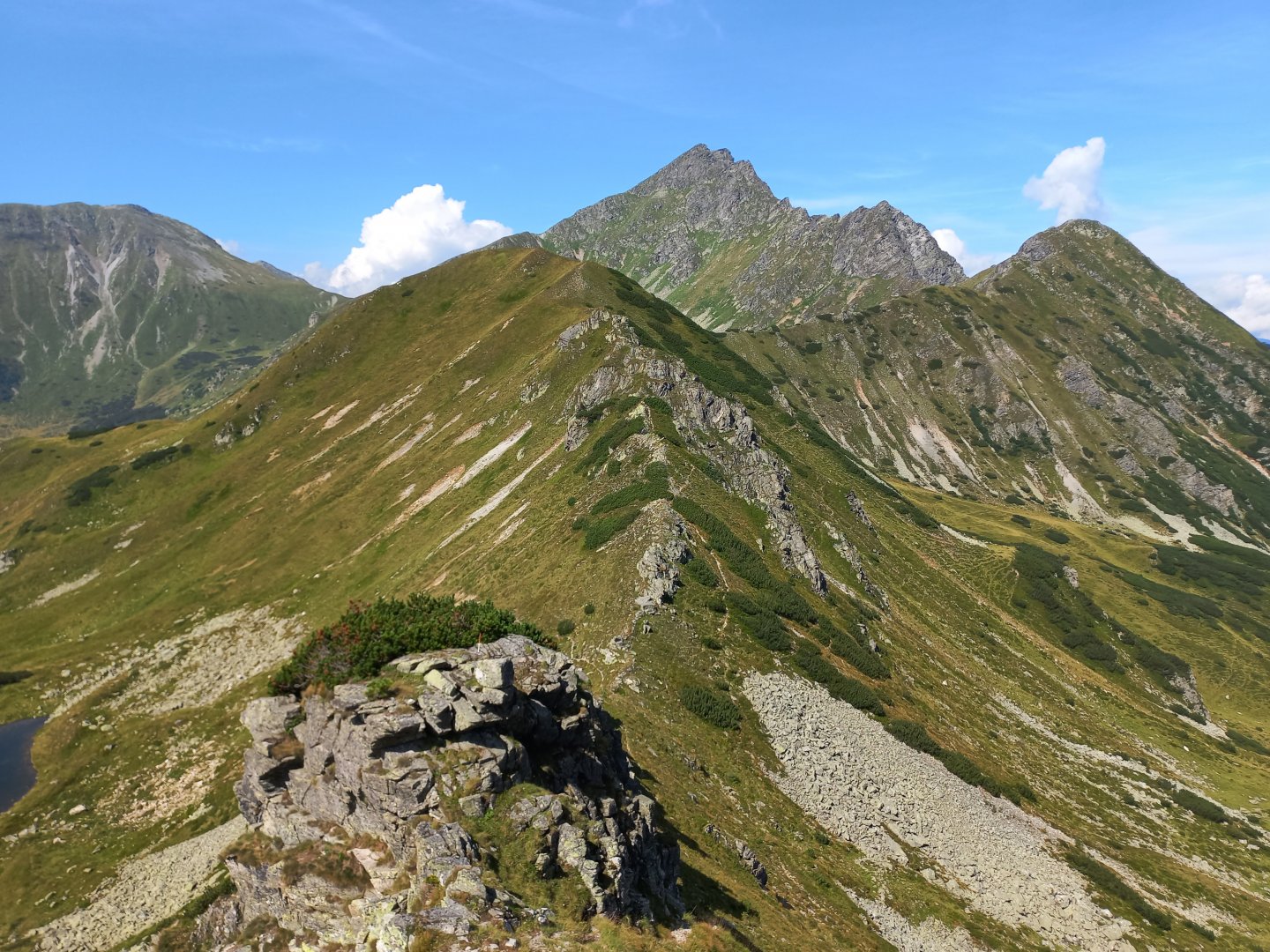
After a rest I return to the fork and climb to the grassy Krugkoppe 2 042 m above sea level. The blue Krugsee pools appear on the other side and above them the pointed Krugspitze. I continue straight along the ridge to the next peak on the path, Speikleitenberg 2 124 m above sea level. There are a few rocks to go around or over on the way, but nothing too difficult.
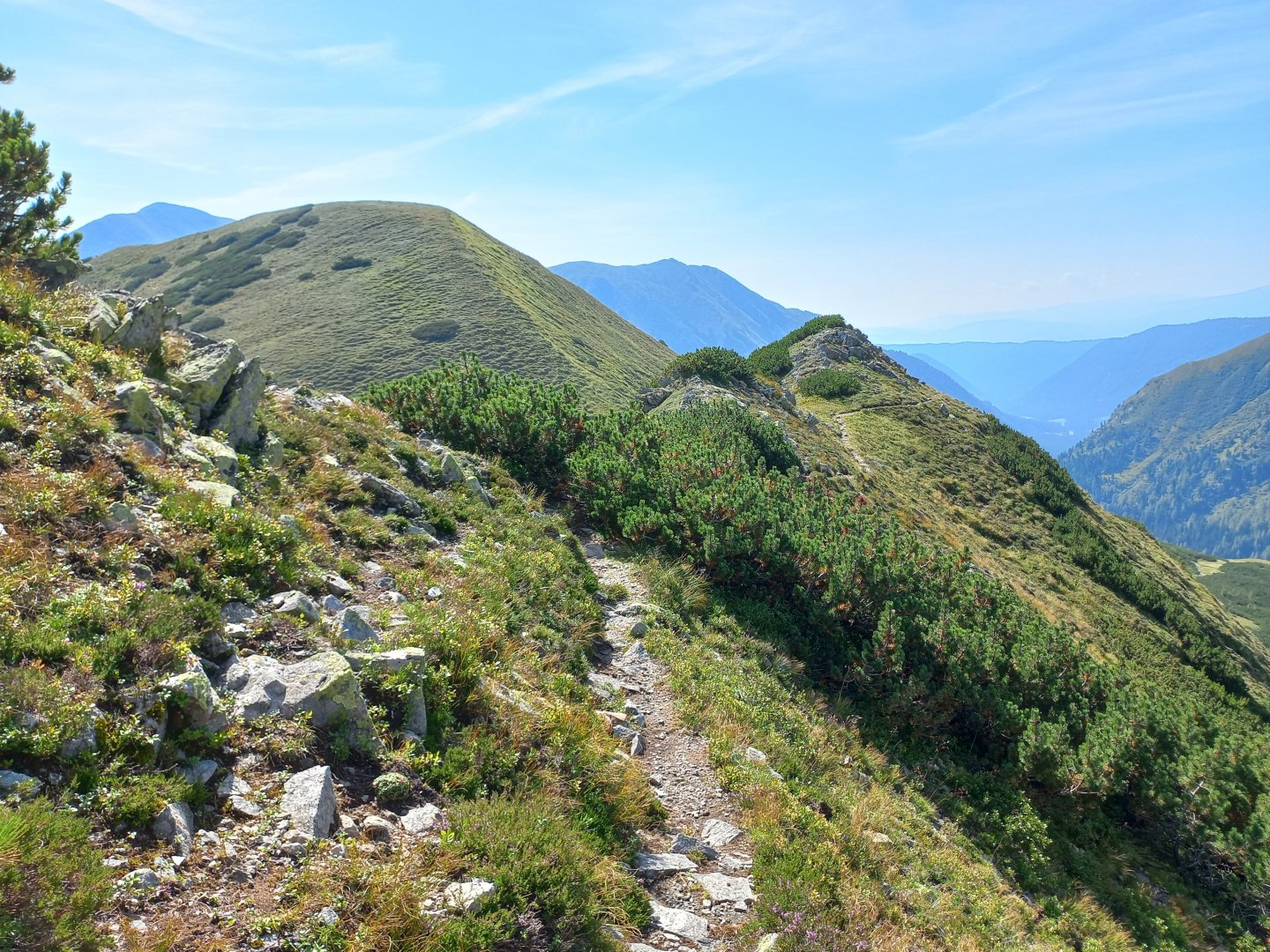
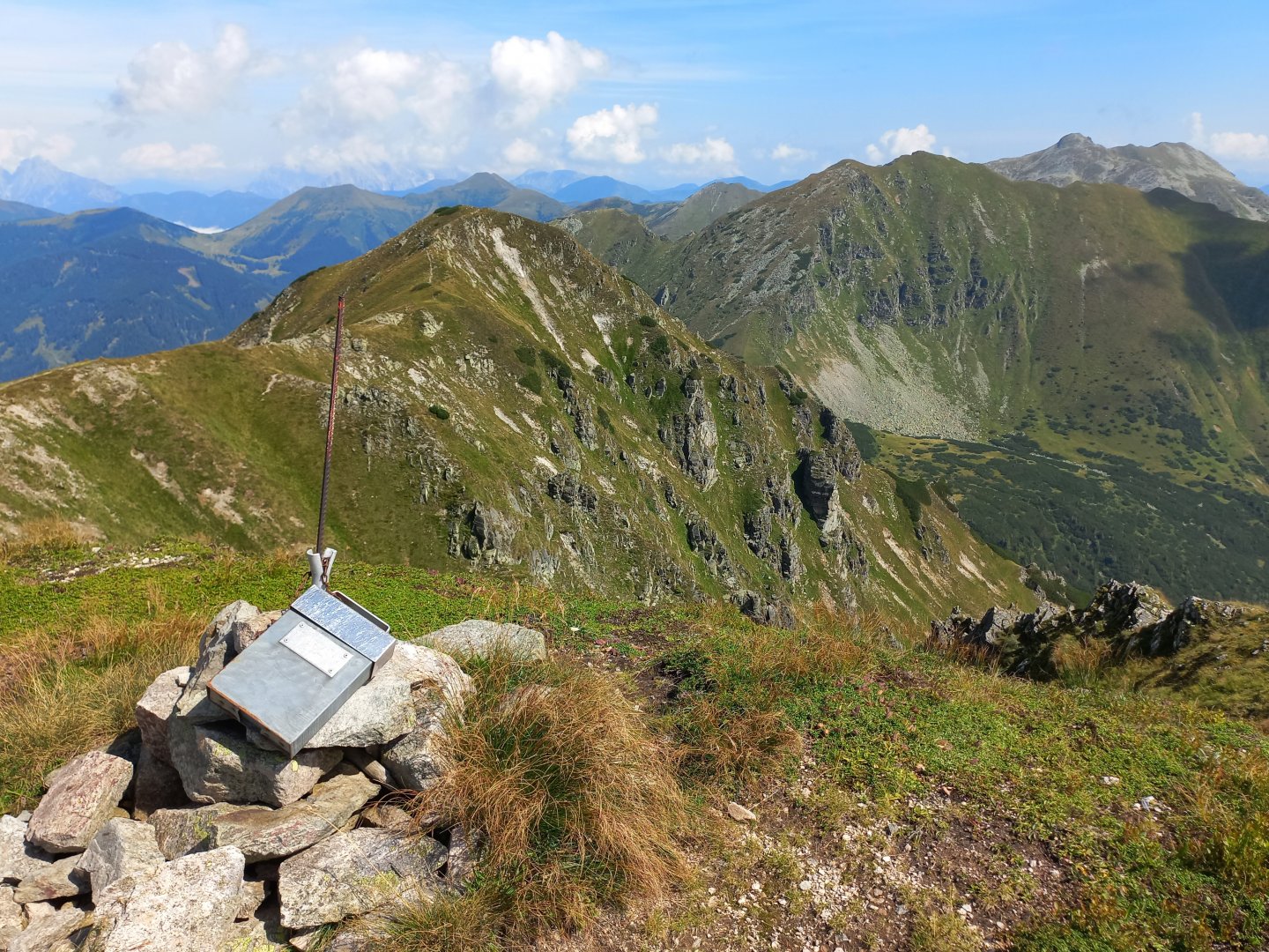
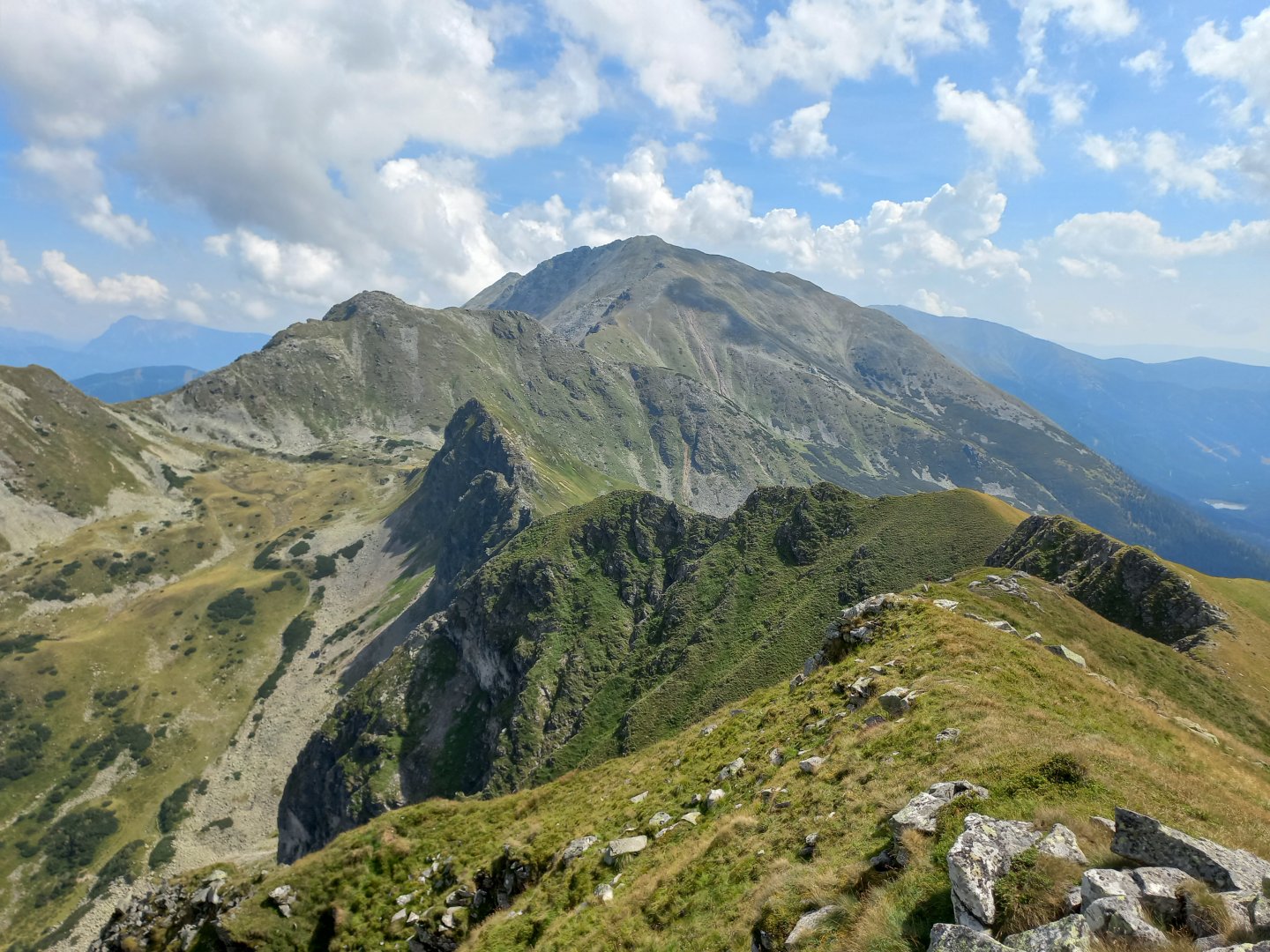
Speikleitenberg is without a cross, there is just a pile of rocks and a summit book on the top. The route continues to follow the ridge, crosses lichen-covered rocks and then descends steeply to the Kettentörl saddle 1 864 m above sea level. I don't feel like going back yet, so I decide to climb the opposite Kettentalkogel 2,151 m and see if the trail continues along the ridge to Lake Schaunitzsee and into the Grüngraben valley, where I could also return to Bergerhube.
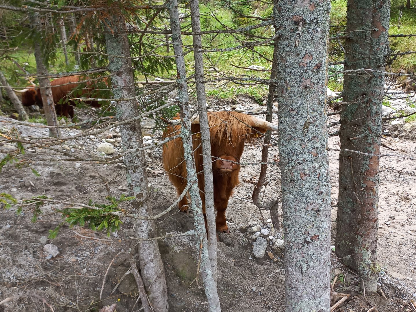
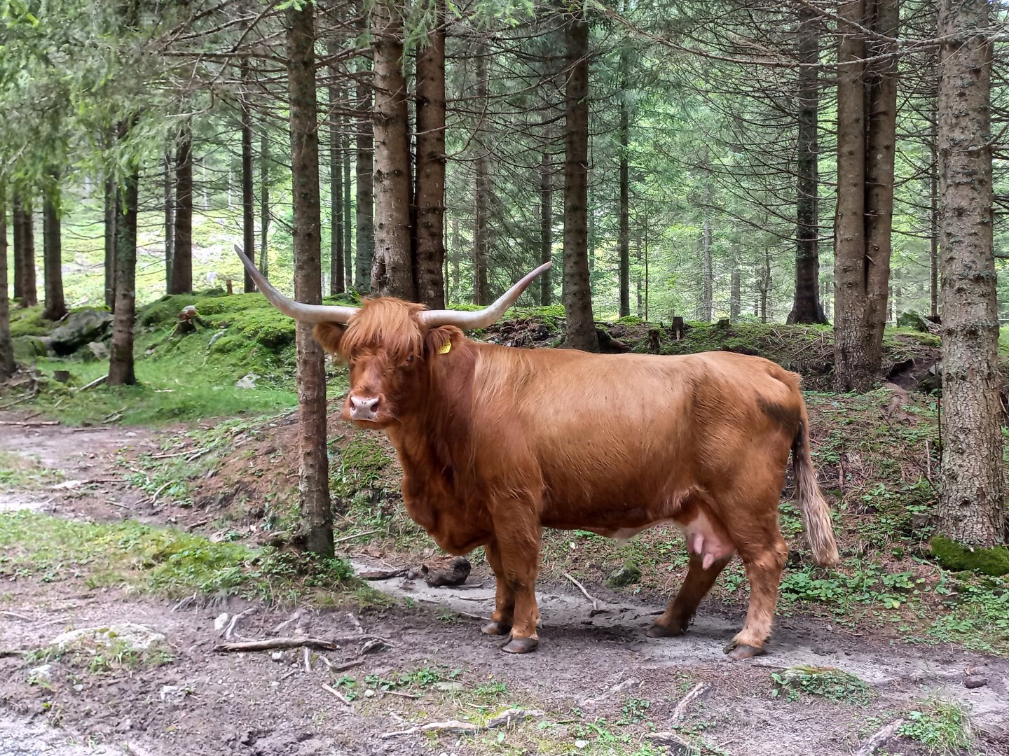
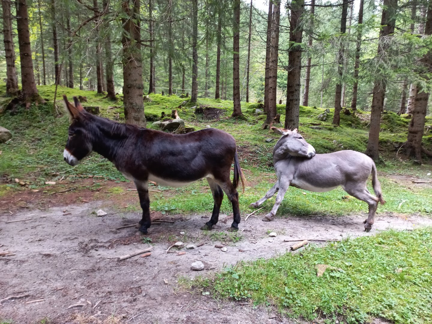
The path to Kettentalkogel is not marked, the path is lost, the direction is sometimes given by men. There are more stone fields and kneeling, the ascent is roughly along the edge of the cliff. There is a simple wooden cross at the top. The ridge continues on towards Geierhaupt, the highest mountain of the Seckauerek. Unfortunately, the path ends here. I return to the Kettengtörl saddle and follow the marked trail to the Bergerhube and the car park. At Bergerhube, take care when moving around in the pastures, they keep long-haired mountain cattle here, fortunately used to visitors.
Difficulty
Water availability
Water can be refilled in the Triebenbach stream at the beginning and end of the route. Or you can refresh yourself at the Bergerhube Inn at the beginning/end of the route where you park.
Mountain peaks
The route crosses four peaks - Mödringkogel 2 142 m above sea level, Krugkoppe 2 042 m above sea level, Speikleitenberg 2 124 m above sea level and Kettentalkogel 1 864 m above sea level. From all peaks you can enjoy views of the Seckauer Tauern.
Danger
The route is not dangerous, it mostly leads through mountain meadows or grassy ridge. There are no exposed sections.
Food
Refreshments are available at the Bergerhube mountain hut, there is no other hut on the route.
Attractions
The Bergerhube hut is also a starting point for winter routes, there are marked paths for skiing or snowshoeing with an elevation of 600 - 1200 m. The map is in the parking lot.