Circular hike in the High Atlas without a guide
Mountain range, region / State
Atlas Mountains / Moroccoco
Season
Fall
29. 10. - 31. 10. 2024
Difficulty
3 / 5
Elevation
↑ 2086 m
↓ 2086 m
Length
26.1 km
3 days
Altitude
max. 2939 m n.m.
min. 1578 m n.m.
Tourist map of the Great Atlas
Morocco - trekking in the High Atlas
Starting point
The trek starts at the parking lot in the town of Imlil, which is not difficult to get to from Marrakech by bus or taxi, tourists head here on a regular basis. It is possible to leave a rental car here for free, the parking lot is not guarded, but the police are there regularly.
Description of the hike
1. day
We started in the evening almost with darkness, which was quite fast, so we walked only a few kilometers on the first day. (In an ideal world we would have started in the morning and walked the whole thing with only one overnight stop.) We had the option of starting straight from Imlil on the mountain path, but decided to go through the villages.
We ran down the road we had taken into the mountains to the turn-off to Matate, which was pointed out by a sign enticing us to stay there. We then climbed up the serpentine path almost to the village and set up our sleeping bags and camping mats just above the path, on one of the small terraces. It would have been hard to find a place to pitch a tent here, and we didn't find a meaningful one until the next day, still half an hour above the village.
2. day
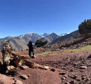
Following the dirt road we reached the end of Matate village. Here, tourists with donkeys set off from the local hostel towards the Tizi n'Oudite saddle. The path is not marked in any way, but there is no need, it is quite intuitive, one just follows the beaten track. At the same time it is not difficult, it is a gradual climb. You will meet local herders' dwellings and goat pens, you will pass under trees, so quite pleasant in the shade.
There are nice views to either side from the saddle, if it comes to that, it's also an ideal place to camp. The drive down to the village of Aït Aïssa is in a similar vein. Once you hit the road, stick to it until you reach Tizi Oussem. Not that there's any sign at the start of the village, but it's a shortcut to that pile of shacks two kilometres further on. It's not hard to get lost here, maps.cz doesn't match, satellite doesn't help much.
However, if you keep your bearings and don't worry about walking through someone's yard or on the roof occasionally, you'll make your way to the water channel in Walnut Grove. Stick to that and you're more or less set. In the village, you may also come across a few mini-stores where they have drinking water that also runs from a tap in the wall. Your choice. There's a fairly challenging climb up to the Tamsoult refugio.
The road is not marked, but the maps are pretty good and you are going in a logical direction, so you can guess pretty well. Refugio Tamsoult is a barracks at the end of the valley that offers accommodation (and electricity, food, water...), but you can also find places to camp. We took advantage of one patio, but there are also sites around the defunct refugio, which is a few hundred metres above the functional one - that is, if you're not afraid to pitch your tent next to the ruins.
3. day
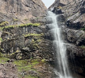
From Tamsoult it is definitely worth going to the waterfall. It's about a 3 km walk, but it's worth it and you can leave your backpacks where you sleep. The enterprising Moroccans run a tea house below the waterfall, so you can enjoy the 40-metre waterfall with a glass of mint tea.
And that's worth it, because you'll be facing the most challenging climb of the day, up the Tizi n'tzikert saddle, almost three kilometres above sea level. In places you're walking through a debris field, and the path gets pretty lost in places, but if you've ever walked in the mountains before, this shouldn't faze you and you'll scramble up the saddle. There are some very nice views from it, however I would highly recommend the top of Adrar Hadj.
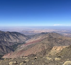
It's another 200 metres up and there's no road leading up there, but you can leave your pack in the saddle and you can't get lost if you walk along the ridge. You'll get views not only of the highest peak of the Atlas itself, but also across the flat "desert" towards Marrakech. The descent down afterwards is long, after all it is almost 1.5 kilometres in altitude. However, the road is quite well-maintained and incredibly stacked with large stones, almost reminiscent of German tourism.
A year ago there was an earthquake here that dropped a lot of boulders on the road and the surrounding trees, which really messed it up - it looks a bit scary, but rocks don't normally fall here and the road is still passable. Once you scramble down to Amroud, maps.cz offer a great shortcut around the falls, just follow the stream.
Watch out here - maybe because of the earthquake, maybe because of something else, but the trail has practically disappeared, so if you're not into scrambling through rubble, over fallen trees, etc., skip this shortcut. Instead, take the road a little way and head back upstream to the falls and the adjacent tea house if you like, it will save you a lot of trouble. Then it's just a matter of passing through Imlil, this Spindleruv Mlyn of the Atlas. Here you can return/sell equipment you no longer need, buy some of the nuts you've encountered along the way as a souvenir, and then continue on.
Difficulty
It is a pleasant mountain trek, which can be challenging in terms of altitude and, depending on the season, heat, but there are no exposed or dangerous sections - it is mostly rocky and clay trails for donkeys and mules.
In some places it is on a road, in others on a debris field. The highest point is about three kilometres above sea level. I wouldn't be afraid to go with my dog because of the difficulty of the trail, but I would be concerned about the local dogs.
Water availability
Water can be bought in the villages at the beginning and during the trek and is most reliable. You may come across a tap in a public area (which is not a sure thing) or rely on stream water at higher elevations, but there are goats grazing everywhere so I would be careful. We were carrying 4 litres per person on our backs.
Sleeping options
There are several accommodation options along the way. The easiest is to arrange at the Tamsoult refugio, where you can book a place online for about 10 euros with your own sleeping bag. There are also accommodations in villages along the way, usually local guides take their clients there, but apparently it is possible to arrange with them individually (which we didn't try). The advantage is that they often have cooking and drinking water.
In terms of camping, the situation is not quite as simple as one is used to here, there are not suitable places at every turn. This is mainly because the locals use every flat spot for farming (and they had to build most of the flat spots themselves beforehand). However, it is possible to camp in both saddles, and there are also some places around the refugio.
Mountain peaks
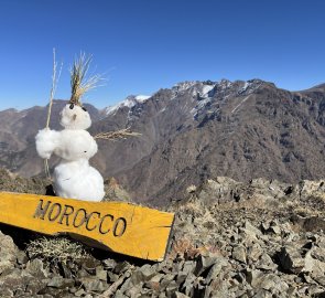
Adrar Hadj 3 140 m above sea level is definitely worth the hike. From it you can see the ridge around the summit of Jebel Toubkal 4 167 m above sea level. However, you will see it on the way down, so it's not a necessity if you want to see Morocco's highest mountain. There are also some nice views of Mount Adrar 3,255m above sea level, with the only Marik ski resort.
Danger
It is possible to meet barking shepherd dogs on the way, but it is nothing really unpleasant (e.g. compared to the ones you meet in Romania). The locals are friendly, either for selfish reasons, because they are trying to sell you something, or just for the sake of it. The whole road is safe, don't expect any exposed sections.
Food
We cooked for ourselves on the way. You can buy basic ingredients in Imlil, but it is better to buy them in a supermarket (e.g. in Marrakech). You can buy a gas bomb here, which is great.
There are plenty of tourist restaurants in Imlil, so if you don't mind paying too much money for food, go for it. You can also buy food in other villages along the way during the season, but I don't know how much you can rely on that.
In fact, most tourists go with local guides who arrange this for them. However, you can buy food at the Tamsoult refugio, they offer it on their website.
Attractions
The route deliberately avoids Toubkal National Park (except for the turn to the waterfall). It wasn't entirely clear to us which routes are covered by the obligation to have a guide (at least directly to Toubkal this obligation applies), so we avoided it.
The route can certainly be modified - just look at maps.cz and you'll see that there are more than one dotted trail. Most of them are also paths on which locals guide tourists with donkeys. For example, instead of the last Tizi n'tzikert saddle, you can choose the more northern Tizi n'Mzik saddle, which will save you half a kilometre of altitude (but you will lose some of the views).
Anyway, we recommend this direction. The route would certainly work the other way around, but given the gradation it makes sense for us to take it counterclockwise.


